Hunter Mountain Topo Map Wyoming
To zoom in, hover over the map of Hunter Mountain
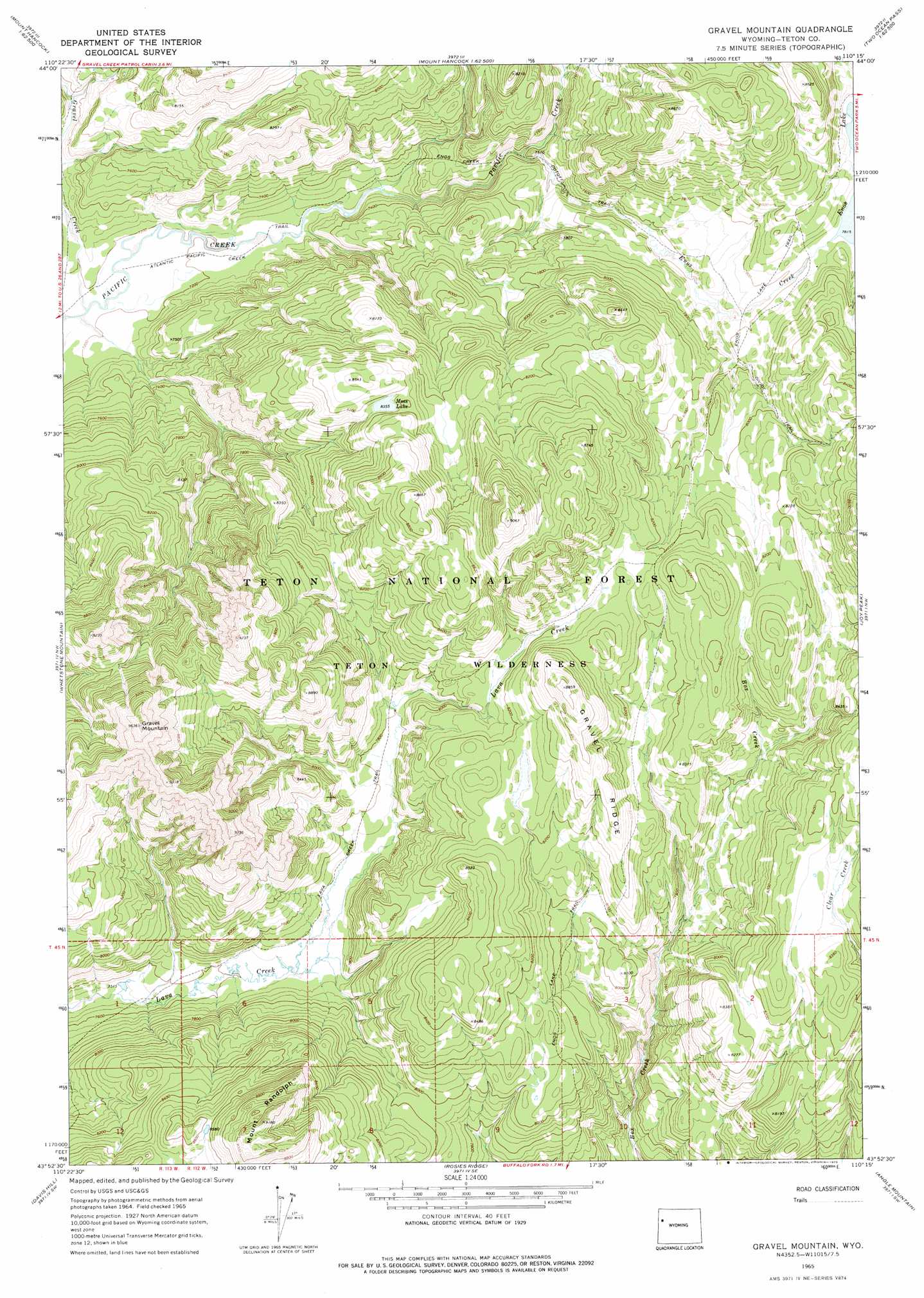
USGS Topo Quad 43110h3 - 1:24,000 scale
| Topo Map Name: | Hunter Mountain |
| USGS Topo Quad ID: | 43110h3 |
| Print Size: | ca. 21 1/4" wide x 27" high |
| Southeast Coordinates: | 43.875° N latitude / 110.25° W longitude |
| Map Center Coordinates: | 43.9375° N latitude / 110.3125° W longitude |
| U.S. State: | WY |
| Filename: | o43110h3.jpg |
| Download Map JPG Image: | Hunter Mountain topo map 1:24,000 scale |
| Map Type: | Topographic |
| Topo Series: | 7.5´ |
| Map Scale: | 1:24,000 |
| Source of Map Images: | United States Geological Survey (USGS) |
| Alternate Map Versions: |
Gravel Mountain WY 1965, updated 1971 Download PDF Buy paper map Gravel Mountain WY 1965, updated 1975 Download PDF Buy paper map Gravel Mountain WY 1996, updated 1998 Download PDF Buy paper map Gravel Mountain WY 2012 Download PDF Buy paper map Gravel Mountain WY 2015 Download PDF Buy paper map |
| FStopo: | US Forest Service topo Gravel Mountain is available: Download FStopo PDF Download FStopo TIF |
1:24,000 Topo Quads surrounding Hunter Mountain
Snake Hot Springs |
Mount Hancock |
Crooked Creek |
Badger Creek |
The Trident |
Huckleberry Mountain |
Bobcat Ridge |
Gravel Peak |
Two Ocean Pass |
Yellowstone Point |
Two Ocean Lake |
Whetstone Mountain |
Hunter Mountain |
Joy Peak |
Crater Lake |
Moran |
Davis Hill |
Rosies Ridge |
Angle Mountain |
Togwotee Pass |
Shadow Mountain |
Mount Leidy |
Green Mountain |
Tripod Peak |
Lava Mountain |
> Back to 43110e1 at 1:100,000 scale
> Back to 43110a1 at 1:250,000 scale
> Back to U.S. Topo Maps home
Hunter Mountain topo map: Gazetteer
Hunter Mountain: Lakes
Moss Lake elevation 2548m 8359′Hunter Mountain: Ridges
Gravel Ridge elevation 2599m 8526′Hunter Mountain: Streams
Enos Creek elevation 2241m 7352′Gravel Creek elevation 2190m 7185′
Hunter Mountain: Summits
Gravel Mountain elevation 2920m 9580′Mount Randolph elevation 2778m 9114′
Hunter Mountain: Trails
Divide Trail elevation 2431m 7975′Enos Creek Cutoff Trail elevation 2289m 7509′
Moss Lake Trail elevation 2410m 7906′
Hunter Mountain digital topo map on disk
Buy this Hunter Mountain topo map showing relief, roads, GPS coordinates and other geographical features, as a high-resolution digital map file on DVD: