Tincup Mountain Topo Map Idaho
To zoom in, hover over the map of Tincup Mountain
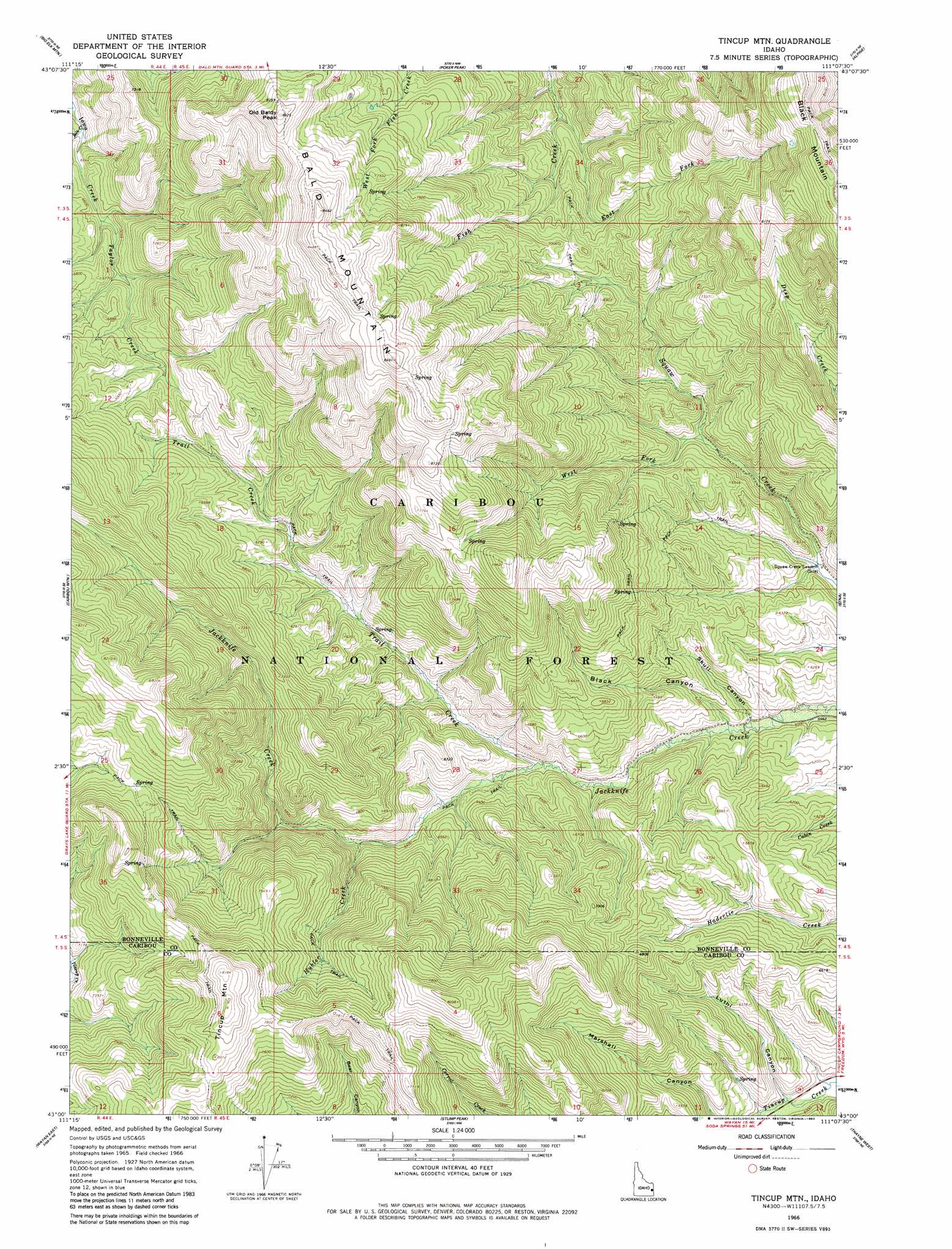
USGS Topo Quad 43111a2 - 1:24,000 scale
| Topo Map Name: | Tincup Mountain |
| USGS Topo Quad ID: | 43111a2 |
| Print Size: | ca. 21 1/4" wide x 27" high |
| Southeast Coordinates: | 43° N latitude / 111.125° W longitude |
| Map Center Coordinates: | 43.0625° N latitude / 111.1875° W longitude |
| U.S. State: | ID |
| Filename: | o43111a2.jpg |
| Download Map JPG Image: | Tincup Mountain topo map 1:24,000 scale |
| Map Type: | Topographic |
| Topo Series: | 7.5´ |
| Map Scale: | 1:24,000 |
| Source of Map Images: | United States Geological Survey (USGS) |
| Alternate Map Versions: |
Tincup Mtn ID 1966, updated 1969 Download PDF Buy paper map Tincup Mtn ID 1966, updated 1982 Download PDF Buy paper map Tincup Mtn ID 1966, updated 1982 Download PDF Buy paper map Tincup Mtn ID 1966, updated 1982 Download PDF Buy paper map Tincup Mountain ID 2011 Download PDF Buy paper map Tincup Mountain ID 2013 Download PDF Buy paper map |
| FStopo: | US Forest Service topo Tincup Mountain is available: Download FStopo PDF Download FStopo TIF |
1:24,000 Topo Quads surrounding Tincup Mountain
Commissary Ridge |
Red Ridge |
Palisades Dam |
Mount Baird |
Observation Peak |
Herman |
Big Elk Mountain |
Poker Peak |
Alpine |
Ferry Peak |
Bear Island |
Caribou Mountain |
Tincup Mountain |
Etna |
Stewart Peak |
Wayan West |
Wayan East |
Stump Peak |
Thayne West |
Thayne East |
Lower Valley |
Upper Valley |
Diamond Flat |
Auburn |
Grover |
> Back to 43111a1 at 1:100,000 scale
> Back to 43110a1 at 1:250,000 scale
> Back to U.S. Topo Maps home
Tincup Mountain topo map: Gazetteer
Tincup Mountain: Streams
Bilk Creek elevation 1939m 6361′Black Creek elevation 1837m 6026′
East Fork Fish Creek elevation 1951m 6400′
Hubler Creek elevation 1952m 6404′
Sadie Creek elevation 1801m 5908′
Taylor Creek elevation 1984m 6509′
Trail Creek elevation 1886m 6187′
West Fork Squaw Creek elevation 1926m 6318′
Tincup Mountain: Summits
Bald Mountain elevation 2585m 8480′Black Mountain elevation 2677m 8782′
Old Baldy Peak elevation 2537m 8323′
Tincup Mountain elevation 2502m 8208′
Tincup Mountain: Valleys
Black Canyon elevation 1839m 6033′Luthi Canyon elevation 1821m 5974′
Skull Canyon elevation 1828m 5997′
Tincup Mountain digital topo map on disk
Buy this Tincup Mountain topo map showing relief, roads, GPS coordinates and other geographical features, as a high-resolution digital map file on DVD: