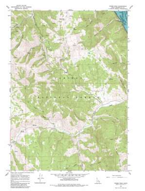
Poker Peak Topo Map Idaho
To zoom in, hover over the map of Poker Peak
USGS Topo Quad 43111b2 - 1:24,000 scale
| Topo Map Name: | Poker Peak |
| USGS Topo Quad ID: | 43111b2 |
| Print Size: | ca. 21 1/4" wide x 27" high |
| Southeast Coordinates: | 43.125° N latitude / 111.125° W longitude |
| Map Center Coordinates: | 43.1875° N latitude / 111.1875° W longitude |
| U.S. State: | ID |
| Filename: | o43111b2.jpg |
| Download Map JPG Image: | Poker Peak topo map 1:24,000 scale |
| Map Type: | Topographic |
| Topo Series: | 7.5´ |
| Map Scale: | 1:24,000 |
| Source of Map Images: | United States Geological Survey (USGS) |
| Alternate Map Versions: |
Poker Peak ID 1966, updated 1969 Download PDF Buy paper map Poker Peak ID 1966, updated 1980 Download PDF Buy paper map Poker Peak ID 2011 Download PDF Buy paper map Poker Peak ID 2013 Download PDF Buy paper map |
| FStopo: | US Forest Service topo Poker Peak is available: Download FStopo PDF Download FStopo TIF |
1:24,000 Topo Quads surrounding Poker Peak
> Back to 43111a1 at 1:100,000 scale
> Back to 43110a1 at 1:250,000 scale
> Back to U.S. Topo Maps home
Poker Peak topo map: Gazetteer
Poker Peak: Flats
Jensen Meadow elevation 1998m 6555′Poker Peak: Ridges
Chicken Ridge elevation 2371m 7778′Poker Peak: Streams
Box Canyon Creek elevation 1810m 5938′Comb Creek elevation 1881m 6171′
Fish Creek elevation 1788m 5866′
Hell Creek elevation 1767m 5797′
Iowa Creek elevation 1859m 6099′
Jensen Creek elevation 1743m 5718′
Kirk Creek elevation 1878m 6161′
Lake Creek elevation 1840m 6036′
Sulphur Bar Creek elevation 1717m 5633′
West Fork Fish Creek elevation 1889m 6197′
York Creek elevation 1779m 5836′
Poker Peak: Summits
Poker Peak elevation 2565m 8415′Poker Peak digital topo map on disk
Buy this Poker Peak topo map showing relief, roads, GPS coordinates and other geographical features, as a high-resolution digital map file on DVD:


