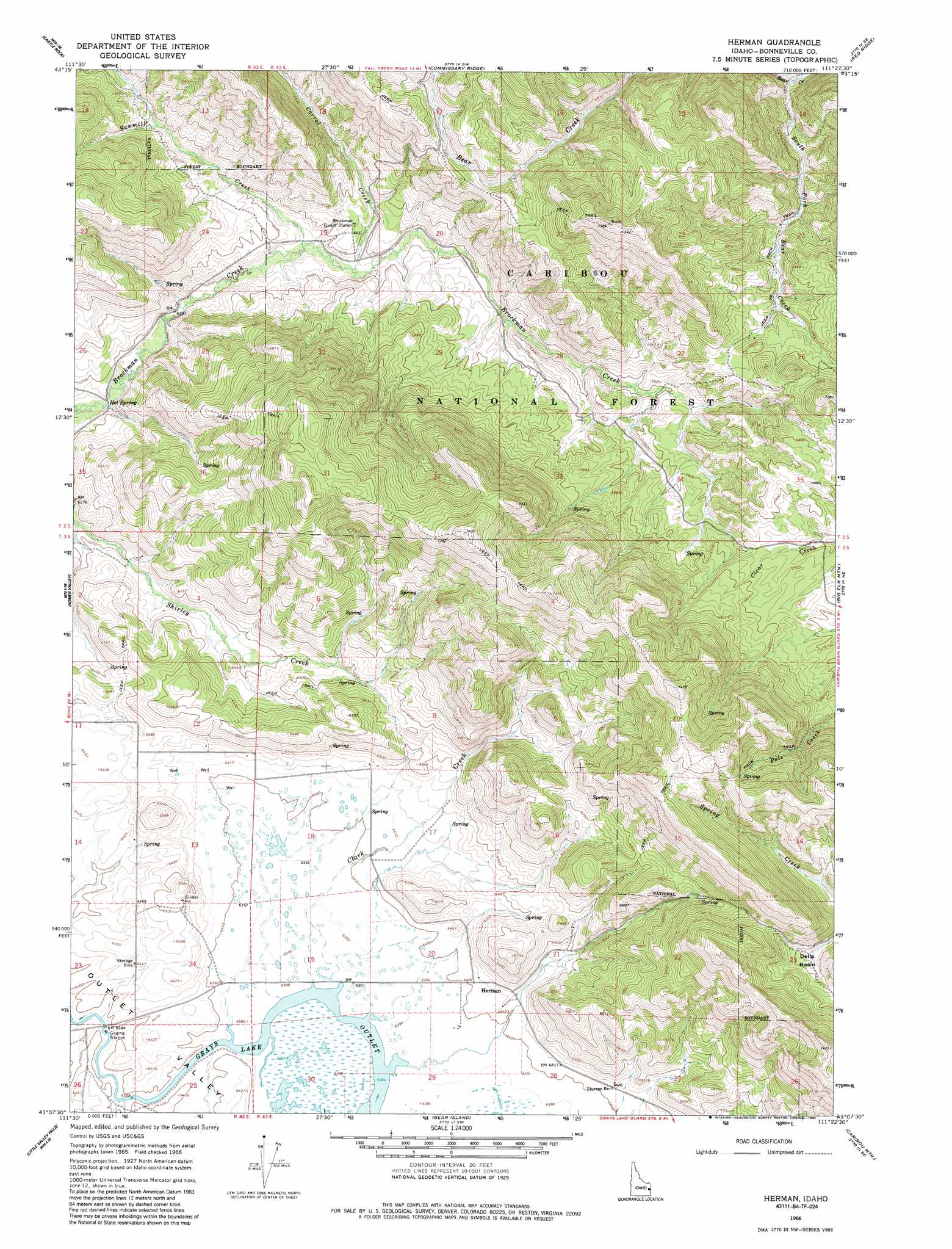
Herman Topo Map Idaho
To zoom in, hover over the map of Herman
USGS Topo Quad 43111b4 - 1:24,000 scale
| Topo Map Name: | Herman |
| USGS Topo Quad ID: | 43111b4 |
| Print Size: | ca. 21 1/4" wide x 27" high |
| Southeast Coordinates: | 43.125° N latitude / 111.375° W longitude |
| Map Center Coordinates: | 43.1875° N latitude / 111.4375° W longitude |
| U.S. State: | ID |
| Filename: | o43111b4.jpg |
| Download Map JPG Image: | Herman topo map 1:24,000 scale |
| Map Type: | Topographic |
| Topo Series: | 7.5´ |
| Map Scale: | 1:24,000 |
| Source of Map Images: | United States Geological Survey (USGS) |
| Alternate Map Versions: |
Herman ID 1966, updated 1969 Download PDF Buy paper map Herman ID 1966, updated 1985 Download PDF Buy paper map Herman ID 2011 Download PDF Buy paper map Herman ID 2013 Download PDF Buy paper map |
| FStopo: | US Forest Service topo Herman is available: Download FStopo PDF Download FStopo TIF |
1:24,000 Topo Quads surrounding Herman
Lone Pine Ridge |
Point Lookout |
Conant Valley |
Swan Valley |
Thompson Peak |
Jumpoff Hill |
Castle Rock |
Commissary Ridge |
Red Ridge |
Palisades Dam |
Long Valley |
Homer Valley |
Herman |
Big Elk Mountain |
Poker Peak |
Meadow Creek Mountain |
Little Valley Hills |
Bear Island |
Caribou Mountain |
Tincup Mountain |
Reservoir Mountain |
Henry |
Wayan West |
Wayan East |
Stump Peak |
> Back to 43111a1 at 1:100,000 scale
> Back to 43110a1 at 1:250,000 scale
> Back to U.S. Topo Maps home
Herman topo map: Gazetteer
Herman: Basins
Della Basin elevation 2092m 6863′Herman: Populated Places
Herman elevation 1967m 6453′Herman: Streams
Clark Creek elevation 1947m 6387′Corral Creek elevation 1936m 6351′
Sawmill Creek elevation 1930m 6332′
South Fork Bear Creek elevation 1958m 6423′
Herman digital topo map on disk
Buy this Herman topo map showing relief, roads, GPS coordinates and other geographical features, as a high-resolution digital map file on DVD: