Red Ridge Topo Map Idaho
To zoom in, hover over the map of Red Ridge
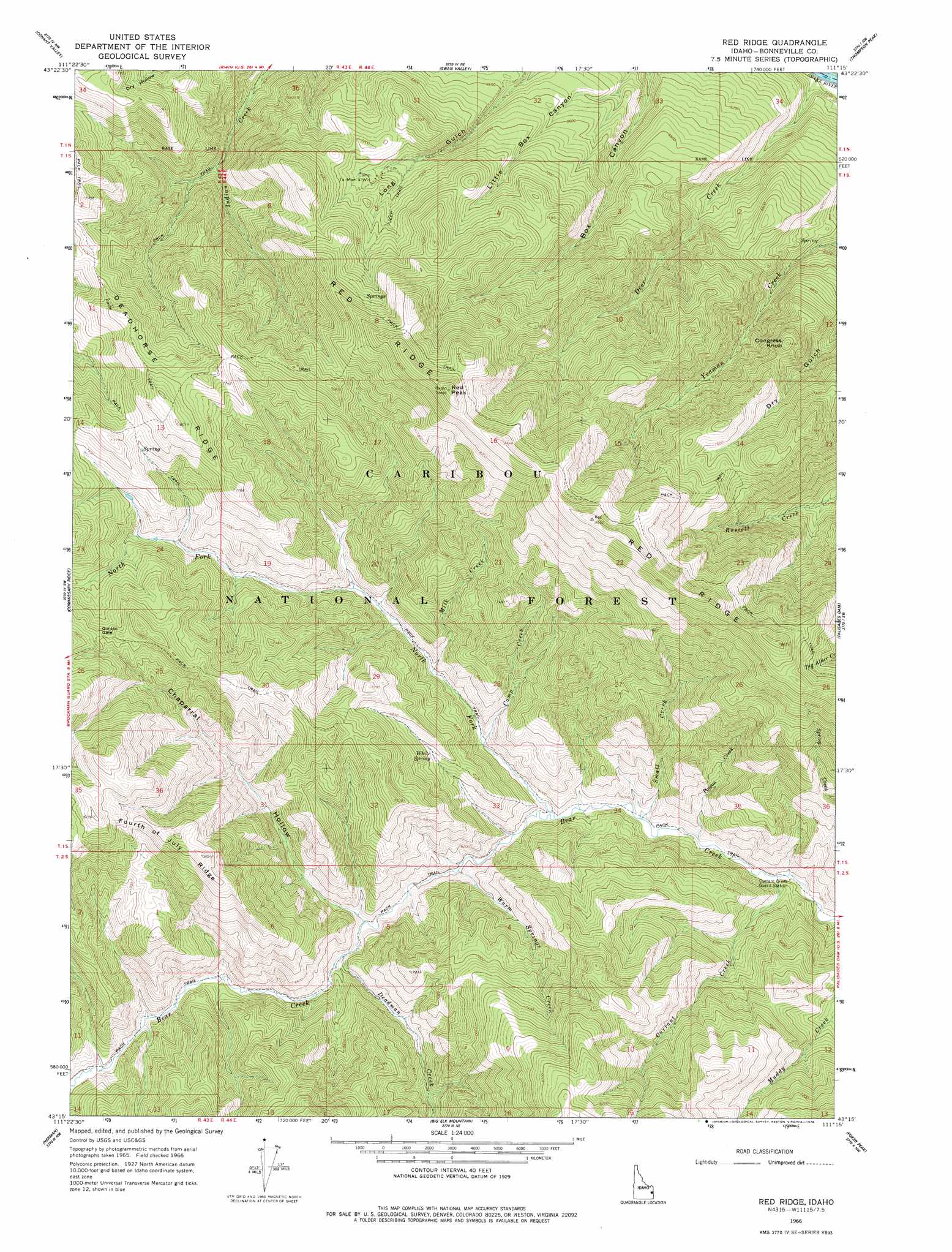
USGS Topo Quad 43111c3 - 1:24,000 scale
| Topo Map Name: | Red Ridge |
| USGS Topo Quad ID: | 43111c3 |
| Print Size: | ca. 21 1/4" wide x 27" high |
| Southeast Coordinates: | 43.25° N latitude / 111.25° W longitude |
| Map Center Coordinates: | 43.3125° N latitude / 111.3125° W longitude |
| U.S. State: | ID |
| Filename: | o43111c3.jpg |
| Download Map JPG Image: | Red Ridge topo map 1:24,000 scale |
| Map Type: | Topographic |
| Topo Series: | 7.5´ |
| Map Scale: | 1:24,000 |
| Source of Map Images: | United States Geological Survey (USGS) |
| Alternate Map Versions: |
Red Ridge ID 1966, updated 1969 Download PDF Buy paper map Red Ridge ID 1966, updated 1978 Download PDF Buy paper map Red Ridge ID 1966, updated 1978 Download PDF Buy paper map Red Ridge ID 2011 Download PDF Buy paper map Red Ridge ID 2013 Download PDF Buy paper map |
| FStopo: | US Forest Service topo Red Ridge is available: Download FStopo PDF Download FStopo TIF |
1:24,000 Topo Quads surrounding Red Ridge
Heise Se |
Wheaton Mountain |
Stouts Mountain |
Fourth Of July Peak |
Victor |
Point Lookout |
Conant Valley |
Swan Valley |
Thompson Peak |
Palisades Peak |
Castle Rock |
Commissary Ridge |
Red Ridge |
Palisades Dam |
Mount Baird |
Homer Valley |
Herman |
Big Elk Mountain |
Poker Peak |
Alpine |
Little Valley Hills |
Bear Island |
Caribou Mountain |
Tincup Mountain |
Etna |
> Back to 43111a1 at 1:100,000 scale
> Back to 43110a1 at 1:250,000 scale
> Back to U.S. Topo Maps home
Red Ridge topo map: Gazetteer
Red Ridge: Gaps
Golden Gate elevation 2326m 7631′Red Ridge: Ridges
Deadhorse Ridge elevation 2354m 7723′Red Ridge elevation 2623m 8605′
Red Ridge: Springs
White Spring elevation 1995m 6545′Red Ridge: Streams
Camp Creek elevation 1838m 6030′Chaparral Creek elevation 1849m 6066′
Currant Creek elevation 1762m 5780′
Deadman Creek elevation 1866m 6122′
Deer Creek elevation 1640m 5380′
Milk Creek elevation 1878m 6161′
North Fork Bear Creek elevation 1800m 5905′
Poison Creek elevation 1779m 5836′
Small Creek elevation 1790m 5872′
Warm Springs Creek elevation 1824m 5984′
Red Ridge: Summits
Congress Knob elevation 2280m 7480′Red Peak elevation 2658m 8720′
Red Ridge: Valleys
Chaparral Hollow elevation 1854m 6082′Red Ridge digital topo map on disk
Buy this Red Ridge topo map showing relief, roads, GPS coordinates and other geographical features, as a high-resolution digital map file on DVD: