Ammon Topo Map Idaho
To zoom in, hover over the map of Ammon
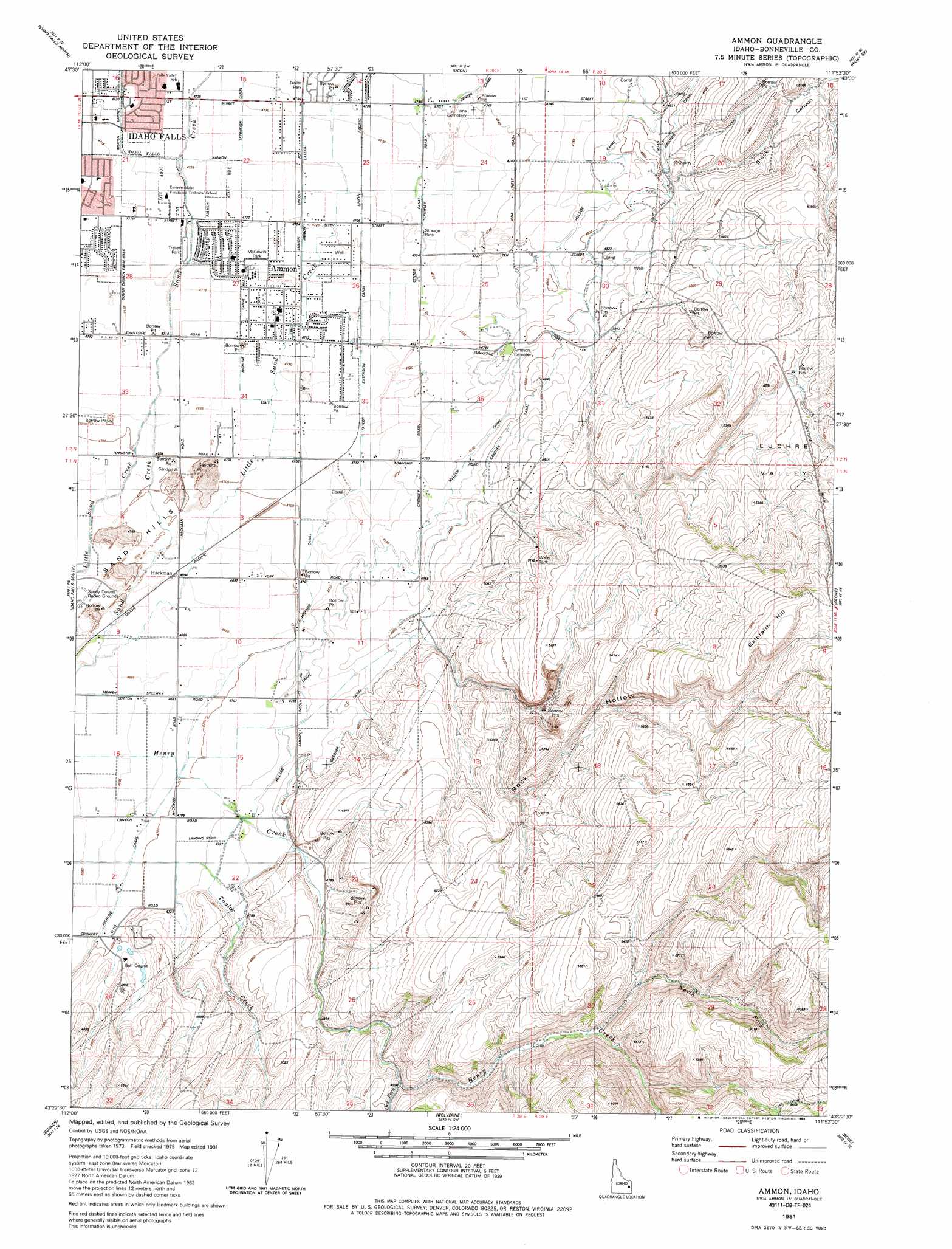
USGS Topo Quad 43111d8 - 1:24,000 scale
| Topo Map Name: | Ammon |
| USGS Topo Quad ID: | 43111d8 |
| Print Size: | ca. 21 1/4" wide x 27" high |
| Southeast Coordinates: | 43.375° N latitude / 111.875° W longitude |
| Map Center Coordinates: | 43.4375° N latitude / 111.9375° W longitude |
| U.S. State: | ID |
| Filename: | o43111d8.jpg |
| Download Map JPG Image: | Ammon topo map 1:24,000 scale |
| Map Type: | Topographic |
| Topo Series: | 7.5´ |
| Map Scale: | 1:24,000 |
| Source of Map Images: | United States Geological Survey (USGS) |
| Alternate Map Versions: |
Ammon ID 1981, updated 1981 Download PDF Buy paper map Ammon ID 1981, updated 1985 Download PDF Buy paper map Ammon ID 1981, updated 1985 Download PDF Buy paper map Ammon ID 2011 Download PDF Buy paper map Ammon ID 2013 Download PDF Buy paper map |
1:24,000 Topo Quads surrounding Ammon
Roberts |
Lewisville |
Rigby |
Ririe |
Heise |
Shattuck Butte |
Idaho Falls North |
Ucon |
Rigby Se |
Poplar |
Woodville |
Idaho Falls South |
Ammon |
Ozone |
Lone Pine Ridge |
Firth |
Goshen |
Wolverine |
Bone |
Jumpoff Hill |
Lincoln Creek |
Higham Peak |
Miner Creek |
Poison Creek |
Long Valley |
> Back to 43111a1 at 1:100,000 scale
> Back to 43110a1 at 1:250,000 scale
> Back to U.S. Topo Maps home
Ammon topo map: Gazetteer
Ammon: Airports
E I Regional Medical Center Heliport elevation 1437m 4714′Rainbow Ranch Airport elevation 1439m 4721′
Ammon: Basins
Euchre Valley elevation 1628m 5341′Ammon: Canals
Center Canal elevation 1441m 4727′Highline Canal elevation 1446m 4744′
Hillside Canal elevation 1463m 4799′
Meppen Spillway elevation 1429m 4688′
Taylor Extension Canal elevation 1437m 4714′
Ammon: Flats
Snake River Plain elevation 1437m 4714′Ammon: Parks
McCowin Park elevation 1439m 4721′Ammon: Populated Places
Ammon elevation 1437m 4714′Ammon: Streams
Dry Fork elevation 1547m 5075′Henry Creek elevation 1443m 4734′
North Fork Henry Creek elevation 1596m 5236′
Taylor Creek elevation 1433m 4701′
Ammon: Summits
Galbraith Hill elevation 1796m 5892′Ammon: Valleys
Black Canyon elevation 1483m 4865′Rock Hollow elevation 1463m 4799′
Ammon digital topo map on disk
Buy this Ammon topo map showing relief, roads, GPS coordinates and other geographical features, as a high-resolution digital map file on DVD: