Driggs Topo Map Idaho
To zoom in, hover over the map of Driggs
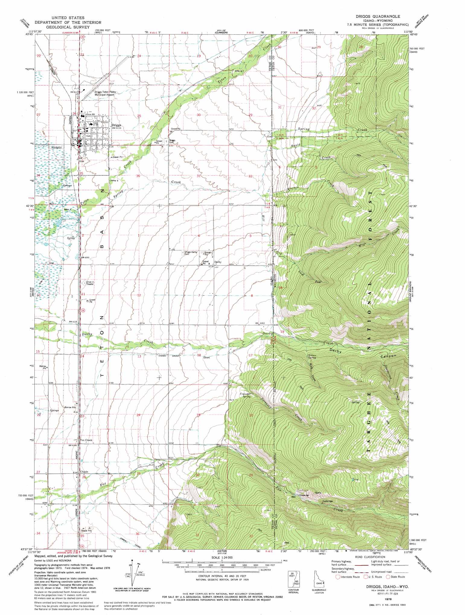
USGS Topo Quad 43111f1 - 1:24,000 scale
| Topo Map Name: | Driggs |
| USGS Topo Quad ID: | 43111f1 |
| Print Size: | ca. 21 1/4" wide x 27" high |
| Southeast Coordinates: | 43.625° N latitude / 111° W longitude |
| Map Center Coordinates: | 43.6875° N latitude / 111.0625° W longitude |
| U.S. States: | ID, WY |
| Filename: | o43111f1.jpg |
| Download Map JPG Image: | Driggs topo map 1:24,000 scale |
| Map Type: | Topographic |
| Topo Series: | 7.5´ |
| Map Scale: | 1:24,000 |
| Source of Map Images: | United States Geological Survey (USGS) |
| Alternate Map Versions: |
Driggs ID 1978, updated 1978 Download PDF Buy paper map Driggs ID 1978, updated 1986 Download PDF Buy paper map Driggs ID 2011 Download PDF Buy paper map Driggs ID 2013 Download PDF Buy paper map |
| FStopo: | US Forest Service topo Driggs is available: Download FStopo PDF Download FStopo TIF |
1:24,000 Topo Quads surrounding Driggs
Drummond |
Lamont |
Mcrenolds Reservoir |
Rammel Mountain |
Ranger Peak |
Packsaddle Lake |
Tetonia |
Clawson |
Granite Basin |
Mount Moran |
Garns Mountain |
Bates |
Driggs |
Mount Bannon |
Grand Teton |
Stouts Mountain |
Fourth Of July Peak |
Victor |
Rendezvous Peak |
Teton Village |
Swan Valley |
Thompson Peak |
Palisades Peak |
Teton Pass |
Jackson |
> Back to 43111e1 at 1:100,000 scale
> Back to 43110a1 at 1:250,000 scale
> Back to U.S. Topo Maps home
Driggs topo map: Gazetteer
Driggs: Airports
Driggs Teton Peaks Municipal Airport elevation 1880m 6167′Teton Peaks Airport elevation 1874m 6148′
Driggs: Canals
Cherry Grove Canal elevation 1902m 6240′Driggs: Populated Places
Chapin elevation 1876m 6154′Darby elevation 1927m 6322′
Driggs elevation 1862m 6108′
Fox Creek elevation 1874m 6148′
Driggs: Springs
Crandall Spring elevation 2006m 6581′Nelson Spring elevation 2034m 6673′
Driggs: Streams
Deadwood Creek elevation 2057m 6748′Hill Creek elevation 1901m 6236′
Hill Creek elevation 1902m 6240′
Rapid Creek elevation 1916m 6286′
Rock Creek elevation 1992m 6535′
Slocum Creek elevation 1899m 6230′
Sorensen Creek elevation 1945m 6381′
Sorensen Creek elevation 1946m 6384′
South Fork Hill Creek elevation 2007m 6584′
Spring Creek elevation 1843m 6046′
Spring Creek elevation 1847m 6059′
Driggs: Valleys
Darby Canyon elevation 1983m 6505′Driggs digital topo map on disk
Buy this Driggs topo map showing relief, roads, GPS coordinates and other geographical features, as a high-resolution digital map file on DVD: