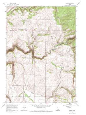
Lamont Topo Map Idaho
To zoom in, hover over the map of Lamont
USGS Topo Quad 43111h2 - 1:24,000 scale
| Topo Map Name: | Lamont |
| USGS Topo Quad ID: | 43111h2 |
| Print Size: | ca. 21 1/4" wide x 27" high |
| Southeast Coordinates: | 43.875° N latitude / 111.125° W longitude |
| Map Center Coordinates: | 43.9375° N latitude / 111.1875° W longitude |
| U.S. State: | ID |
| Filename: | o43111h2.jpg |
| Download Map JPG Image: | Lamont topo map 1:24,000 scale |
| Map Type: | Topographic |
| Topo Series: | 7.5´ |
| Map Scale: | 1:24,000 |
| Source of Map Images: | United States Geological Survey (USGS) |
| Alternate Map Versions: |
Lamont ID 1965, updated 1967 Download PDF Buy paper map Lamont ID 1965, updated 1985 Download PDF Buy paper map Lamont ID 2011 Download PDF Buy paper map Lamont ID 2013 Download PDF Buy paper map |
| FStopo: | US Forest Service topo Lamont is available: Download FStopo PDF Download FStopo TIF |
1:24,000 Topo Quads surrounding Lamont
> Back to 43111e1 at 1:100,000 scale
> Back to 43110a1 at 1:250,000 scale
> Back to U.S. Topo Maps home
Lamont topo map: Gazetteer
Lamont: Populated Places
Judkins elevation 1839m 6033′Lamont elevation 1838m 6030′
Lamont: Streams
Bull Elk Creek elevation 1800m 5905′Dry Creek elevation 1725m 5659′
Dry Creek elevation 1798m 5898′
Horse Creek elevation 1835m 6020′
Morris Creek elevation 1817m 5961′
Swanner Creek elevation 1774m 5820′
Tepee Creek elevation 1846m 6056′
Lamont: Valleys
Pole Canyon elevation 1845m 6053′Lamont digital topo map on disk
Buy this Lamont topo map showing relief, roads, GPS coordinates and other geographical features, as a high-resolution digital map file on DVD:


