Drummond Topo Map Idaho
To zoom in, hover over the map of Drummond
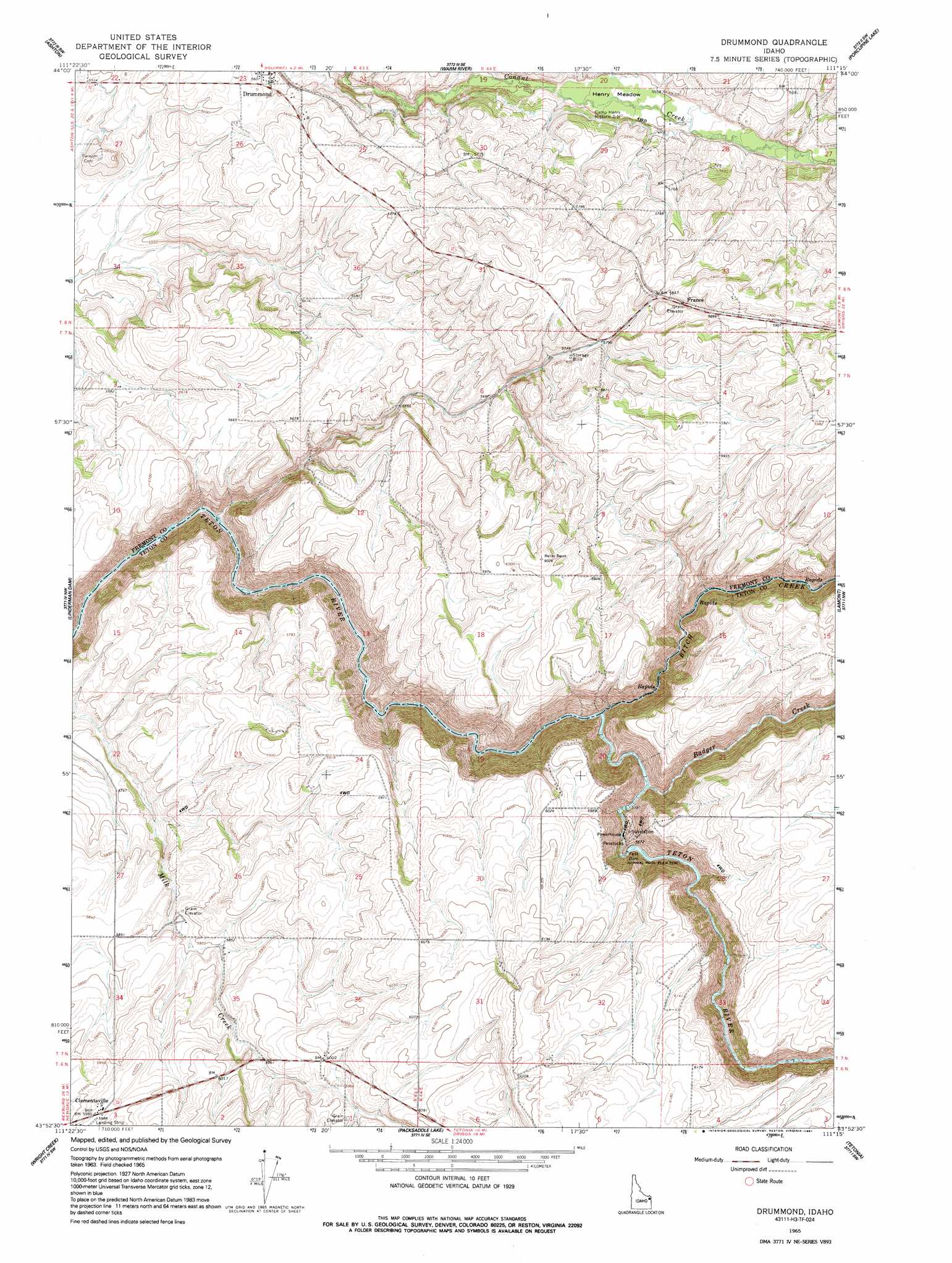
USGS Topo Quad 43111h3 - 1:24,000 scale
| Topo Map Name: | Drummond |
| USGS Topo Quad ID: | 43111h3 |
| Print Size: | ca. 21 1/4" wide x 27" high |
| Southeast Coordinates: | 43.875° N latitude / 111.25° W longitude |
| Map Center Coordinates: | 43.9375° N latitude / 111.3125° W longitude |
| U.S. State: | ID |
| Filename: | o43111h3.jpg |
| Download Map JPG Image: | Drummond topo map 1:24,000 scale |
| Map Type: | Topographic |
| Topo Series: | 7.5´ |
| Map Scale: | 1:24,000 |
| Source of Map Images: | United States Geological Survey (USGS) |
| Alternate Map Versions: |
Drummond ID 1965, updated 1967 Download PDF Buy paper map Drummond ID 1965, updated 1991 Download PDF Buy paper map Drummond ID 2010 Download PDF Buy paper map Drummond ID 2013 Download PDF Buy paper map |
1:24,000 Topo Quads surrounding Drummond
Blue Creek Reservoir |
Lookout Butte |
Snake River Butte |
Warm River Butte |
Bechler Falls |
Lemon Lake |
Ashton |
Warm River |
Porcupine Lake |
Sheep Falls |
Newdale |
Linderman Dam |
Drummond |
Lamont |
Mcrenolds Reservoir |
White Owl Butte |
Wright Creek |
Packsaddle Lake |
Tetonia |
Clawson |
Hawley Gulch |
Temple Peak |
Garns Mountain |
Bates |
Driggs |
> Back to 43111e1 at 1:100,000 scale
> Back to 43110a1 at 1:250,000 scale
> Back to U.S. Topo Maps home
Drummond topo map: Gazetteer
Drummond: Dams
Felt Dam elevation 1687m 5534′Drummond: Flats
Henry Meadow elevation 1687m 5534′Drummond: Populated Places
Clementsville elevation 1828m 5997′Drummond elevation 1710m 5610′
France elevation 1784m 5853′
Drummond: Streams
Badger Creek elevation 1636m 5367′Bitch Creek elevation 1677m 5501′
North Fork Teton River elevation 1677m 5501′
Drummond digital topo map on disk
Buy this Drummond topo map showing relief, roads, GPS coordinates and other geographical features, as a high-resolution digital map file on DVD: