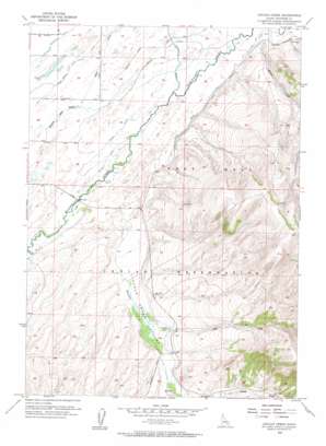
Lincoln Creek Topo Map Idaho
To zoom in, hover over the map of Lincoln Creek
USGS Topo Quad 43112b2 - 1:24,000 scale
| Topo Map Name: | Lincoln Creek |
| USGS Topo Quad ID: | 43112b2 |
| Print Size: | ca. 21 1/4" wide x 27" high |
| Southeast Coordinates: | 43.125° N latitude / 112.125° W longitude |
| Map Center Coordinates: | 43.1875° N latitude / 112.1875° W longitude |
| U.S. State: | ID |
| Filename: | o43112b2.jpg |
| Download Map JPG Image: | Lincoln Creek topo map 1:24,000 scale |
| Map Type: | Topographic |
| Topo Series: | 7.5´ |
| Map Scale: | 1:24,000 |
| Source of Map Images: | United States Geological Survey (USGS) |
| Alternate Map Versions: |
Lincoln Creek ID 1955, updated 1957 Download PDF Buy paper map Lincoln Creek ID 1955, updated 1957 Download PDF Buy paper map Lincoln Creek ID 1998, updated 2002 Download PDF Buy paper map Lincoln Creek ID 2010 Download PDF Buy paper map Lincoln Creek ID 2013 Download PDF Buy paper map |
1:24,000 Topo Quads surrounding Lincoln Creek
> Back to 43112a1 at 1:100,000 scale
> Back to 43112a1 at 1:250,000 scale
> Back to U.S. Topo Maps home
Lincoln Creek topo map: Gazetteer
Lincoln Creek: Canals
East Branch Blackfoot Canal elevation 1388m 4553′Hanson Ditch elevation 1387m 4550′
Little Indian Ditch elevation 1404m 4606′
Taylor Ditch elevation 1388m 4553′
Lincoln Creek: Streams
Cold Creek elevation 1439m 4721′Garden Creek elevation 1408m 4619′
Lincoln Creek elevation 1390m 4560′
Sand Creek elevation 1385m 4543′
Lincoln Creek: Valleys
Lincoln Creek Valley elevation 1406m 4612′Lincoln Creek digital topo map on disk
Buy this Lincoln Creek topo map showing relief, roads, GPS coordinates and other geographical features, as a high-resolution digital map file on DVD:


