Shattuck Butte Topo Map Idaho
To zoom in, hover over the map of Shattuck Butte
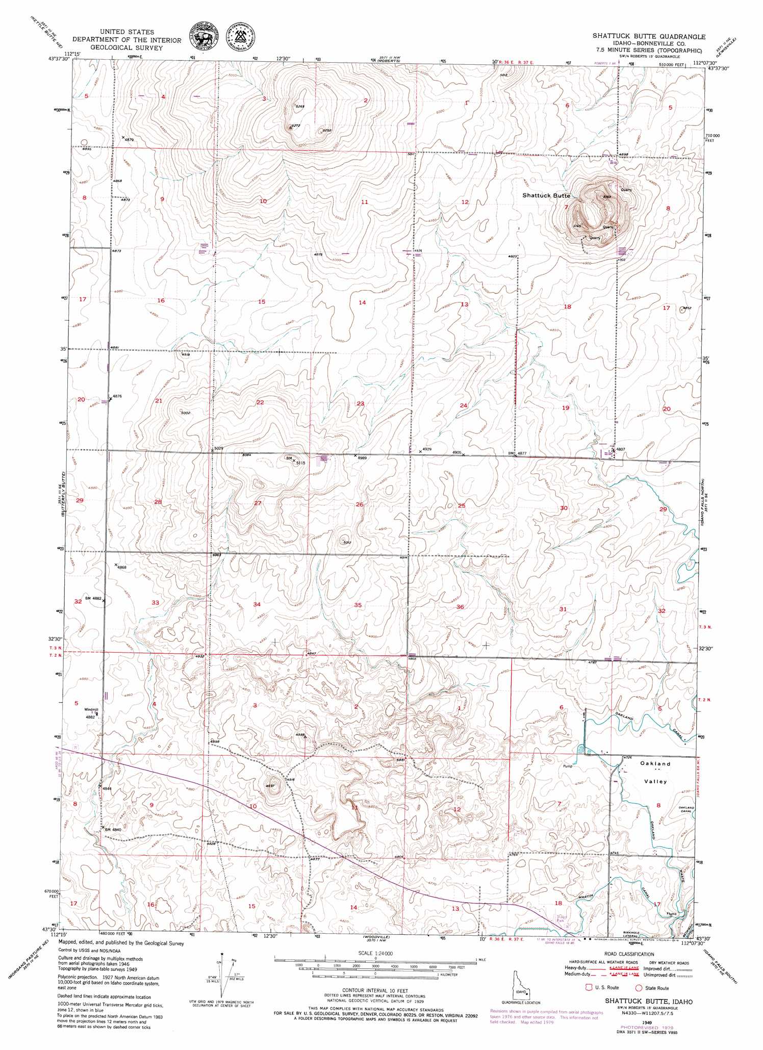
USGS Topo Quad 43112e2 - 1:24,000 scale
| Topo Map Name: | Shattuck Butte |
| USGS Topo Quad ID: | 43112e2 |
| Print Size: | ca. 21 1/4" wide x 27" high |
| Southeast Coordinates: | 43.5° N latitude / 112.125° W longitude |
| Map Center Coordinates: | 43.5625° N latitude / 112.1875° W longitude |
| U.S. State: | ID |
| Filename: | o43112e2.jpg |
| Download Map JPG Image: | Shattuck Butte topo map 1:24,000 scale |
| Map Type: | Topographic |
| Topo Series: | 7.5´ |
| Map Scale: | 1:24,000 |
| Source of Map Images: | United States Geological Survey (USGS) |
| Alternate Map Versions: |
Shattuck Butte ID 1949, updated 1973 Download PDF Buy paper map Shattuck Butte ID 1949, updated 1979 Download PDF Buy paper map Shattuck Butte ID 1950 Download PDF Buy paper map Shattuck Butte ID 2010 Download PDF Buy paper map Shattuck Butte ID 2013 Download PDF Buy paper map |
1:24,000 Topo Quads surrounding Shattuck Butte
Terreton |
Mud Lake Se |
Market Lake |
Deer Parks |
Menan Buttes |
Kettle Butte Nw |
Kettle Butte Ne |
Roberts |
Lewisville |
Rigby |
Kettle Butte |
Butterfly Butte |
Shattuck Butte |
Idaho Falls North |
Ucon |
Morgans Pasture Nw |
Morgans Pasture Ne |
Woodville |
Idaho Falls South |
Ammon |
Baldy Knoll |
Rose |
Firth |
Goshen |
Wolverine |
> Back to 43112e1 at 1:100,000 scale
> Back to 43112a1 at 1:250,000 scale
> Back to U.S. Topo Maps home
Shattuck Butte topo map: Gazetteer
Shattuck Butte: Airports
Q B One Airport elevation 1485m 4872′Shattuck Butte: Canals
Beckman Ditch elevation 1449m 4753′Hayes Lateral elevation 1463m 4799′
Martin Canal elevation 1444m 4737′
Regulation Spillway elevation 1442m 4730′
Shattuck Butte: Summits
Shattuck Butte elevation 1568m 5144′Shattuck Butte: Valleys
Oakland Valley elevation 1440m 4724′Shattuck Butte digital topo map on disk
Buy this Shattuck Butte topo map showing relief, roads, GPS coordinates and other geographical features, as a high-resolution digital map file on DVD: