Tyler Peak Topo Map Idaho
To zoom in, hover over the map of Tyler Peak
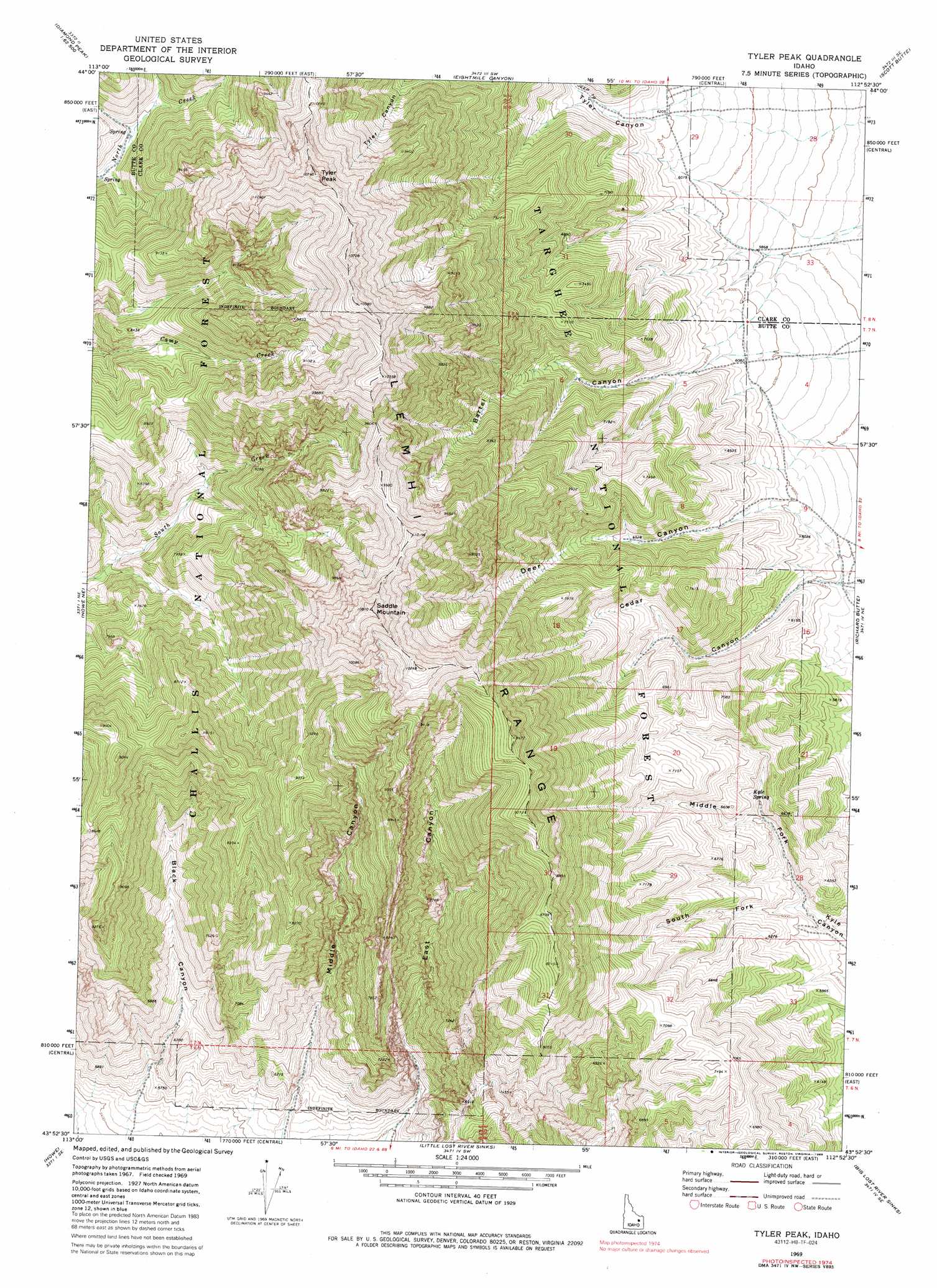
USGS Topo Quad 43112h8 - 1:24,000 scale
| Topo Map Name: | Tyler Peak |
| USGS Topo Quad ID: | 43112h8 |
| Print Size: | ca. 21 1/4" wide x 27" high |
| Southeast Coordinates: | 43.875° N latitude / 112.875° W longitude |
| Map Center Coordinates: | 43.9375° N latitude / 112.9375° W longitude |
| U.S. State: | ID |
| Filename: | o43112h8.jpg |
| Download Map JPG Image: | Tyler Peak topo map 1:24,000 scale |
| Map Type: | Topographic |
| Topo Series: | 7.5´ |
| Map Scale: | 1:24,000 |
| Source of Map Images: | United States Geological Survey (USGS) |
| Alternate Map Versions: |
Tyler Peak ID 1969, updated 1973 Download PDF Buy paper map Tyler Peak ID 1969, updated 1988 Download PDF Buy paper map Tyler Peak ID 2011 Download PDF Buy paper map Tyler Peak ID 2013 Download PDF Buy paper map |
| FStopo: | US Forest Service topo Tyler Peak is available: Download FStopo PDF Download FStopo TIF |
1:24,000 Topo Quads surrounding Tyler Peak
Bell Mountain |
Diamond Peak |
Blue Dome |
Copper Mountain |
Shamrock Gulch |
Badger Creek |
Fallert Springs |
Eightmile Canyon |
Scott Butte |
Snaky Canyon |
Howe Nw |
Howe Ne |
Tyler Peak |
Richard Butte |
Circular Butte Nw |
Arco Pass |
Howe |
Little Lost River Sinks |
Big Lost River Sinks |
Circular Butte |
Arco Hills |
Howe Peak |
Circular Butte 3 Nw |
Circular Butte 3 Ne |
Little Butte Nw |
> Back to 43112e1 at 1:100,000 scale
> Back to 43112a1 at 1:250,000 scale
> Back to U.S. Topo Maps home
Tyler Peak topo map: Gazetteer
Tyler Peak: Springs
Kyle Spring elevation 1929m 6328′Tyler Peak: Streams
Middle Fork Kyle Canyon elevation 1788m 5866′South Fork Kyle Canyon elevation 1788m 5866′
Tyler Peak: Summits
Saddle Mountain elevation 3279m 10757′Tyler Peak elevation 3252m 10669′
Tyler Peak: Valleys
Bartel Canyon elevation 1781m 5843′Black Canyon elevation 1678m 5505′
Cedar Canyon elevation 1748m 5734′
Deer Canyon elevation 1782m 5846′
East Canyon elevation 1723m 5652′
Middle Canyon elevation 1740m 5708′
Tyler Peak digital topo map on disk
Buy this Tyler Peak topo map showing relief, roads, GPS coordinates and other geographical features, as a high-resolution digital map file on DVD: