Mosby Well Topo Map Idaho
To zoom in, hover over the map of Mosby Well
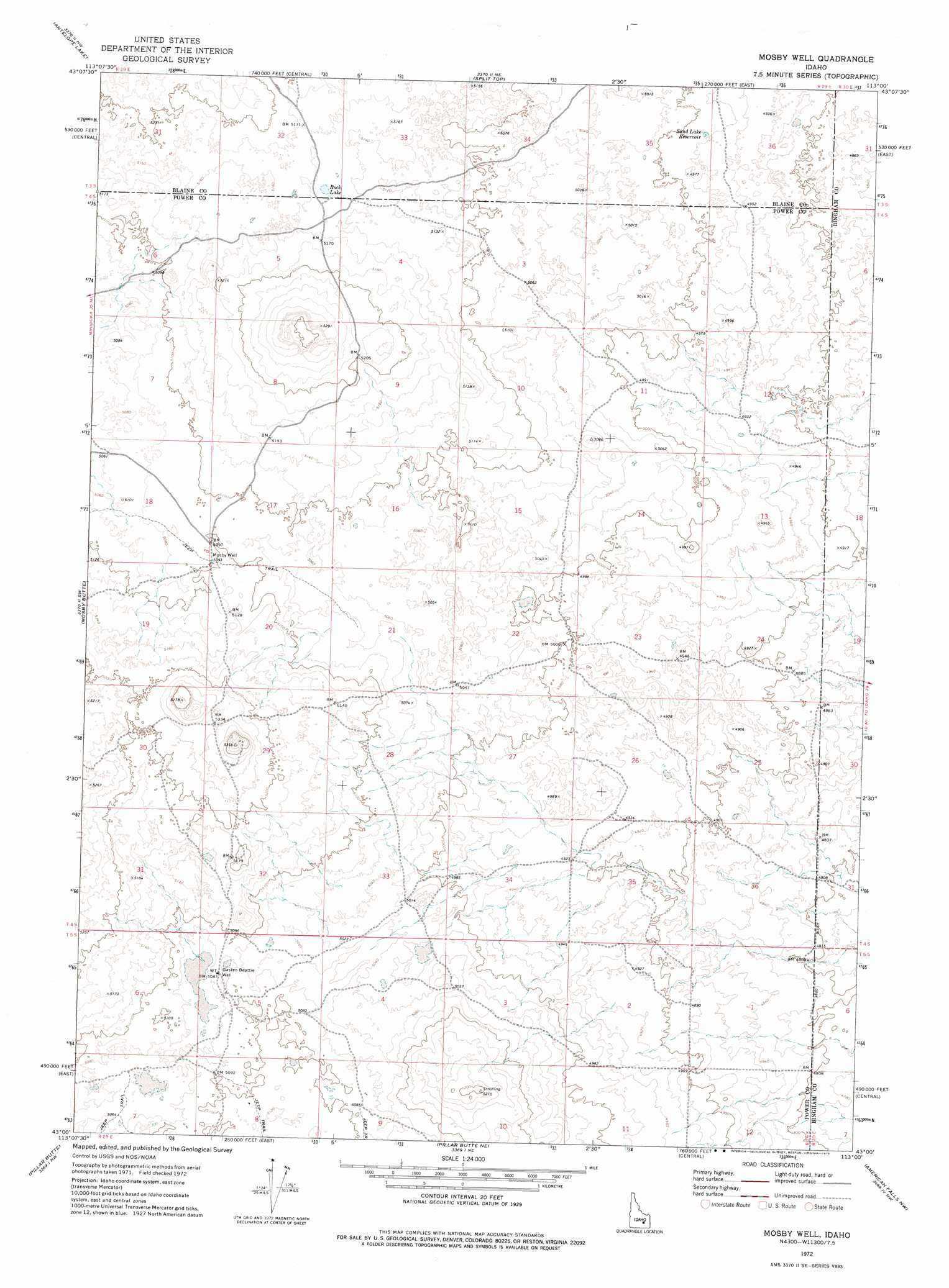
USGS Topo Quad 43113a1 - 1:24,000 scale
| Topo Map Name: | Mosby Well |
| USGS Topo Quad ID: | 43113a1 |
| Print Size: | ca. 21 1/4" wide x 27" high |
| Southeast Coordinates: | 43° N latitude / 113° W longitude |
| Map Center Coordinates: | 43.0625° N latitude / 113.0625° W longitude |
| U.S. State: | ID |
| Filename: | o43113a1.jpg |
| Download Map JPG Image: | Mosby Well topo map 1:24,000 scale |
| Map Type: | Topographic |
| Topo Series: | 7.5´ |
| Map Scale: | 1:24,000 |
| Source of Map Images: | United States Geological Survey (USGS) |
| Alternate Map Versions: |
Mosby Well ID 1972, updated 1976 Download PDF Buy paper map Mosby Well ID 2010 Download PDF Buy paper map Mosby Well ID 2013 Download PDF Buy paper map |
1:24,000 Topo Quads surrounding Mosby Well
Pratt Butte |
Serviceberry Butte |
Sunset Lake |
Rock Butte |
Lava Lake Reservoir |
Bear Park East |
Antelope Lake |
Split Top |
Coffee Point |
Coffee Point Ne |
Mule Butte |
Mosby Butte |
Mosby Well |
Coffee Point Sw |
Big Fill Reservoir |
Bear Trap Cave |
Pillar Butte |
Pillar Butte Ne |
American Falls Nw |
Aberdeen |
Schodde Well |
Rattlesnake Butte |
Pillar Butte Se |
American Falls Sw |
American Falls |
> Back to 43113a1 at 1:100,000 scale
> Back to 43112a1 at 1:250,000 scale
> Back to U.S. Topo Maps home
Mosby Well topo map: Gazetteer
Mosby Well: Lakes
Rock Lake elevation 1572m 5157′Mosby Well: Reservoirs
Sand Lake Reservoir elevation 1519m 4983′Mosby Well: Wells
Gasten Beattie Well elevation 1549m 5082′Mosby Well elevation 1555m 5101′
Mosby Well digital topo map on disk
Buy this Mosby Well topo map showing relief, roads, GPS coordinates and other geographical features, as a high-resolution digital map file on DVD: