Halfway Lake Topo Map Idaho
To zoom in, hover over the map of Halfway Lake
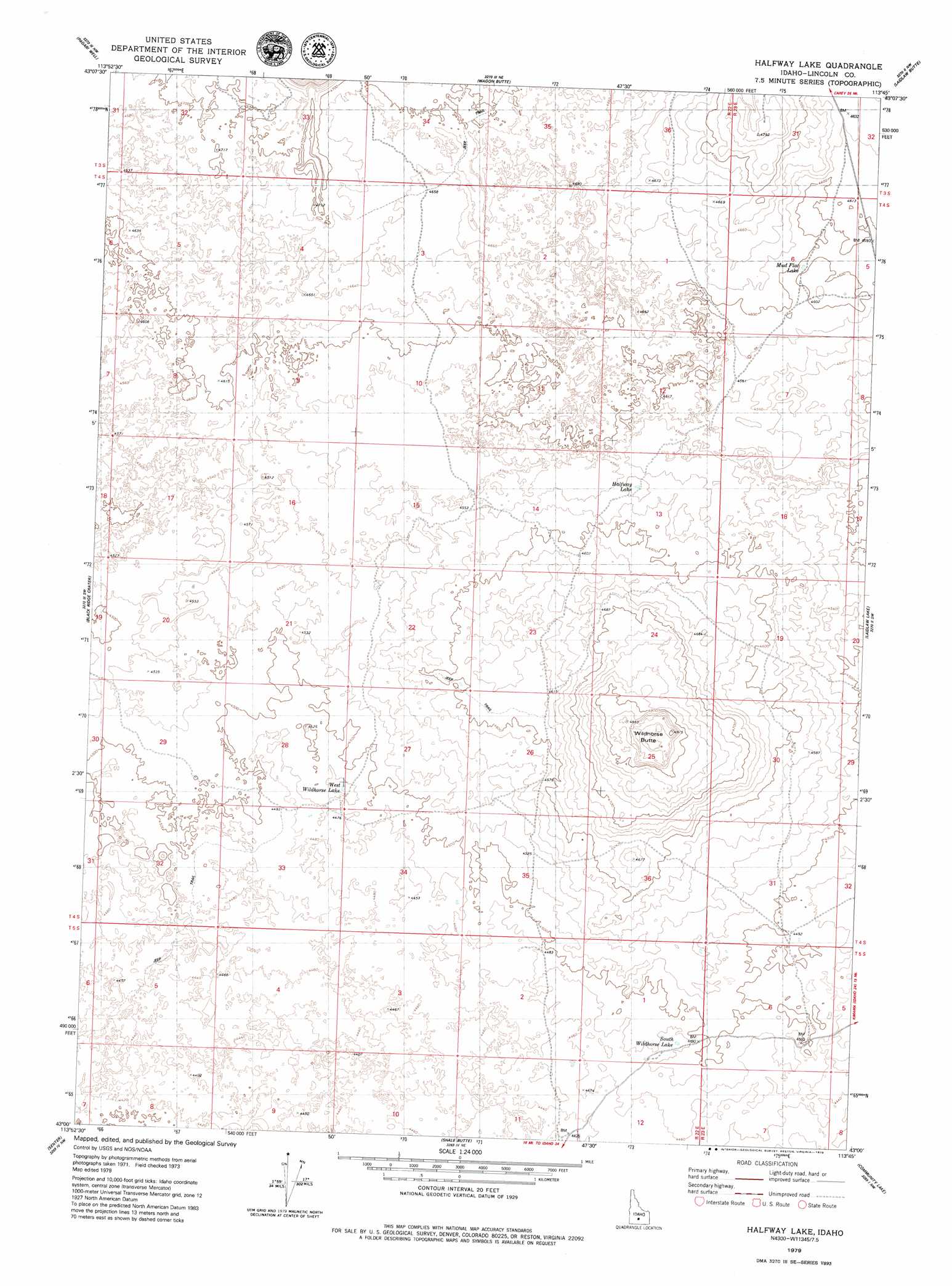
USGS Topo Quad 43113a7 - 1:24,000 scale
| Topo Map Name: | Halfway Lake |
| USGS Topo Quad ID: | 43113a7 |
| Print Size: | ca. 21 1/4" wide x 27" high |
| Southeast Coordinates: | 43° N latitude / 113.75° W longitude |
| Map Center Coordinates: | 43.0625° N latitude / 113.8125° W longitude |
| U.S. State: | ID |
| Filename: | o43113a7.jpg |
| Download Map JPG Image: | Halfway Lake topo map 1:24,000 scale |
| Map Type: | Topographic |
| Topo Series: | 7.5´ |
| Map Scale: | 1:24,000 |
| Source of Map Images: | United States Geological Survey (USGS) |
| Alternate Map Versions: |
Halfway Lake ID 1979, updated 1979 Download PDF Buy paper map Halfway Lake ID 2010 Download PDF Buy paper map Halfway Lake ID 2013 Download PDF Buy paper map |
1:24,000 Topo Quads surrounding Halfway Lake
Picabo |
Carey |
Paddelford Flat |
Little Park |
North Laidlaw Butte |
Tikura |
Pagari Well |
Wagon Butte |
Laidlaw Butte |
Bear Den Butte |
Pagari |
Black Ridge Crater |
Halfway Lake |
Laidlaw Lake |
Bottleneck Lake |
Owinza |
Senter |
Shale Butte |
Community Lake |
Larkspur Park |
Owinza Butte |
Kimama Butte |
Kimama |
Norland |
Max |
> Back to 43113a1 at 1:100,000 scale
> Back to 43112a1 at 1:250,000 scale
> Back to U.S. Topo Maps home
Halfway Lake topo map: Gazetteer
Halfway Lake: Lakes
Halfway Lake elevation 1391m 4563′Mud Flat Lake elevation 1403m 4603′
South Wildhorse Lake elevation 1366m 4481′
West Wildhorse Lake elevation 1366m 4481′
Halfway Lake: Summits
Wildhorse Butte elevation 1496m 4908′Halfway Lake digital topo map on disk
Buy this Halfway Lake topo map showing relief, roads, GPS coordinates and other geographical features, as a high-resolution digital map file on DVD: