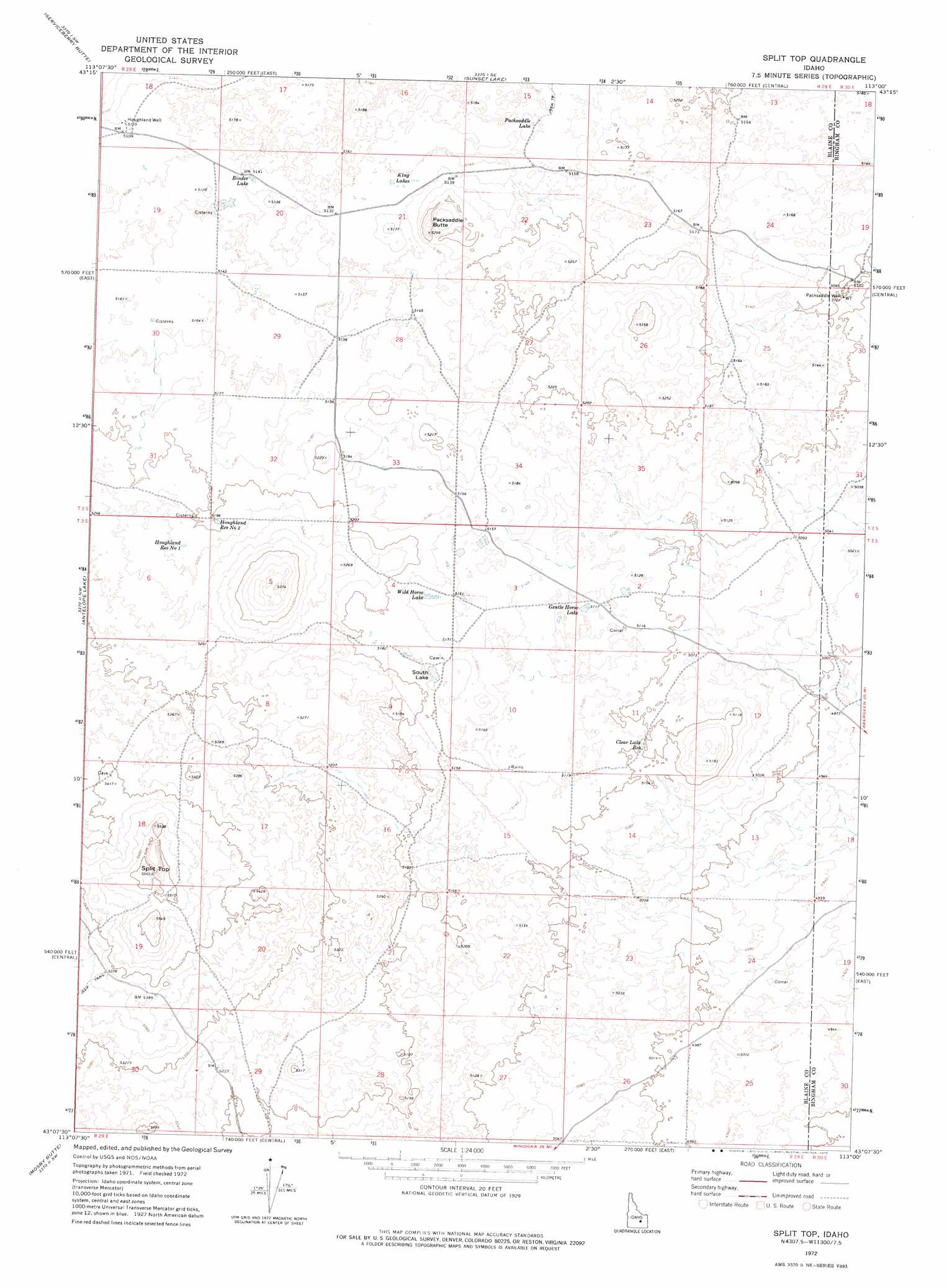
Split Top Topo Map Idaho
To zoom in, hover over the map of Split Top
USGS Topo Quad 43113b1 - 1:24,000 scale
| Topo Map Name: | Split Top |
| USGS Topo Quad ID: | 43113b1 |
| Print Size: | ca. 21 1/4" wide x 27" high |
| Southeast Coordinates: | 43.125° N latitude / 113° W longitude |
| Map Center Coordinates: | 43.1875° N latitude / 113.0625° W longitude |
| U.S. State: | ID |
| Filename: | o43113b1.jpg |
| Download Map JPG Image: | Split Top topo map 1:24,000 scale |
| Map Type: | Topographic |
| Topo Series: | 7.5´ |
| Map Scale: | 1:24,000 |
| Source of Map Images: | United States Geological Survey (USGS) |
| Alternate Map Versions: |
Split Top ID 1972, updated 1975 Download PDF Buy paper map Split Top ID 2010 Download PDF Buy paper map Split Top ID 2013 Download PDF Buy paper map |
1:24,000 Topo Quads surrounding Split Top
Fingers Butte |
Quaking Aspen Butte |
Big Southern Butte |
Scoville |
Atomic City |
Pratt Butte |
Serviceberry Butte |
Sunset Lake |
Rock Butte |
Lava Lake Reservoir |
Bear Park East |
Antelope Lake |
Split Top |
Coffee Point |
Coffee Point Ne |
Mule Butte |
Mosby Butte |
Mosby Well |
Coffee Point Sw |
Big Fill Reservoir |
Bear Trap Cave |
Pillar Butte |
Pillar Butte Ne |
American Falls Nw |
Aberdeen |
> Back to 43113a1 at 1:100,000 scale
> Back to 43112a1 at 1:250,000 scale
> Back to U.S. Topo Maps home
Split Top topo map: Gazetteer
Split Top: Lakes
Binder Lake elevation 1568m 5144′Gentle Horse Lake elevation 1561m 5121′
King Lakes elevation 1568m 5144′
Packsaddle Lake elevation 1568m 5144′
South Lake elevation 1580m 5183′
Wild Horse Lake elevation 1573m 5160′
Split Top: Reservoirs
Clear Lake Reservoir elevation 1555m 5101′Houghland Reservoir Number 1 elevation 1591m 5219′
Houghland Reservoir Number 2 elevation 1586m 5203′
Split Top: Summits
Packsaddle Butte elevation 1598m 5242′Split Top elevation 1696m 5564′
Split Top: Wells
Houghland Well elevation 1562m 5124′Packsaddle Well elevation 1555m 5101′
Split Top digital topo map on disk
Buy this Split Top topo map showing relief, roads, GPS coordinates and other geographical features, as a high-resolution digital map file on DVD: