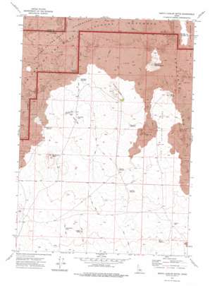
North Laidlaw Butte Topo Map Idaho
To zoom in, hover over the map of North Laidlaw Butte
USGS Topo Quad 43113c5 - 1:24,000 scale
| Topo Map Name: | North Laidlaw Butte |
| USGS Topo Quad ID: | 43113c5 |
| Print Size: | ca. 21 1/4" wide x 27" high |
| Southeast Coordinates: | 43.25° N latitude / 113.5° W longitude |
| Map Center Coordinates: | 43.3125° N latitude / 113.5625° W longitude |
| U.S. State: | ID |
| Filename: | o43113c5.jpg |
| Download Map JPG Image: | North Laidlaw Butte topo map 1:24,000 scale |
| Map Type: | Topographic |
| Topo Series: | 7.5´ |
| Map Scale: | 1:24,000 |
| Source of Map Images: | United States Geological Survey (USGS) |
| Alternate Map Versions: |
North Laidlaw Butte ID 1972, updated 1975 Download PDF Buy paper map North Laidlaw Butte ID 2010 Download PDF Buy paper map North Laidlaw Butte ID 2013 Download PDF Buy paper map |
1:24,000 Topo Quads surrounding North Laidlaw Butte
> Back to 43113a1 at 1:100,000 scale
> Back to 43112a1 at 1:250,000 scale
> Back to U.S. Topo Maps home
North Laidlaw Butte topo map: Gazetteer
North Laidlaw Butte: Airports
Hollow Top Airport elevation 1633m 5357′North Laidlaw Butte: Craters
Bowl Crater elevation 1655m 5429′Snowdrift Crater elevation 1665m 5462′
North Laidlaw Butte: Flats
Little Laidlaw Park elevation 1636m 5367′North Laidlaw Butte: Gaps
Hollow Top elevation 1640m 5380′North Laidlaw Butte: Lakes
Bullshot Reservoir elevation 1598m 5242′Spencer Lake elevation 1566m 5137′
Two Bottom Lake elevation 1571m 5154′
North Laidlaw Butte: Lavas
Sentinel West Flow elevation 1695m 5561′North Laidlaw Butte: Reservoirs
Blowout Reservoir elevation 1629m 5344′Erwin Reservoir elevation 1555m 5101′
Hawk Reservoir elevation 1554m 5098′
North Blowout Reservoir elevation 1598m 5242′
North Pole Lake elevation 1630m 5347′
Northside Reservoir elevation 1659m 5442′
Snowdrift Reservoir elevation 1647m 5403′
North Laidlaw Butte: Summits
Ant Butte elevation 1579m 5180′Big Blowout Butte elevation 1640m 5380′
North Laidlaw Butte elevation 1802m 5912′
Turnbull Butte elevation 1601m 5252′
North Laidlaw Butte: Wells
Ellsworth Well elevation 1628m 5341′North End Indian Well elevation 1677m 5501′
North Laidlaw Butte digital topo map on disk
Buy this North Laidlaw Butte topo map showing relief, roads, GPS coordinates and other geographical features, as a high-resolution digital map file on DVD:


