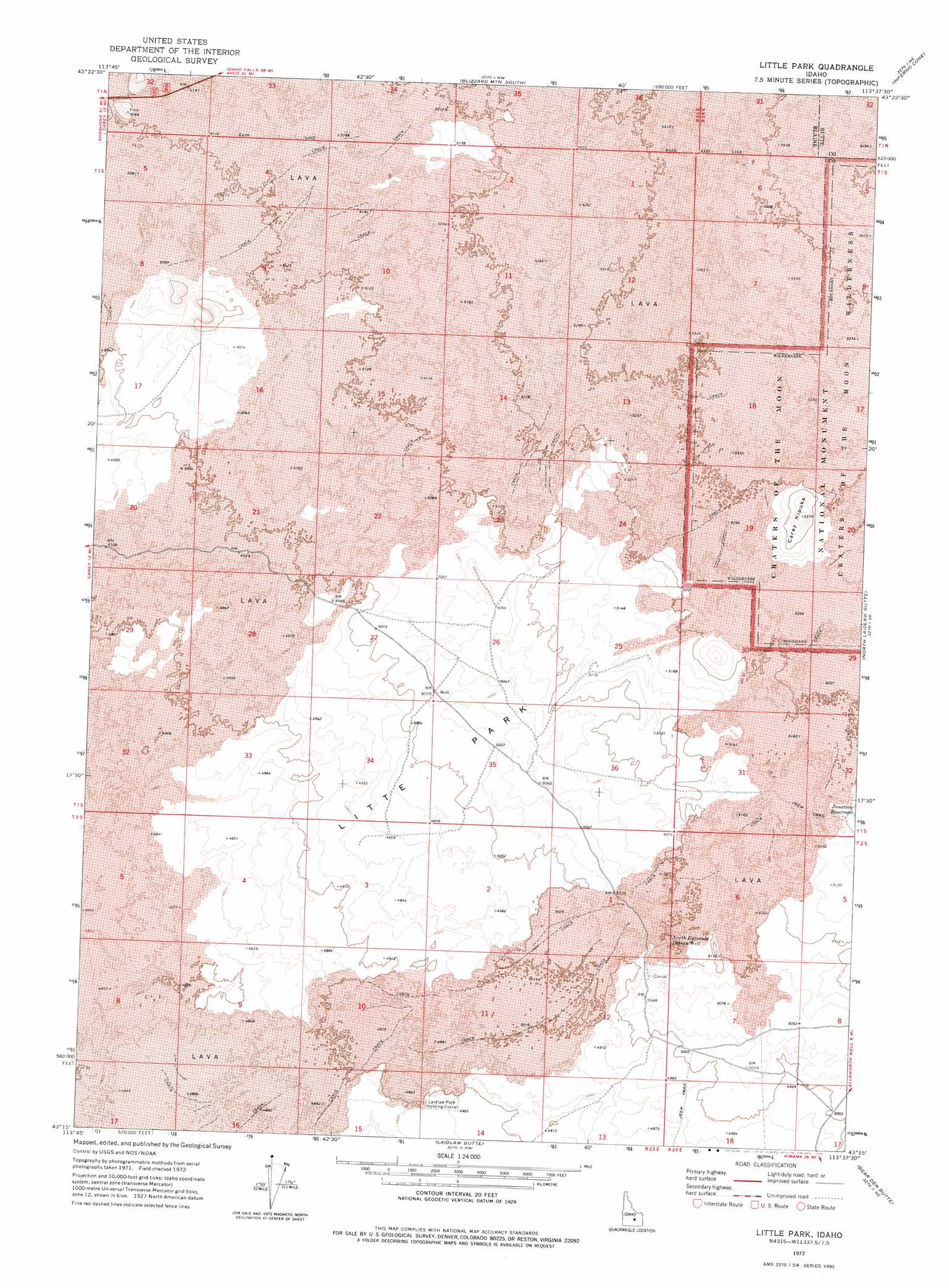
Little Park Topo Map Idaho
To zoom in, hover over the map of Little Park
USGS Topo Quad 43113c6 - 1:24,000 scale
| Topo Map Name: | Little Park |
| USGS Topo Quad ID: | 43113c6 |
| Print Size: | ca. 21 1/4" wide x 27" high |
| Southeast Coordinates: | 43.25° N latitude / 113.625° W longitude |
| Map Center Coordinates: | 43.3125° N latitude / 113.6875° W longitude |
| U.S. State: | ID |
| Filename: | o43113c6.jpg |
| Download Map JPG Image: | Little Park topo map 1:24,000 scale |
| Map Type: | Topographic |
| Topo Series: | 7.5´ |
| Map Scale: | 1:24,000 |
| Source of Map Images: | United States Geological Survey (USGS) |
| Alternate Map Versions: |
Little Park ID 1972, updated 1976 Download PDF Buy paper map Little Park ID 2011 Download PDF Buy paper map Little Park ID 2013 Download PDF Buy paper map |
1:24,000 Topo Quads surrounding Little Park
Muldoon |
Trail Creek |
Blizzard Mountain North |
Champagne Creek |
Nichols Reservoir |
Lake Hills |
Fish Creek Reservoir |
Blizzard Mountain South |
Inferno Cone |
The Watchman |
Carey |
Paddelford Flat |
Little Park |
North Laidlaw Butte |
Fissure Butte |
Pagari Well |
Wagon Butte |
Laidlaw Butte |
Bear Den Butte |
Bear Park West |
Black Ridge Crater |
Halfway Lake |
Laidlaw Lake |
Bottleneck Lake |
Bear Park Sw |
> Back to 43113a1 at 1:100,000 scale
> Back to 43112a1 at 1:250,000 scale
> Back to U.S. Topo Maps home
Little Park topo map: Gazetteer
Little Park: Flats
Litte Park elevation 1528m 5013′Little Park: Reservoirs
Junction Reservoir elevation 1564m 5131′Little Park: Summits
Carey Kipuka elevation 1635m 5364′Little Park: Wells
North Entrance Indian Well elevation 1549m 5082′Little Park digital topo map on disk
Buy this Little Park topo map showing relief, roads, GPS coordinates and other geographical features, as a high-resolution digital map file on DVD: