Howe Peak Topo Map Idaho
To zoom in, hover over the map of Howe Peak
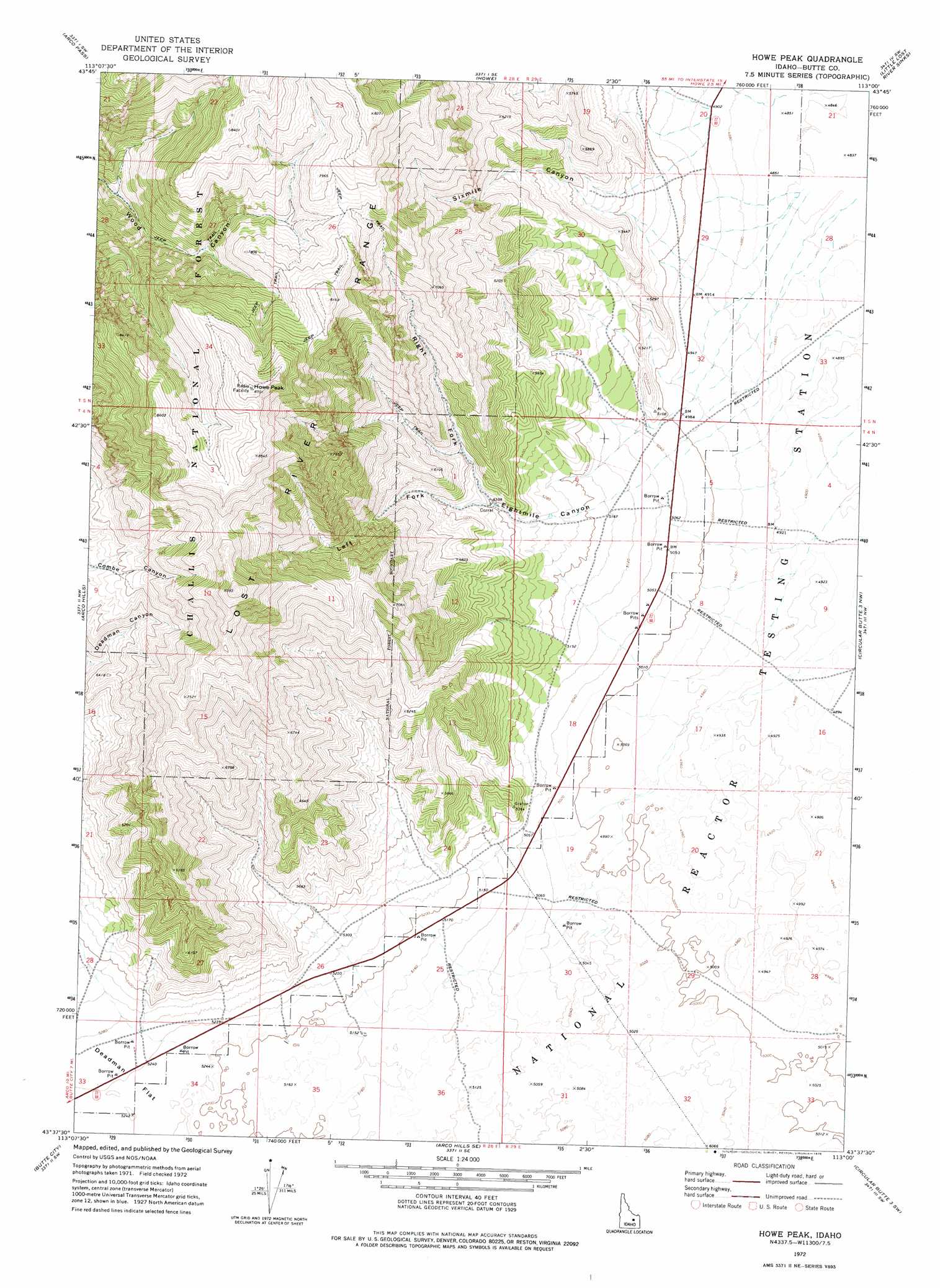
USGS Topo Quad 43113f1 - 1:24,000 scale
| Topo Map Name: | Howe Peak |
| USGS Topo Quad ID: | 43113f1 |
| Print Size: | ca. 21 1/4" wide x 27" high |
| Southeast Coordinates: | 43.625° N latitude / 113° W longitude |
| Map Center Coordinates: | 43.6875° N latitude / 113.0625° W longitude |
| U.S. State: | ID |
| Filename: | o43113f1.jpg |
| Download Map JPG Image: | Howe Peak topo map 1:24,000 scale |
| Map Type: | Topographic |
| Topo Series: | 7.5´ |
| Map Scale: | 1:24,000 |
| Source of Map Images: | United States Geological Survey (USGS) |
| Alternate Map Versions: |
Howe Peak ID 1972, updated 1976 Download PDF Buy paper map Howe Peak ID 2011 Download PDF Buy paper map Howe Peak ID 2013 Download PDF Buy paper map |
| FStopo: | US Forest Service topo Howe Peak is available: Download FStopo PDF Download FStopo TIF |
1:24,000 Topo Quads surrounding Howe Peak
Sunset Peak |
Howe Nw |
Howe Ne |
Tyler Peak |
Richard Butte |
Ramshorn Canyon |
Arco Pass |
Howe |
Little Lost River Sinks |
Big Lost River Sinks |
Arco North |
Arco Hills |
Howe Peak |
Circular Butte 3 Nw |
Circular Butte 3 Ne |
Arco South |
Butte City |
Arco Hills Se |
Circular Butte 3 Sw |
Circular Butte 3 Se |
Fingers Butte |
Quaking Aspen Butte |
Big Southern Butte |
Scoville |
Atomic City |
> Back to 43113e1 at 1:100,000 scale
> Back to 43112a1 at 1:250,000 scale
> Back to U.S. Topo Maps home
Howe Peak topo map: Gazetteer
Howe Peak: Summits
Howe Peak elevation 2651m 8697′Howe Peak: Valleys
Eightmile Canyon elevation 1585m 5200′Left Fork Eightmile Canyon elevation 1646m 5400′
Right Fork Eightmile Canyon elevation 1646m 5400′
Sixmile Canyon elevation 1509m 4950′
Howe Peak digital topo map on disk
Buy this Howe Peak topo map showing relief, roads, GPS coordinates and other geographical features, as a high-resolution digital map file on DVD: