Howe Topo Map Idaho
To zoom in, hover over the map of Howe
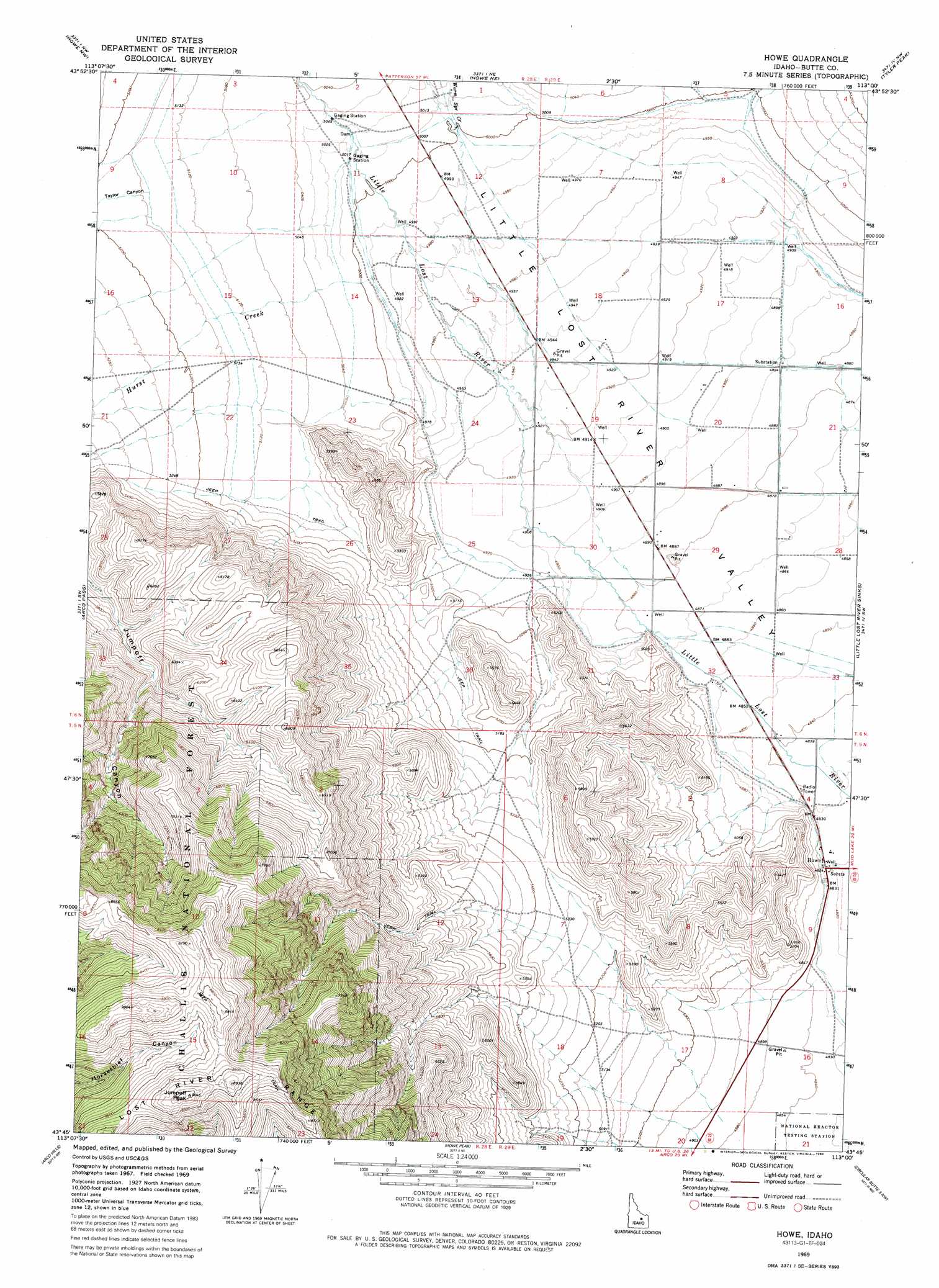
USGS Topo Quad 43113g1 - 1:24,000 scale
| Topo Map Name: | Howe |
| USGS Topo Quad ID: | 43113g1 |
| Print Size: | ca. 21 1/4" wide x 27" high |
| Southeast Coordinates: | 43.75° N latitude / 113° W longitude |
| Map Center Coordinates: | 43.8125° N latitude / 113.0625° W longitude |
| U.S. State: | ID |
| Filename: | o43113g1.jpg |
| Download Map JPG Image: | Howe topo map 1:24,000 scale |
| Map Type: | Topographic |
| Topo Series: | 7.5´ |
| Map Scale: | 1:24,000 |
| Source of Map Images: | United States Geological Survey (USGS) |
| Alternate Map Versions: |
Howe ID 1969, updated 1973 Download PDF Buy paper map Howe ID 1969, updated 1986 Download PDF Buy paper map Howe ID 2011 Download PDF Buy paper map Howe ID 2013 Download PDF Buy paper map |
| FStopo: | US Forest Service topo Howe is available: Download FStopo PDF Download FStopo TIF |
1:24,000 Topo Quads surrounding Howe
Hawley Mountain |
Badger Creek |
Fallert Springs |
Eightmile Canyon |
Scott Butte |
Sunset Peak |
Howe Nw |
Howe Ne |
Tyler Peak |
Richard Butte |
Ramshorn Canyon |
Arco Pass |
Howe |
Little Lost River Sinks |
Big Lost River Sinks |
Arco North |
Arco Hills |
Howe Peak |
Circular Butte 3 Nw |
Circular Butte 3 Ne |
Arco South |
Butte City |
Arco Hills Se |
Circular Butte 3 Sw |
Circular Butte 3 Se |
> Back to 43113e1 at 1:100,000 scale
> Back to 43112a1 at 1:250,000 scale
> Back to U.S. Topo Maps home
Howe topo map: Gazetteer
Howe: Airports
Howe Airport elevation 1504m 4934′Howe: Populated Places
Howe elevation 1472m 4829′Howe: Streams
Hurst Creek elevation 1523m 4996′South Creek elevation 1528m 5013′
Warm Spring Creek elevation 1525m 5003′
Howe: Summits
Jumpoff Peak elevation 2756m 9041′Howe: Valleys
Taylor Canyon elevation 1573m 5160′Howe digital topo map on disk
Buy this Howe topo map showing relief, roads, GPS coordinates and other geographical features, as a high-resolution digital map file on DVD: