Sunset Peak Topo Map Idaho
To zoom in, hover over the map of Sunset Peak
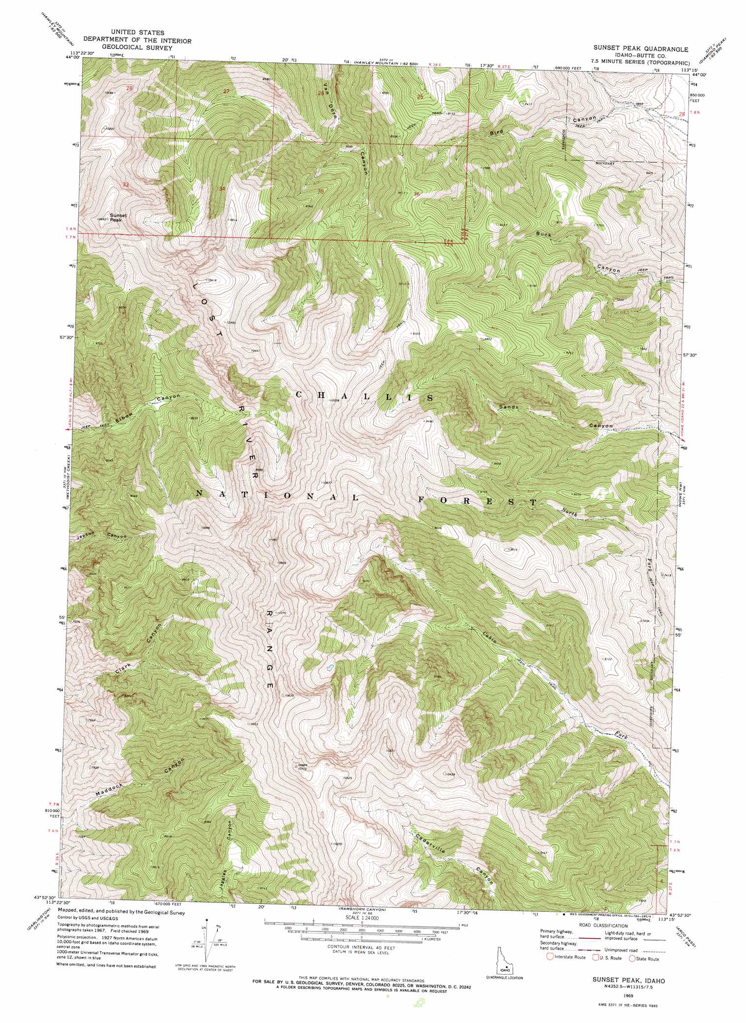
USGS Topo Quad 43113h3 - 1:24,000 scale
| Topo Map Name: | Sunset Peak |
| USGS Topo Quad ID: | 43113h3 |
| Print Size: | ca. 21 1/4" wide x 27" high |
| Southeast Coordinates: | 43.875° N latitude / 113.25° W longitude |
| Map Center Coordinates: | 43.9375° N latitude / 113.3125° W longitude |
| U.S. State: | ID |
| Filename: | o43113h3.jpg |
| Download Map JPG Image: | Sunset Peak topo map 1:24,000 scale |
| Map Type: | Topographic |
| Topo Series: | 7.5´ |
| Map Scale: | 1:24,000 |
| Source of Map Images: | United States Geological Survey (USGS) |
| Alternate Map Versions: |
Sunset Peak ID 1969, updated 1973 Download PDF Buy paper map Sunset Peak ID 2011 Download PDF Buy paper map Sunset Peak ID 2013 Download PDF Buy paper map |
| FStopo: | US Forest Service topo Sunset Peak is available: Download FStopo PDF Download FStopo TIF |
1:24,000 Topo Quads surrounding Sunset Peak
Short Creek |
Red Hills |
Mulkey Bar |
Bell Mountain |
Diamond Peak |
Massacre Mountain |
Warren Mountain |
Hawley Mountain |
Badger Creek |
Fallert Springs |
Mackay |
Methodist Creek |
Sunset Peak |
Howe Nw |
Howe Ne |
Big Blind Canyon |
Darlington |
Ramshorn Canyon |
Arco Pass |
Howe |
Grouse |
Appendicitis Hill |
Arco North |
Arco Hills |
Howe Peak |
> Back to 43113e1 at 1:100,000 scale
> Back to 43112a1 at 1:250,000 scale
> Back to U.S. Topo Maps home
Sunset Peak digital topo map on disk
Buy this Sunset Peak topo map showing relief, roads, GPS coordinates and other geographical features, as a high-resolution digital map file on DVD: