Kinzie Butte Topo Map Idaho
To zoom in, hover over the map of Kinzie Butte
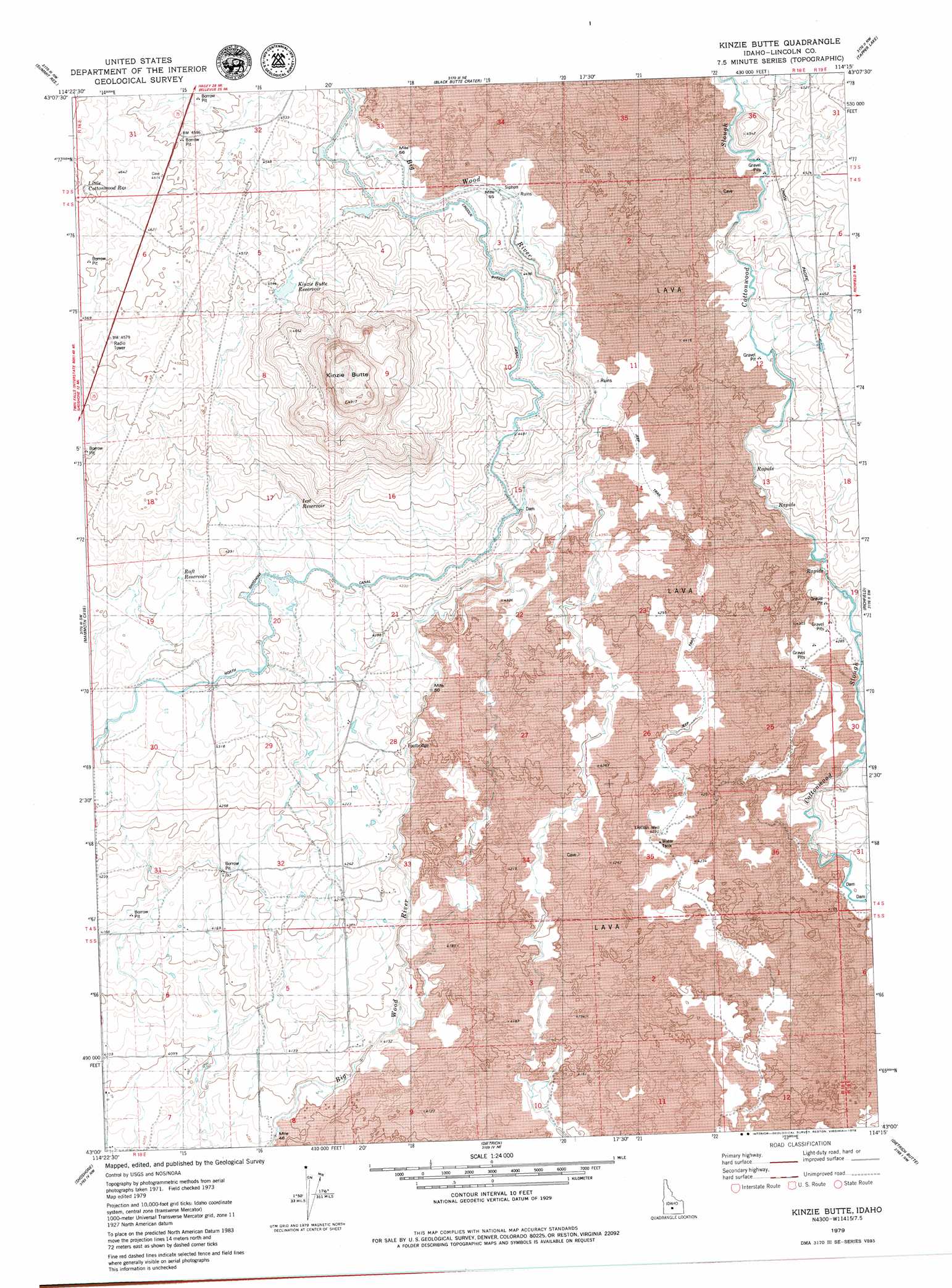
USGS Topo Quad 43114a3 - 1:24,000 scale
| Topo Map Name: | Kinzie Butte |
| USGS Topo Quad ID: | 43114a3 |
| Print Size: | ca. 21 1/4" wide x 27" high |
| Southeast Coordinates: | 43° N latitude / 114.25° W longitude |
| Map Center Coordinates: | 43.0625° N latitude / 114.3125° W longitude |
| U.S. State: | ID |
| Filename: | o43114a3.jpg |
| Download Map JPG Image: | Kinzie Butte topo map 1:24,000 scale |
| Map Type: | Topographic |
| Topo Series: | 7.5´ |
| Map Scale: | 1:24,000 |
| Source of Map Images: | United States Geological Survey (USGS) |
| Alternate Map Versions: |
Kinzie Butte ID 1979, updated 1979 Download PDF Buy paper map Kinzie Butte ID 2010 Download PDF Buy paper map Kinzie Butte ID 2013 Download PDF Buy paper map |
1:24,000 Topo Quads surrounding Kinzie Butte
Macon |
Magic Reservoir West |
Magic Reservoir East |
Gannett |
Picabo |
Thorn Creek Reservoir |
Summit Reservoir |
Shoshone Ice Cave |
Tapper Lake |
Tikura |
Thorn Creek Se |
Mammoth Cave |
Kinzie Butte |
Richfield |
Pagari |
Tunupa |
Shoshone |
Dietrich |
Dietrich Butte |
Owinza |
Gooding Se |
Shoshone Sw |
Shoshone Se |
Star Lake |
Owinza Butte |
> Back to 43114a1 at 1:100,000 scale
> Back to 43114a1 at 1:250,000 scale
> Back to U.S. Topo Maps home
Kinzie Butte topo map: Gazetteer
Kinzie Butte: Canals
Lincoln Bypass Canal elevation 1371m 4498′Lincoln Canal elevation 1278m 4192′
North Shoshone Canal elevation 1327m 4353′
Kinzie Butte: Reservoirs
Iest Reservoir elevation 1336m 4383′Kinzie Butte Reservoir elevation 1421m 4662′
Little Cottonwood Reservoir elevation 1418m 4652′
Raft Reservoir elevation 1331m 4366′
Kinzie Butte: Summits
Kinzie Butte elevation 1486m 4875′Kinzie Butte: Wells
Lincoln Well elevation 1290m 4232′Kinzie Butte digital topo map on disk
Buy this Kinzie Butte topo map showing relief, roads, GPS coordinates and other geographical features, as a high-resolution digital map file on DVD: