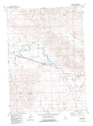
Picabo Topo Map Idaho
To zoom in, hover over the map of Picabo
USGS Topo Quad 43114c1 - 1:24,000 scale
| Topo Map Name: | Picabo |
| USGS Topo Quad ID: | 43114c1 |
| Print Size: | ca. 21 1/4" wide x 27" high |
| Southeast Coordinates: | 43.25° N latitude / 114° W longitude |
| Map Center Coordinates: | 43.3125° N latitude / 114.0625° W longitude |
| U.S. State: | ID |
| Filename: | o43114c1.jpg |
| Download Map JPG Image: | Picabo topo map 1:24,000 scale |
| Map Type: | Topographic |
| Topo Series: | 7.5´ |
| Map Scale: | 1:24,000 |
| Source of Map Images: | United States Geological Survey (USGS) |
| Alternate Map Versions: |
Picabo ID 2010 Download PDF Buy paper map Picabo ID 2013 Download PDF Buy paper map |
1:24,000 Topo Quads surrounding Picabo
> Back to 43114a1 at 1:100,000 scale
> Back to 43114a1 at 1:250,000 scale
> Back to U.S. Topo Maps home
Picabo topo map: Gazetteer
Picabo: Airports
Picabo Airport elevation 1471m 4826′Picabo: Canals
Kilpatrick Ditch elevation 1481m 4858′Lawson Ditch elevation 1467m 4812′
Picabo: Flats
Jasper Flats elevation 1781m 5843′Picabo: Gaps
Bradley Summit elevation 1644m 5393′Picabo: Populated Places
Leduc (historical) elevation 1506m 4940′Picabo elevation 1475m 4839′
Picabo: Springs
Antler Spring elevation 1634m 5360′Deer Mountain Spring elevation 1835m 6020′
Deerhorn Spring elevation 1722m 5649′
Picabo Town Spring elevation 1520m 4986′
Red Rock Spring elevation 1717m 5633′
Tipton Spring elevation 1590m 5216′
Picabo: Streams
Dip Vat Creek elevation 1585m 5200′East Fork Dip Vat Creek elevation 1669m 5475′
East Fork Dry Creek elevation 1693m 5554′
West Fork Dip Vat Creek elevation 1686m 5531′
West Fork Dry Creek elevation 1693m 5554′
Picabo: Valleys
Baker Canyon elevation 1470m 4822′Leduck Canyon elevation 1513m 4963′
Sagehen Canyon elevation 1655m 5429′
Schultz Canyon elevation 1531m 5022′
Picabo: Wells
Tikura Well elevation 1471m 4826′Picabo digital topo map on disk
Buy this Picabo topo map showing relief, roads, GPS coordinates and other geographical features, as a high-resolution digital map file on DVD:


