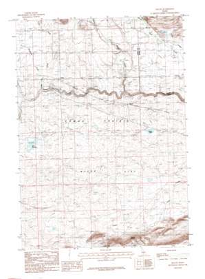
Macon Topo Map Idaho
To zoom in, hover over the map of Macon
USGS Topo Quad 43114c5 - 1:24,000 scale
| Topo Map Name: | Macon |
| USGS Topo Quad ID: | 43114c5 |
| Print Size: | ca. 21 1/4" wide x 27" high |
| Southeast Coordinates: | 43.25° N latitude / 114.5° W longitude |
| Map Center Coordinates: | 43.3125° N latitude / 114.5625° W longitude |
| U.S. State: | ID |
| Filename: | o43114c5.jpg |
| Download Map JPG Image: | Macon topo map 1:24,000 scale |
| Map Type: | Topographic |
| Topo Series: | 7.5´ |
| Map Scale: | 1:24,000 |
| Source of Map Images: | United States Geological Survey (USGS) |
| Alternate Map Versions: |
Macon ID 1986, updated 1986 Download PDF Buy paper map Macon ID 2010 Download PDF Buy paper map Macon ID 2013 Download PDF Buy paper map |
1:24,000 Topo Quads surrounding Macon
> Back to 43114a1 at 1:100,000 scale
> Back to 43114a1 at 1:250,000 scale
> Back to U.S. Topo Maps home
Macon topo map: Gazetteer
Macon: Bridges
Blaine Bridge elevation 1511m 4957′Macon Sheep Bridge elevation 1488m 4881′
Macon: Dams
Kelly Dam elevation 1536m 5039′Macon: Lakes
Macon Lake elevation 1533m 5029′Macon: Populated Places
Blaine elevation 1534m 5032′Macon elevation 1526m 5006′
Macon: Reservoirs
Kelly Reservoir elevation 1536m 5039′Macon: Springs
Chicken Spring elevation 1640m 5380′Macon: Streams
Fricke Creek elevation 1522m 4993′Minnehaha Creek elevation 1515m 4970′
Spare Creek elevation 1547m 5075′
Tolmie Creek elevation 1519m 4983′
Willow Creek elevation 1488m 4881′
Macon digital topo map on disk
Buy this Macon topo map showing relief, roads, GPS coordinates and other geographical features, as a high-resolution digital map file on DVD:


