Corral Topo Map Idaho
To zoom in, hover over the map of Corral
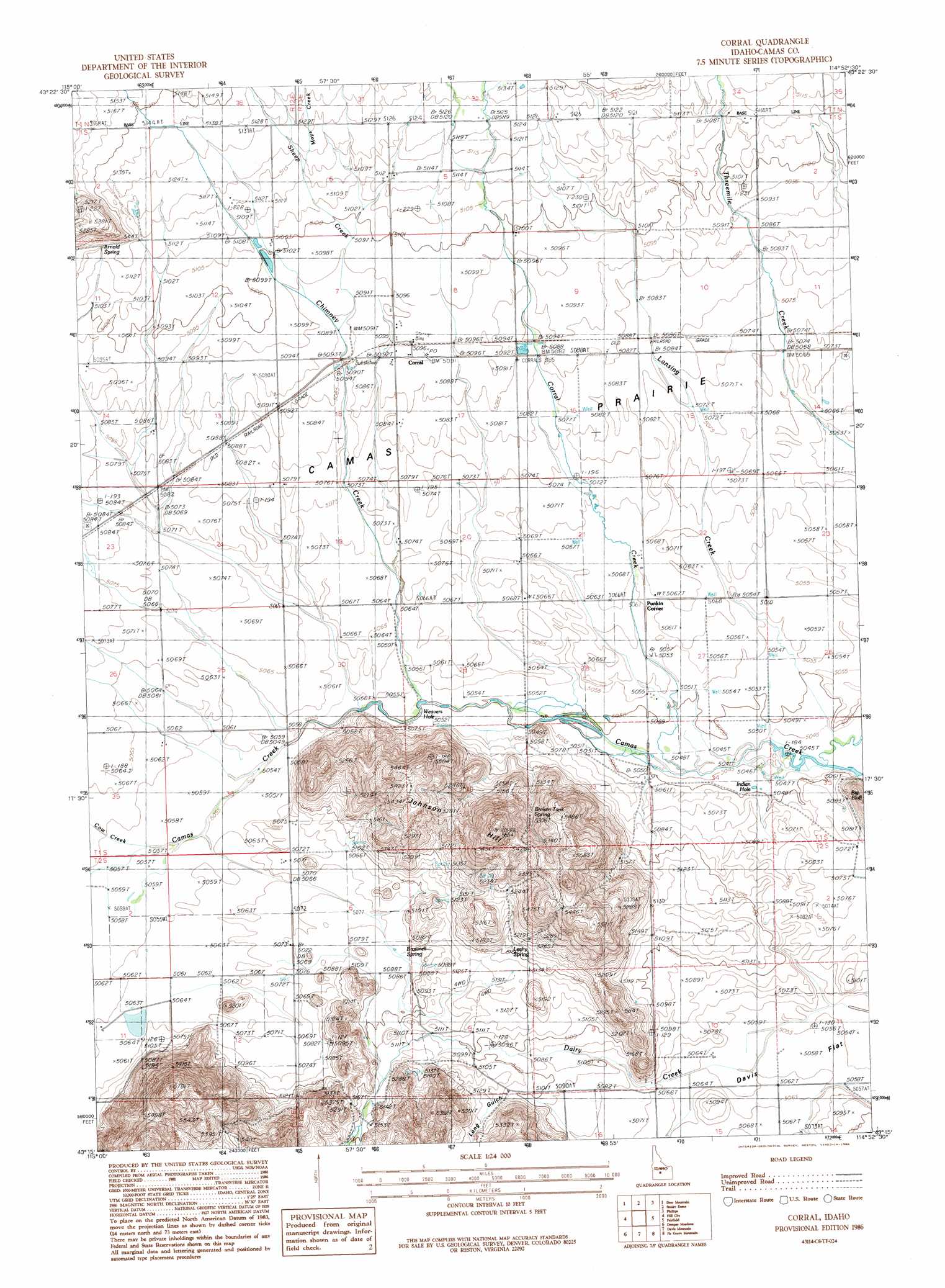
USGS Topo Quad 43114c8 - 1:24,000 scale
| Topo Map Name: | Corral |
| USGS Topo Quad ID: | 43114c8 |
| Print Size: | ca. 21 1/4" wide x 27" high |
| Southeast Coordinates: | 43.25° N latitude / 114.875° W longitude |
| Map Center Coordinates: | 43.3125° N latitude / 114.9375° W longitude |
| U.S. State: | ID |
| Filename: | o43114c8.jpg |
| Download Map JPG Image: | Corral topo map 1:24,000 scale |
| Map Type: | Topographic |
| Topo Series: | 7.5´ |
| Map Scale: | 1:24,000 |
| Source of Map Images: | United States Geological Survey (USGS) |
| Alternate Map Versions: |
Corral ID 1986, updated 1986 Download PDF Buy paper map Corral ID 2010 Download PDF Buy paper map Corral ID 2013 Download PDF Buy paper map |
1:24,000 Topo Quads surrounding Corral
Grouse Butte |
Jumbo Mountain |
Boardman Creek |
Sydney Butte |
Dollarhide Mountain |
Sprout Mountain |
Deer Mountain |
Smoky Dome |
Phillips Creek |
Cannonball Mountain |
High Prairie |
Hill City |
Corral |
Fairfield |
Spring Creek Reservoir |
Deer Haven Mountain |
Dempsey Meadows |
Davis Mountain |
Fir Grove Mountain |
Mchan Reservoir |
King Hill |
Hog Creek |
Davis Mountain Sw |
Mckinney Butte |
Thorn Creek Sw |
> Back to 43114a1 at 1:100,000 scale
> Back to 43114a1 at 1:250,000 scale
> Back to U.S. Topo Maps home
Corral topo map: Gazetteer
Corral: Bends
Weavers Hole elevation 1540m 5052′Corral: Populated Places
Punkin Corner elevation 1544m 5065′Corral: Springs
Broken Tank Spring elevation 1600m 5249′Brownell Spring elevation 1551m 5088′
Leahy Spring elevation 1574m 5164′
Corral: Streams
Chimney Creek elevation 1540m 5052′Corral Creek elevation 1539m 5049′
Cow Creek elevation 1542m 5059′
Lansing Creek elevation 1538m 5045′
Mays Creek elevation 1561m 5121′
Sheep Creek elevation 1552m 5091′
Corral: Summits
Johnson Hill elevation 1718m 5636′Corral digital topo map on disk
Buy this Corral topo map showing relief, roads, GPS coordinates and other geographical features, as a high-resolution digital map file on DVD: