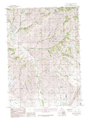
Beaver Creek Topo Map Idaho
To zoom in, hover over the map of Beaver Creek
USGS Topo Quad 43114d5 - 1:24,000 scale
| Topo Map Name: | Beaver Creek |
| USGS Topo Quad ID: | 43114d5 |
| Print Size: | ca. 21 1/4" wide x 27" high |
| Southeast Coordinates: | 43.375° N latitude / 114.5° W longitude |
| Map Center Coordinates: | 43.4375° N latitude / 114.5625° W longitude |
| U.S. State: | ID |
| Filename: | o43114d5.jpg |
| Download Map JPG Image: | Beaver Creek topo map 1:24,000 scale |
| Map Type: | Topographic |
| Topo Series: | 7.5´ |
| Map Scale: | 1:24,000 |
| Source of Map Images: | United States Geological Survey (USGS) |
| Alternate Map Versions: |
Beaver Creek ID 1986, updated 1986 Download PDF Buy paper map Beaver Creek ID 2011 Download PDF Buy paper map Beaver Creek ID 2013 Download PDF Buy paper map |
| FStopo: | US Forest Service topo Beaver Creek is available: Download FStopo PDF Download FStopo TIF |
1:24,000 Topo Quads surrounding Beaver Creek
> Back to 43114a1 at 1:100,000 scale
> Back to 43114a1 at 1:250,000 scale
> Back to U.S. Topo Maps home
Beaver Creek topo map: Gazetteer
Beaver Creek: Mines
Happy Day Mine elevation 1928m 6325′Princess Blue Ribbon Mine elevation 1988m 6522′
Beaver Creek: Streams
Beaver Creek elevation 1623m 5324′Brush Creek elevation 1555m 5101′
Chalmplain Creek elevation 1801m 5908′
Cherry Creek elevation 1674m 5492′
Little Beaver Creek elevation 1655m 5429′
Log Creek elevation 1674m 5492′
Nebraska Creek elevation 1696m 5564′
North Fork Cherry Creek elevation 1709m 5606′
Severe Creek elevation 1572m 5157′
Wine Creek elevation 1709m 5606′
Beaver Creek: Summits
Square Mountain elevation 1849m 6066′Beaver Creek: Valleys
McDonald Gulch elevation 1645m 5396′McKay Gulch elevation 1640m 5380′
Beaver Creek digital topo map on disk
Buy this Beaver Creek topo map showing relief, roads, GPS coordinates and other geographical features, as a high-resolution digital map file on DVD:


