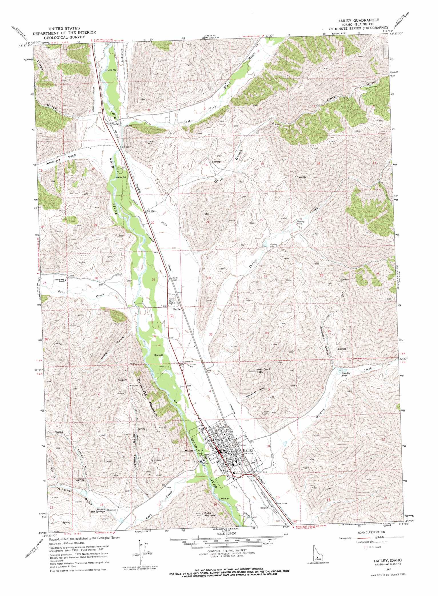
Hailey Topo Map Idaho
To zoom in, hover over the map of Hailey
USGS Topo Quad 43114e3 - 1:24,000 scale
| Topo Map Name: | Hailey |
| USGS Topo Quad ID: | 43114e3 |
| Print Size: | ca. 21 1/4" wide x 27" high |
| Southeast Coordinates: | 43.5° N latitude / 114.25° W longitude |
| Map Center Coordinates: | 43.5625° N latitude / 114.3125° W longitude |
| U.S. State: | ID |
| Filename: | o43114e3.jpg |
| Download Map JPG Image: | Hailey topo map 1:24,000 scale |
| Map Type: | Topographic |
| Topo Series: | 7.5´ |
| Map Scale: | 1:24,000 |
| Source of Map Images: | United States Geological Survey (USGS) |
| Alternate Map Versions: |
Hailey ID 1967, updated 1971 Download PDF Buy paper map Hailey ID 1967, updated 1984 Download PDF Buy paper map Hailey ID 2010 Download PDF Buy paper map Hailey ID 2013 Download PDF Buy paper map |
1:24,000 Topo Quads surrounding Hailey
Easley Hot Springs |
Amber Lakes |
Rock Roll Canyon |
Phi Kappa Mountain |
Standhope Peak |
Boyle Mountain |
Griffin Butte |
Sun Valley |
Hyndman Peak |
Grays Peak |
Buttercup Mountain |
Mahoney Butte |
Hailey |
Baugh Creek Sw |
Baugh Creek |
Beaver Creek |
Richardson Summit |
Bellevue |
Seamans Creek |
Little Wood River Reservoir |
Macon |
Magic Reservoir West |
Magic Reservoir East |
Gannett |
Picabo |
> Back to 43114e1 at 1:100,000 scale
> Back to 43114a1 at 1:250,000 scale
> Back to U.S. Topo Maps home
Hailey topo map: Gazetteer
Hailey: Airports
Friedman Memorial Airport elevation 1617m 5305′Gimlet Airport elevation 1711m 5613′
Hailey: Canals
Comstock Ditch elevation 1714m 5623′Cove Canal elevation 1607m 5272′
Hiawatha Canal elevation 1670m 5479′
Justus Ditch elevation 1617m 5305′
Mizer Ditch elevation 1680m 5511′
Hailey: Lakes
Quigley Pond elevation 1688m 5538′Hailey: Populated Places
Barite elevation 1659m 5442′Gimlet elevation 1700m 5577′
Hailey elevation 1621m 5318′
Hailey: Springs
Hailey Hot Springs elevation 1659m 5442′Hailey: Streams
Croy Creek elevation 1624m 5328′Deer Creek elevation 1645m 5396′
East Fork Wood River elevation 1695m 5561′
Greenhorn Creek elevation 1679m 5508′
Indian Creek elevation 1654m 5426′
Quigley Creek elevation 1637m 5370′
Hailey: Summits
Carbonate Mountain elevation 1984m 6509′Della Mountain elevation 2051m 6729′
Red Devil Mountain elevation 2010m 6594′
Hailey: Valleys
Deadman Gulch elevation 1691m 5547′Democrat Gulch elevation 1668m 5472′
Greenhorn Gulch elevation 1702m 5583′
Hangman Gulch elevation 1652m 5419′
Lambs Gulch elevation 1684m 5524′
Ohio Gulch elevation 1702m 5583′
Osborn Gulch elevation 1676m 5498′
Timber Gulch elevation 1719m 5639′
Vorberg Gulch elevation 1645m 5396′
Hailey digital topo map on disk
Buy this Hailey topo map showing relief, roads, GPS coordinates and other geographical features, as a high-resolution digital map file on DVD: