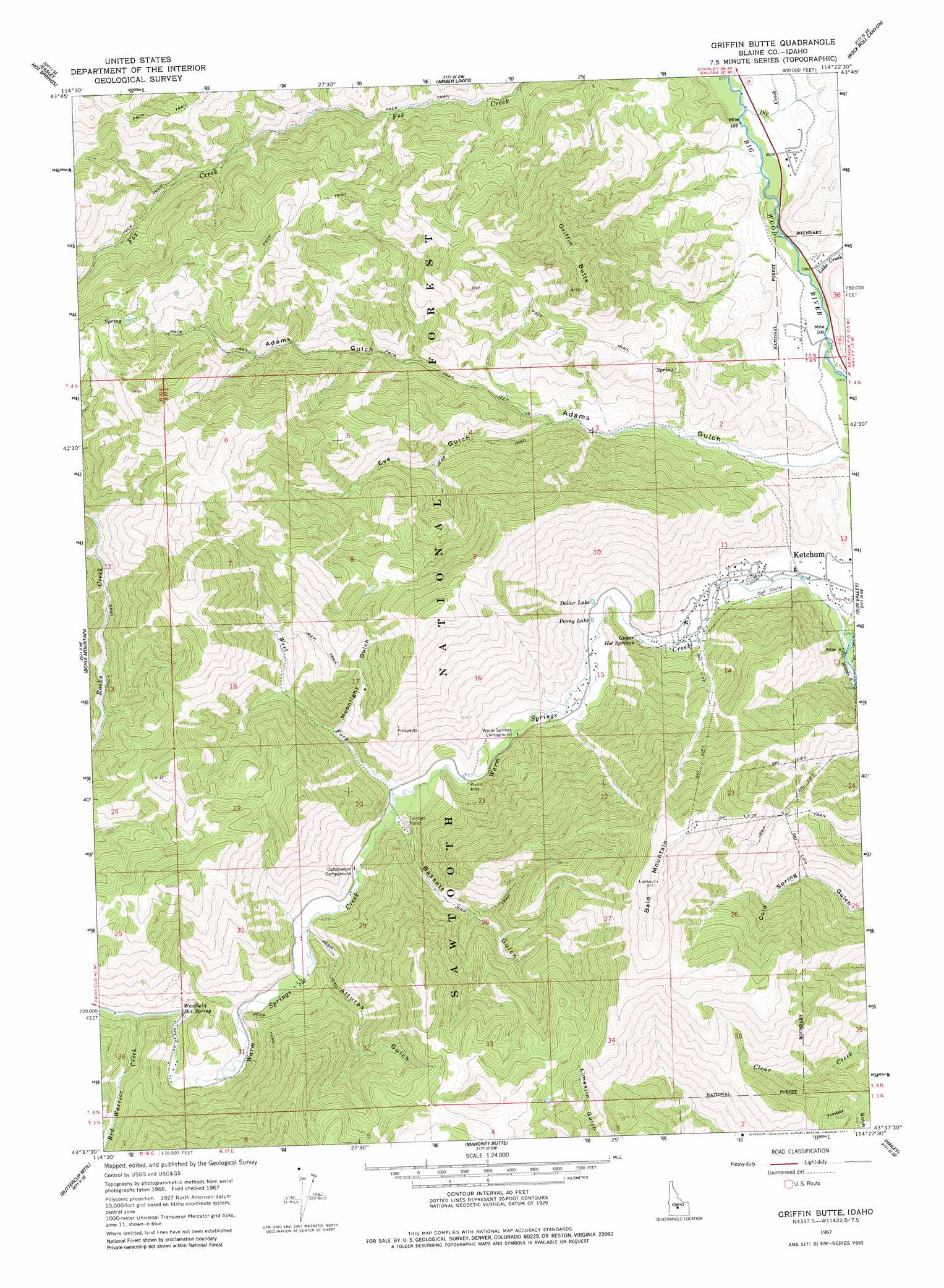
Griffin Butte Topo Map Idaho
To zoom in, hover over the map of Griffin Butte
USGS Topo Quad 43114f4 - 1:24,000 scale
| Topo Map Name: | Griffin Butte |
| USGS Topo Quad ID: | 43114f4 |
| Print Size: | ca. 21 1/4" wide x 27" high |
| Southeast Coordinates: | 43.625° N latitude / 114.375° W longitude |
| Map Center Coordinates: | 43.6875° N latitude / 114.4375° W longitude |
| U.S. State: | ID |
| Filename: | o43114f4.jpg |
| Download Map JPG Image: | Griffin Butte topo map 1:24,000 scale |
| Map Type: | Topographic |
| Topo Series: | 7.5´ |
| Map Scale: | 1:24,000 |
| Source of Map Images: | United States Geological Survey (USGS) |
| Alternate Map Versions: |
Griffin Butte ID 1967, updated 1971 Download PDF Buy paper map Griffin Butte ID 1967, updated 1977 Download PDF Buy paper map Griffin Butte ID 2011 Download PDF Buy paper map Griffin Butte ID 2013 Download PDF Buy paper map |
| FStopo: | US Forest Service topo Griffin Butte is available: Download FStopo PDF Download FStopo TIF |
1:24,000 Topo Quads surrounding Griffin Butte
Horton Peak |
Galena Peak |
Ryan Peak |
Meridian Peak |
Herd Peak |
Galena |
Easley Hot Springs |
Amber Lakes |
Rock Roll Canyon |
Phi Kappa Mountain |
Baker Peak |
Boyle Mountain |
Griffin Butte |
Sun Valley |
Hyndman Peak |
Dollarhide Mountain |
Buttercup Mountain |
Mahoney Butte |
Hailey |
Baugh Creek Sw |
Cannonball Mountain |
Beaver Creek |
Richardson Summit |
Bellevue |
Seamans Creek |
> Back to 43114e1 at 1:100,000 scale
> Back to 43114a1 at 1:250,000 scale
> Back to U.S. Topo Maps home
Griffin Butte topo map: Gazetteer
Griffin Butte: Lakes
Dollar Lake elevation 1815m 5954′Penny Lake elevation 1806m 5925′
Griffin Butte: Springs
Guyer Hot Springs elevation 1800m 5905′Warfield Hot Spring elevation 1906m 6253′
Griffin Butte: Streams
Dip Creek elevation 1840m 6036′Lake Creek elevation 1812m 5944′
Red Warrior Creek elevation 1913m 6276′
Warm Springs Creek elevation 1761m 5777′
West Fork Warm Springs Creek elevation 1844m 6049′
Griffin Butte: Summits
Bald Mountain elevation 2779m 9117′Griffin Butte elevation 2550m 8366′
Griffin Butte: Valleys
Adams Gulch elevation 1793m 5882′Alturas Gulch elevation 1862m 6108′
Bassett Gulch elevation 1856m 6089′
Eve Gulch elevation 1917m 6289′
Moonlight Gulch elevation 1927m 6322′
Griffin Butte digital topo map on disk
Buy this Griffin Butte topo map showing relief, roads, GPS coordinates and other geographical features, as a high-resolution digital map file on DVD: