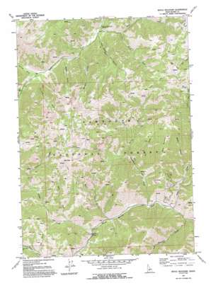
Boyle Mountain Topo Map Idaho
To zoom in, hover over the map of Boyle Mountain
USGS Topo Quad 43114f5 - 1:24,000 scale
| Topo Map Name: | Boyle Mountain |
| USGS Topo Quad ID: | 43114f5 |
| Print Size: | ca. 21 1/4" wide x 27" high |
| Southeast Coordinates: | 43.625° N latitude / 114.5° W longitude |
| Map Center Coordinates: | 43.6875° N latitude / 114.5625° W longitude |
| U.S. State: | ID |
| Filename: | o43114f5.jpg |
| Download Map JPG Image: | Boyle Mountain topo map 1:24,000 scale |
| Map Type: | Topographic |
| Topo Series: | 7.5´ |
| Map Scale: | 1:24,000 |
| Source of Map Images: | United States Geological Survey (USGS) |
| Alternate Map Versions: |
Boyle Mountain ID 1970, updated 1973 Download PDF Buy paper map Boyle Mountain ID 1970, updated 1993 Download PDF Buy paper map Boyle Mountain ID 2011 Download PDF Buy paper map Boyle Mountain ID 2013 Download PDF Buy paper map |
| FStopo: | US Forest Service topo Boyle Mountain is available: Download FStopo PDF Download FStopo TIF |
1:24,000 Topo Quads surrounding Boyle Mountain
> Back to 43114e1 at 1:100,000 scale
> Back to 43114a1 at 1:250,000 scale
> Back to U.S. Topo Maps home
Boyle Mountain topo map: Gazetteer
Boyle Mountain: Pillars
Castle Rock elevation 2050m 6725′Boyle Mountain: Streams
Apollo Creek elevation 2253m 7391′Castle Creek elevation 2024m 6640′
East Fork Baker Creek elevation 2111m 6925′
East Fork Castle Creek elevation 2069m 6788′
Left Fork Placer Creek elevation 2165m 7103′
North Fork Thompson Creek elevation 2091m 6860′
Norton Creek elevation 2223m 7293′
Rooks Creek elevation 1946m 6384′
Thompson Creek elevation 1968m 6456′
Warfield Creek elevation 1934m 6345′
Boyle Mountain: Summits
Bear Peak elevation 2891m 9484′Boyle Mountain elevation 2721m 8927′
Fox Peak elevation 2782m 9127′
Boyle Mountain: Valleys
Alden Gulch elevation 2131m 6991′Badger Gulch elevation 2113m 6932′
Barr Gulch elevation 2001m 6564′
Blue Clay Gulch elevation 2148m 7047′
Boyer Gulch elevation 2184m 7165′
Boyle Canyon elevation 2031m 6663′
Cunard Gulch elevation 2222m 7290′
Elk Gulch elevation 2128m 6981′
Fir Draw elevation 2047m 6715′
Narrow Gorge elevation 2225m 7299′
Boyle Mountain digital topo map on disk
Buy this Boyle Mountain topo map showing relief, roads, GPS coordinates and other geographical features, as a high-resolution digital map file on DVD:


