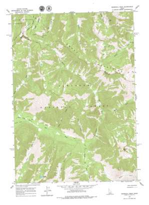
Marshall Peak Topo Map Idaho
To zoom in, hover over the map of Marshall Peak
USGS Topo Quad 43114g8 - 1:24,000 scale
| Topo Map Name: | Marshall Peak |
| USGS Topo Quad ID: | 43114g8 |
| Print Size: | ca. 21 1/4" wide x 27" high |
| Southeast Coordinates: | 43.75° N latitude / 114.875° W longitude |
| Map Center Coordinates: | 43.8125° N latitude / 114.9375° W longitude |
| U.S. State: | ID |
| Filename: | o43114g8.jpg |
| Download Map JPG Image: | Marshall Peak topo map 1:24,000 scale |
| Map Type: | Topographic |
| Topo Series: | 7.5´ |
| Map Scale: | 1:24,000 |
| Source of Map Images: | United States Geological Survey (USGS) |
| Alternate Map Versions: |
Marshall Peak ID 1964, updated 1966 Download PDF Buy paper map Marshall Peak ID 1964, updated 1979 Download PDF Buy paper map Marshall Peak ID 2011 Download PDF Buy paper map Marshall Peak ID 2013 Download PDF Buy paper map |
| FStopo: | US Forest Service topo Marshall Peak is available: Download FStopo PDF Download FStopo TIF |
1:24,000 Topo Quads surrounding Marshall Peak
> Back to 43114e1 at 1:100,000 scale
> Back to 43114a1 at 1:250,000 scale
> Back to U.S. Topo Maps home
Marshall Peak topo map: Gazetteer
Marshall Peak: Basins
Ross Fork Basin elevation 2012m 6601′Marshall Peak: Lakes
Perkons Lake elevation 2656m 8713′Marshall Peak: Mines
Silver King Mine elevation 2356m 7729′Marshall Peak: Pillars
Marshall Peak elevation 2967m 9734′Marshall Peak: Streams
Bass Creek elevation 1994m 6541′Gold Run Creek elevation 1963m 6440′
Johnson Creek elevation 1915m 6282′
Little Bear Creek elevation 1948m 6391′
North Fork Ross Fork elevation 2012m 6601′
Perkons Creek elevation 1974m 6476′
Ross Fork elevation 1916m 6286′
South Fork Ross Fork elevation 2014m 6607′
Steep Creek elevation 1972m 6469′
Vienna Creek elevation 2034m 6673′
Marshall Peak digital topo map on disk
Buy this Marshall Peak topo map showing relief, roads, GPS coordinates and other geographical features, as a high-resolution digital map file on DVD:


