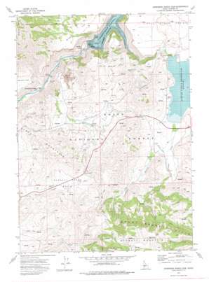
Anderson Ranch Dam Topo Map Idaho
To zoom in, hover over the map of Anderson Ranch Dam
USGS Topo Quad 43115c4 - 1:24,000 scale
| Topo Map Name: | Anderson Ranch Dam |
| USGS Topo Quad ID: | 43115c4 |
| Print Size: | ca. 21 1/4" wide x 27" high |
| Southeast Coordinates: | 43.25° N latitude / 115.375° W longitude |
| Map Center Coordinates: | 43.3125° N latitude / 115.4375° W longitude |
| U.S. State: | ID |
| Filename: | o43115c4.jpg |
| Download Map JPG Image: | Anderson Ranch Dam topo map 1:24,000 scale |
| Map Type: | Topographic |
| Topo Series: | 7.5´ |
| Map Scale: | 1:24,000 |
| Source of Map Images: | United States Geological Survey (USGS) |
| Alternate Map Versions: |
Anderson Ranch Dam ID 1973, updated 1977 Download PDF Buy paper map Anderson Ranch Dam ID 1973, updated 1977 Download PDF Buy paper map Anderson Ranch Dam ID 2011 Download PDF Buy paper map Anderson Ranch Dam ID 2013 Download PDF Buy paper map |
| FStopo: | US Forest Service topo Anderson Ranch Dam is available: Download FStopo PDF Download FStopo TIF |
1:24,000 Topo Quads surrounding Anderson Ranch Dam
> Back to 43115a1 at 1:100,000 scale
> Back to 43114a1 at 1:250,000 scale
> Back to U.S. Topo Maps home
Anderson Ranch Dam topo map: Gazetteer
Anderson Ranch Dam: Airports
Bennett Airport elevation 1445m 4740′Anderson Ranch Dam: Basins
Bennett Creek Basin elevation 1564m 5131′Anderson Ranch Dam: Dams
Anderson Ranch Dam elevation 1284m 4212′Little Camas Dam elevation 1504m 4934′
Anderson Ranch Dam: Flats
Little Camas Prairie elevation 1551m 5088′Wilson Flat elevation 1488m 4881′
Anderson Ranch Dam: Gaps
Dixie Summit elevation 1721m 5646′Windy Gap elevation 1572m 5157′
Anderson Ranch Dam: Mines
Daley Con Mines elevation 1234m 4048′Reber Mine elevation 1557m 5108′
Anderson Ranch Dam: Populated Places
Dixie elevation 1451m 4760′Reclamation Village elevation 1168m 3832′
Anderson Ranch Dam: Reservoirs
Anderson Ranch Reservoir elevation 1284m 4212′Little Camas Reservoir elevation 1504m 4934′
Anderson Ranch Dam: Streams
Dixie Creek elevation 1172m 3845′Elk Creek elevation 1283m 4209′
Little Camas Creek elevation 1278m 4192′
Anderson Ranch Dam: Summits
Granite Mountain elevation 1927m 6322′Anderson Ranch Dam: Valleys
Lockman Gulch elevation 1523m 4996′Anderson Ranch Dam digital topo map on disk
Buy this Anderson Ranch Dam topo map showing relief, roads, GPS coordinates and other geographical features, as a high-resolution digital map file on DVD:


