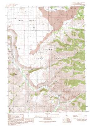
Cathedral Rocks Topo Map Idaho
To zoom in, hover over the map of Cathedral Rocks
USGS Topo Quad 43115d5 - 1:24,000 scale
| Topo Map Name: | Cathedral Rocks |
| USGS Topo Quad ID: | 43115d5 |
| Print Size: | ca. 21 1/4" wide x 27" high |
| Southeast Coordinates: | 43.375° N latitude / 115.5° W longitude |
| Map Center Coordinates: | 43.4375° N latitude / 115.5625° W longitude |
| U.S. State: | ID |
| Filename: | o43115d5.jpg |
| Download Map JPG Image: | Cathedral Rocks topo map 1:24,000 scale |
| Map Type: | Topographic |
| Topo Series: | 7.5´ |
| Map Scale: | 1:24,000 |
| Source of Map Images: | United States Geological Survey (USGS) |
| Alternate Map Versions: |
Cathedral Rocks ID 1990, updated 1991 Download PDF Buy paper map Cathedral Rocks ID 2011 Download PDF Buy paper map Cathedral Rocks ID 2013 Download PDF Buy paper map |
| FStopo: | US Forest Service topo Cathedral Rocks is available: Download FStopo PDF Download FStopo TIF |
1:24,000 Topo Quads surrounding Cathedral Rocks
> Back to 43115a1 at 1:100,000 scale
> Back to 43114a1 at 1:250,000 scale
> Back to U.S. Topo Maps home
Cathedral Rocks topo map: Gazetteer
Cathedral Rocks: Airports
Smith Prairie Airport elevation 1493m 4898′Cathedral Rocks: Basins
Smith Prairie elevation 1443m 4734′Cathedral Rocks: Pillars
Cathedral Rocks elevation 1511m 4957′Cathedral Rocks: Springs
Granite Spring elevation 1149m 3769′Cathedral Rocks: Streams
Bock Creek elevation 1105m 3625′Cayuse Creek elevation 1132m 3713′
Dead Horse Creek elevation 1097m 3599′
Deer Creek elevation 1181m 3874′
Dry Buck Creek elevation 1488m 4881′
Granite Creek elevation 1129m 3704′
Little Pierce Creek elevation 1243m 4078′
Mennecke Creek elevation 1111m 3645′
Pierce Creek elevation 1121m 3677′
Rock Creek elevation 1103m 3618′
South Fork Rock Creek elevation 1582m 5190′
Trail Creek elevation 1096m 3595′
Williams Creek elevation 1511m 4957′
Cathedral Rocks digital topo map on disk
Buy this Cathedral Rocks topo map showing relief, roads, GPS coordinates and other geographical features, as a high-resolution digital map file on DVD:


