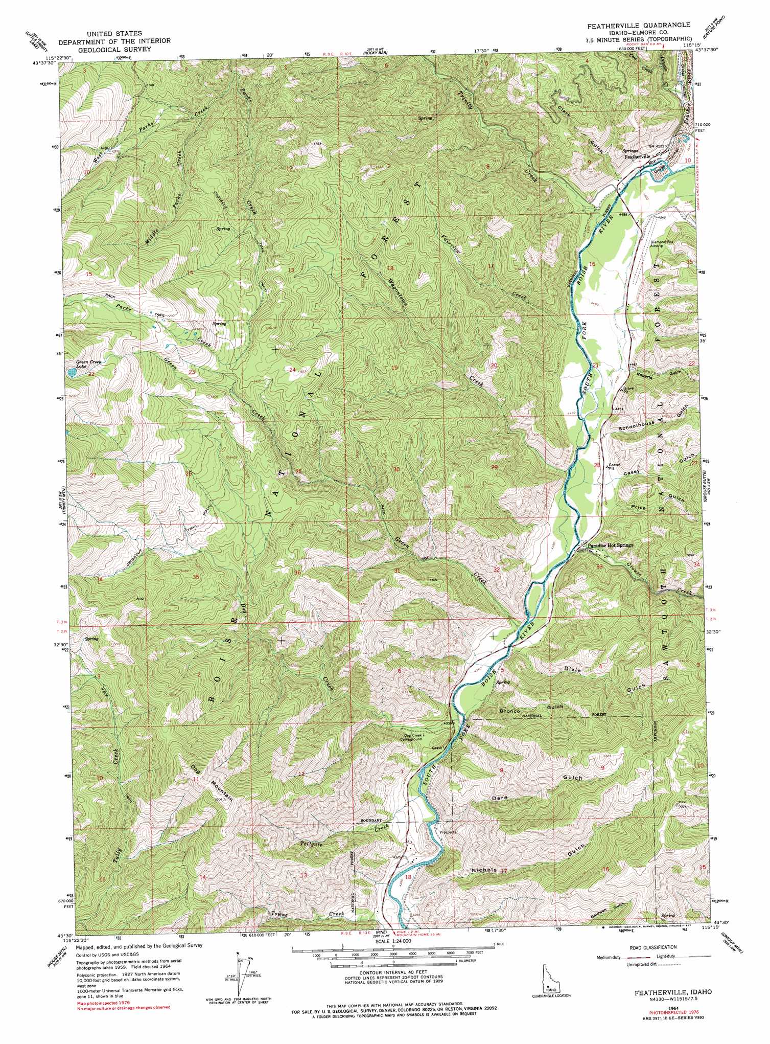
Featherville Topo Map Idaho
To zoom in, hover over the map of Featherville
USGS Topo Quad 43115e3 - 1:24,000 scale
| Topo Map Name: | Featherville |
| USGS Topo Quad ID: | 43115e3 |
| Print Size: | ca. 21 1/4" wide x 27" high |
| Southeast Coordinates: | 43.5° N latitude / 115.25° W longitude |
| Map Center Coordinates: | 43.5625° N latitude / 115.3125° W longitude |
| U.S. State: | ID |
| Filename: | o43115e3.jpg |
| Download Map JPG Image: | Featherville topo map 1:24,000 scale |
| Map Type: | Topographic |
| Topo Series: | 7.5´ |
| Map Scale: | 1:24,000 |
| Source of Map Images: | United States Geological Survey (USGS) |
| Alternate Map Versions: |
Featherville ID 1964, updated 1965 Download PDF Buy paper map Featherville ID 1964, updated 1977 Download PDF Buy paper map Featherville ID 1964, updated 1977 Download PDF Buy paper map Featherville ID 2011 Download PDF Buy paper map Featherville ID 2013 Download PDF Buy paper map |
| FStopo: | US Forest Service topo Featherville is available: Download FStopo PDF Download FStopo TIF |
1:24,000 Topo Quads surrounding Featherville
Barber Flat |
Grand Mountain |
Phifer Creek |
Atlanta West |
Atlanta East |
Sheep Creek |
Little Trinity Lake |
Rocky Bar |
Cayuse Point |
Ross Peak |
Prairie |
Trinity Mountain |
Featherville |
Grouse Butte |
Jumbo Mountain |
Cathedral Rocks |
House Mountain |
Pine |
Sprout Mountain |
Deer Mountain |
Long Tom Reservoir |
Anderson Ranch Dam |
Cat Creek Summit |
High Prairie |
Hill City |
> Back to 43115e1 at 1:100,000 scale
> Back to 43114a1 at 1:250,000 scale
> Back to U.S. Topo Maps home
Featherville topo map: Gazetteer
Featherville: Populated Places
Featherville elevation 1385m 4543′Paradise Hot Springs elevation 1344m 4409′
Featherville: Streams
Cow Creek elevation 1421m 4662′Dog Creek elevation 1318m 4324′
Fairview Creek elevation 1361m 4465′
Feather River elevation 1378m 4520′
Green Creek elevation 1328m 4356′
Grouse Creek elevation 1335m 4379′
Lincoln Creek elevation 1389m 4557′
Middle Parks Creek elevation 1717m 5633′
Tollgate Creek elevation 1317m 4320′
Trinity Creek elevation 1366m 4481′
Wagontown Creek elevation 1342m 4402′
West Parks Creek elevation 1651m 5416′
Featherville: Summits
Dog Mountain elevation 2343m 7687′Featherville: Valleys
Bronco Gulch elevation 1329m 4360′Casey Gulch elevation 1362m 4468′
Clark Gulch elevation 1397m 4583′
Dare Gulch elevation 1323m 4340′
Dixie Gulch elevation 1342m 4402′
Nichols Gulch elevation 1328m 4356′
Pine Gulch elevation 1397m 4583′
Price Gulch elevation 1354m 4442′
Roberts Gulch elevation 1372m 4501′
Schoolhouse Gulch elevation 1363m 4471′
Featherville digital topo map on disk
Buy this Featherville topo map showing relief, roads, GPS coordinates and other geographical features, as a high-resolution digital map file on DVD: