Prairie Topo Map Idaho
To zoom in, hover over the map of Prairie
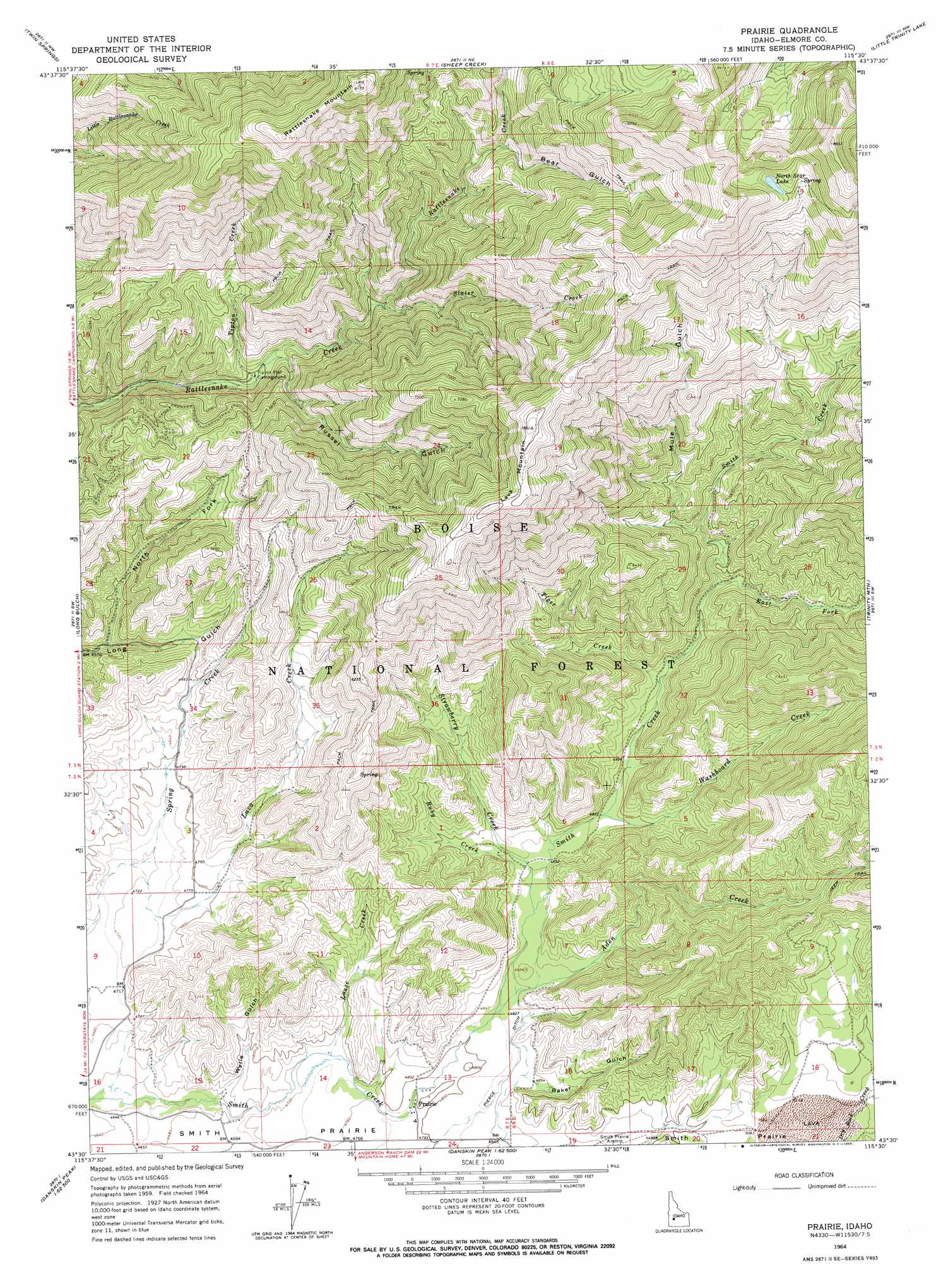
USGS Topo Quad 43115e5 - 1:24,000 scale
| Topo Map Name: | Prairie |
| USGS Topo Quad ID: | 43115e5 |
| Print Size: | ca. 21 1/4" wide x 27" high |
| Southeast Coordinates: | 43.5° N latitude / 115.5° W longitude |
| Map Center Coordinates: | 43.5625° N latitude / 115.5625° W longitude |
| U.S. State: | ID |
| Filename: | o43115e5.jpg |
| Download Map JPG Image: | Prairie topo map 1:24,000 scale |
| Map Type: | Topographic |
| Topo Series: | 7.5´ |
| Map Scale: | 1:24,000 |
| Source of Map Images: | United States Geological Survey (USGS) |
| Alternate Map Versions: |
Prairie ID 1964, updated 1965 Download PDF Buy paper map Prairie ID 1964, updated 1965 Download PDF Buy paper map Prairie ID 2011 Download PDF Buy paper map Prairie ID 2013 Download PDF Buy paper map |
| FStopo: | US Forest Service topo Prairie is available: Download FStopo PDF Download FStopo TIF |
1:24,000 Topo Quads surrounding Prairie
Idaho City |
Rabbit Creek Summit |
Barber Flat |
Grand Mountain |
Phifer Creek |
Arrowrock Reservoir Ne |
Twin Springs |
Sheep Creek |
Little Trinity Lake |
Rocky Bar |
Grape Mountain |
Long Gulch |
Prairie |
Trinity Mountain |
Featherville |
Braves Creek |
Danskin Peak |
Cathedral Rocks |
House Mountain |
Pine |
Mayfield Se |
Syrup Creek |
Long Tom Reservoir |
Anderson Ranch Dam |
Cat Creek Summit |
> Back to 43115e1 at 1:100,000 scale
> Back to 43114a1 at 1:250,000 scale
> Back to U.S. Topo Maps home
Prairie topo map: Gazetteer
Prairie: Canals
Pierce Ditch elevation 1471m 4826′Prairie: Lakes
North Star Lake elevation 2444m 8018′Prairie: Populated Places
Prairie elevation 1464m 4803′Prairie: Streams
Aden Creek elevation 1468m 4816′East Fork Smith Creek elevation 1600m 5249′
Lava Creek elevation 1437m 4714′
Louse Creek elevation 1442m 4730′
Ruby Creek elevation 1485m 4872′
Slater Creek elevation 1645m 5396′
Strawberry Creek elevation 1482m 4862′
Tiger Creek elevation 1547m 5075′
Tipton Creek elevation 1512m 4960′
Washboard Creek elevation 1503m 4931′
Prairie: Summits
Lava Mountain elevation 2395m 7857′Rattlesnake Mountain elevation 2477m 8126′
Prairie: Valleys
Baker Gulch elevation 1485m 4872′Bear Gulch elevation 1900m 6233′
Mule Gulch elevation 1671m 5482′
North Fork Valley elevation 1412m 4632′
Russel Gulch elevation 1535m 5036′
Wylie Gulch elevation 1425m 4675′
Prairie digital topo map on disk
Buy this Prairie topo map showing relief, roads, GPS coordinates and other geographical features, as a high-resolution digital map file on DVD: