Twin Springs Topo Map Idaho
To zoom in, hover over the map of Twin Springs
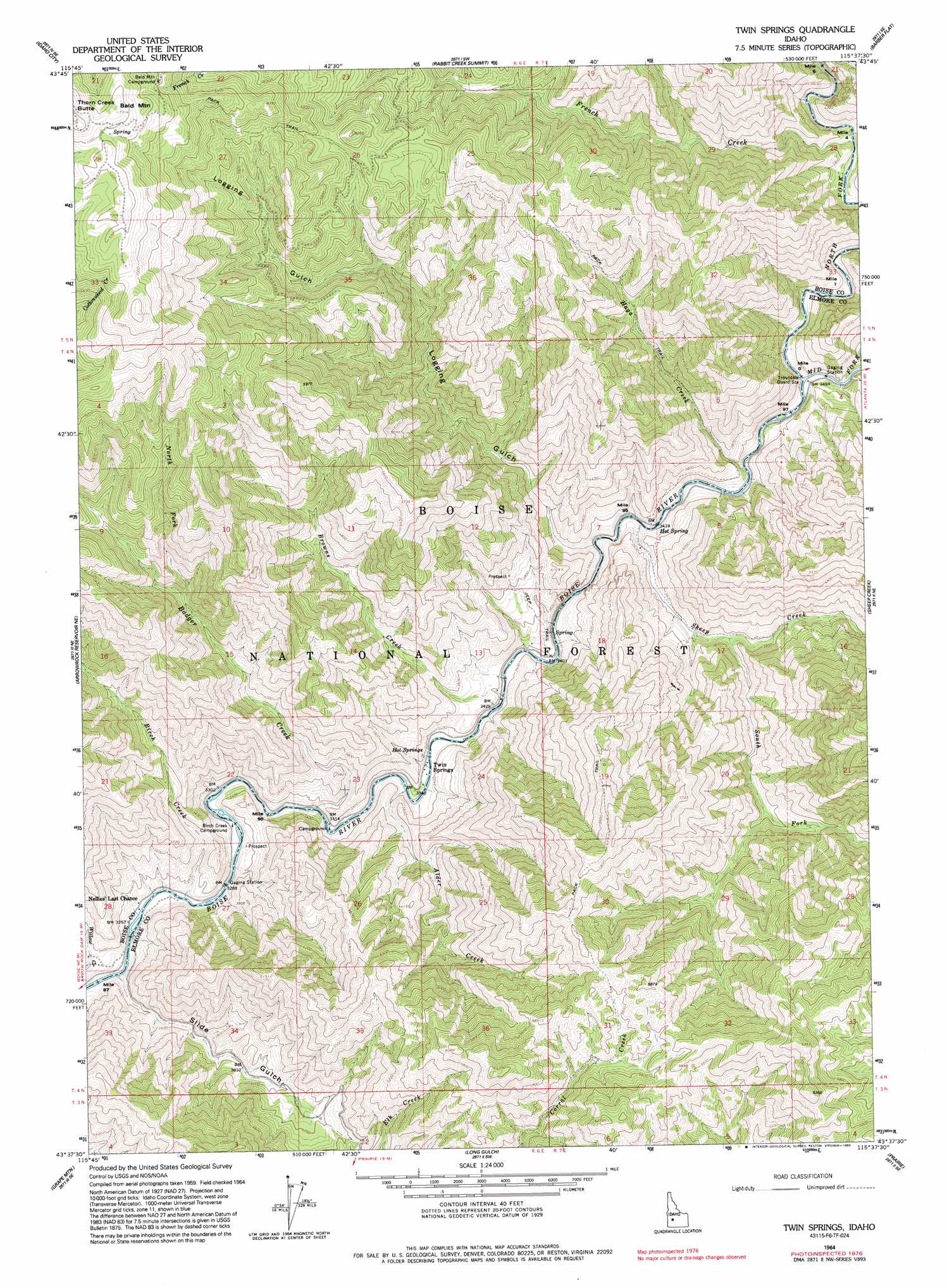
USGS Topo Quad 43115f6 - 1:24,000 scale
| Topo Map Name: | Twin Springs |
| USGS Topo Quad ID: | 43115f6 |
| Print Size: | ca. 21 1/4" wide x 27" high |
| Southeast Coordinates: | 43.625° N latitude / 115.625° W longitude |
| Map Center Coordinates: | 43.6875° N latitude / 115.6875° W longitude |
| U.S. State: | ID |
| Filename: | o43115f6.jpg |
| Download Map JPG Image: | Twin Springs topo map 1:24,000 scale |
| Map Type: | Topographic |
| Topo Series: | 7.5´ |
| Map Scale: | 1:24,000 |
| Source of Map Images: | United States Geological Survey (USGS) |
| Alternate Map Versions: |
Twin Springs ID 1964, updated 1966 Download PDF Buy paper map Twin Springs ID 1964, updated 1983 Download PDF Buy paper map Twin Springs ID 1964, updated 1993 Download PDF Buy paper map Twin Springs ID 2011 Download PDF Buy paper map Twin Springs ID 2013 Download PDF Buy paper map |
| FStopo: | US Forest Service topo Twin Springs is available: Download FStopo PDF Download FStopo TIF |
1:24,000 Topo Quads surrounding Twin Springs
Placerville |
Pioneerville |
Sunset Mountain |
Big Owl Creek |
Bear River |
Warm Springs Point |
Idaho City |
Rabbit Creek Summit |
Barber Flat |
Grand Mountain |
Dunnigan Creek |
Arrowrock Reservoir Ne |
Twin Springs |
Sheep Creek |
Little Trinity Lake |
Arrowrock Dam |
Grape Mountain |
Long Gulch |
Prairie |
Trinity Mountain |
Mayfield |
Braves Creek |
Danskin Peak |
Cathedral Rocks |
House Mountain |
> Back to 43115e1 at 1:100,000 scale
> Back to 43114a1 at 1:250,000 scale
> Back to U.S. Topo Maps home
Twin Springs topo map: Gazetteer
Twin Springs: Populated Places
Twin Springs elevation 1069m 3507′Twin Springs: Post Offices
Twinsprings Post Office (historical) elevation 1069m 3507′Twin Springs: Springs
Hot Springs elevation 1153m 3782′Twin Springs: Streams
Alder Creek elevation 1012m 3320′Badger Creek elevation 1007m 3303′
Birch Creek elevation 1014m 3326′
Browns Creek elevation 1050m 3444′
French Creek elevation 1111m 3645′
Haga Creek elevation 1109m 3638′
Middle Fork Boise River elevation 1062m 3484′
North Fork Badger Creek elevation 1523m 4996′
North Fork Boise River elevation 1061m 3480′
Rough Creek elevation 1069m 3507′
Sheep Creek elevation 1060m 3477′
South Fork Sheep Creek elevation 1122m 3681′
Twin Springs: Valleys
Logging Gulch elevation 1070m 3510′Twin Springs digital topo map on disk
Buy this Twin Springs topo map showing relief, roads, GPS coordinates and other geographical features, as a high-resolution digital map file on DVD: