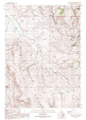
Swisher Mountain Topo Map Idaho
To zoom in, hover over the map of Swisher Mountain
USGS Topo Quad 43116a8 - 1:24,000 scale
| Topo Map Name: | Swisher Mountain |
| USGS Topo Quad ID: | 43116a8 |
| Print Size: | ca. 21 1/4" wide x 27" high |
| Southeast Coordinates: | 43° N latitude / 116.875° W longitude |
| Map Center Coordinates: | 43.0625° N latitude / 116.9375° W longitude |
| U.S. State: | ID |
| Filename: | o43116a8.jpg |
| Download Map JPG Image: | Swisher Mountain topo map 1:24,000 scale |
| Map Type: | Topographic |
| Topo Series: | 7.5´ |
| Map Scale: | 1:24,000 |
| Source of Map Images: | United States Geological Survey (USGS) |
| Alternate Map Versions: |
Swisher Mountain ID 1990, updated 1991 Download PDF Buy paper map Swisher Mountain ID 2010 Download PDF Buy paper map Swisher Mountain ID 2013 Download PDF Buy paper map |
1:24,000 Topo Quads surrounding Swisher Mountain
> Back to 43116a1 at 1:100,000 scale
> Back to 43116a1 at 1:250,000 scale
> Back to U.S. Topo Maps home
Swisher Mountain topo map: Gazetteer
Swisher Mountain: Basins
Baxter Basin elevation 1551m 5088′Sommercamp Basin elevation 1647m 5403′
Swisher Mountain: Flats
Moss Flat elevation 1551m 5088′Swisher Mountain: Populated Places
Petersons Crossing elevation 1897m 6223′Swisher Mountain: Reservoirs
Chimney Pot Reservoir elevation 1655m 5429′Swisher Mountain: Ridges
Long Ridge elevation 1731m 5679′Swisher Ridge elevation 1660m 5446′
Swisher Mountain: Springs
Bare Hill Spring elevation 1846m 6056′Blue Clay Pit Spring elevation 1532m 5026′
Bucket Spring elevation 1733m 5685′
Chubby Spring elevation 1635m 5364′
Grace Spring elevation 1482m 4862′
Kiyi Spring elevation 1700m 5577′
Lower Flat Spring elevation 1737m 5698′
Monahan Spring elevation 1535m 5036′
Nichols Spring elevation 1614m 5295′
Raymond Spring elevation 1811m 5941′
Soda Spring elevation 1623m 5324′
Sommercamp Spring elevation 1620m 5314′
Stanford Spring elevation 1504m 4934′
Sullivan Spring elevation 1726m 5662′
Tony Springs elevation 1859m 6099′
Trail Spring elevation 1693m 5554′
Turner Spring elevation 1583m 5193′
Willinicker Spring elevation 1784m 5853′
Swisher Mountain: Streams
Chimney Creek elevation 1510m 4954′Cold Spring Creek elevation 1675m 5495′
Jacks Creek elevation 1667m 5469′
Jackson Creek elevation 1430m 4691′
Little Cow Creek elevation 1682m 5518′
Posey Creek elevation 1427m 4681′
Soda Creek elevation 1452m 4763′
Swisher Mountain: Summits
Bare Hill elevation 1916m 6286′Sommer Camp Mountain elevation 1810m 5938′
Spain Hill elevation 1885m 6184′
Swisher Mountain elevation 1867m 6125′
Swisher Mountain: Valleys
Alkali Draw elevation 1451m 4760′Jackson Gulch elevation 1510m 4954′
Long Draw elevation 1484m 4868′
Maws Gulch elevation 1483m 4865′
Wildcat Canyon elevation 1594m 5229′
Swisher Mountain digital topo map on disk
Buy this Swisher Mountain topo map showing relief, roads, GPS coordinates and other geographical features, as a high-resolution digital map file on DVD:


