Northeast Emmett Topo Map Idaho
To zoom in, hover over the map of Northeast Emmett
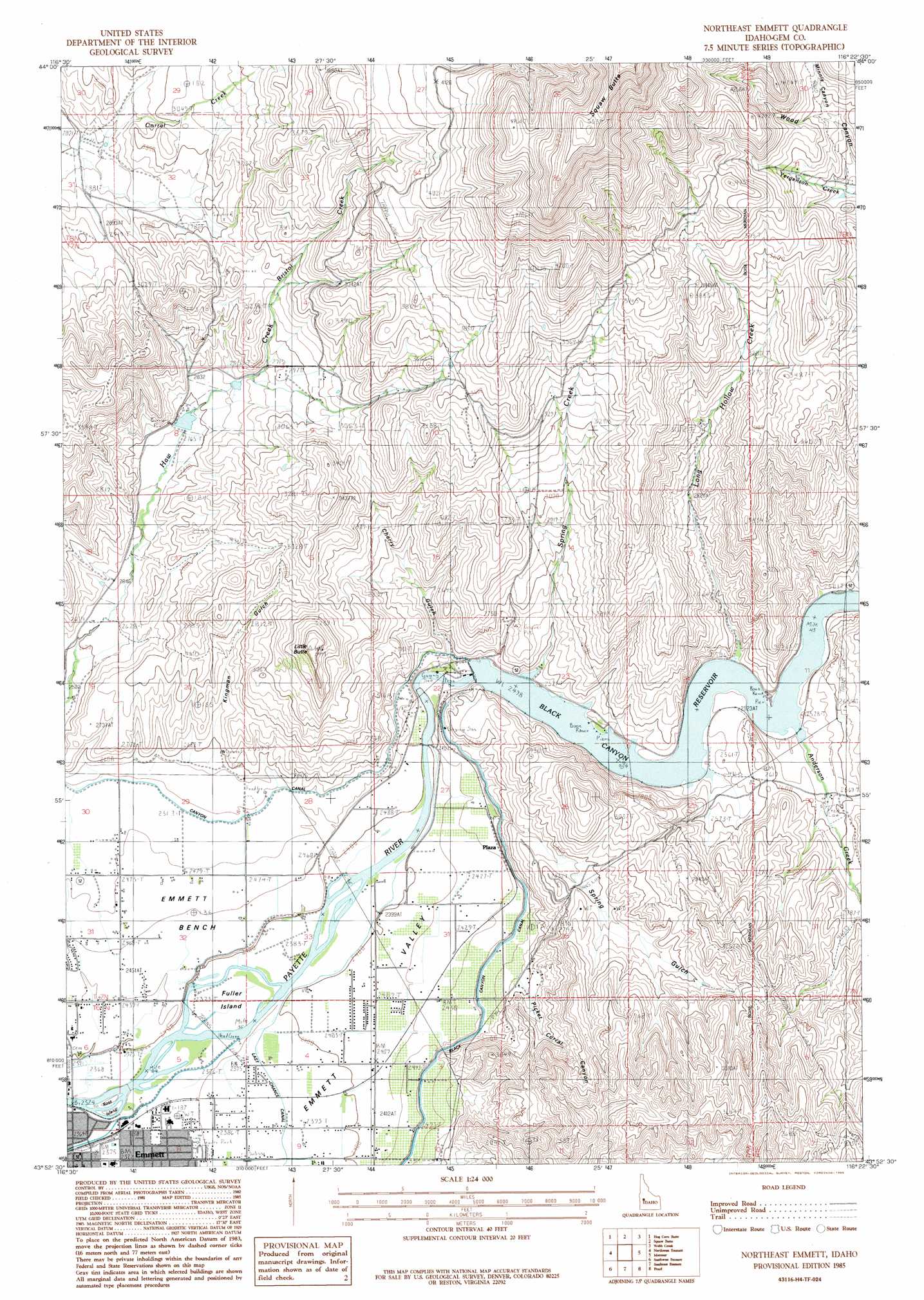
USGS Topo Quad 43116h4 - 1:24,000 scale
| Topo Map Name: | Northeast Emmett |
| USGS Topo Quad ID: | 43116h4 |
| Print Size: | ca. 21 1/4" wide x 27" high |
| Southeast Coordinates: | 43.875° N latitude / 116.375° W longitude |
| Map Center Coordinates: | 43.9375° N latitude / 116.4375° W longitude |
| U.S. State: | ID |
| Filename: | o43116h4.jpg |
| Download Map JPG Image: | Northeast Emmett topo map 1:24,000 scale |
| Map Type: | Topographic |
| Topo Series: | 7.5´ |
| Map Scale: | 1:24,000 |
| Source of Map Images: | United States Geological Survey (USGS) |
| Alternate Map Versions: |
Northeast Emmett ID 1985, updated 1986 Download PDF Buy paper map Northeast Emmett ID 2010 Download PDF Buy paper map Northeast Emmett ID 2013 Download PDF Buy paper map |
1:24,000 Topo Quads surrounding Northeast Emmett
Holland Gulch |
Paddock Valley Reservoir |
Coonrod Gulch |
Ola |
High Valley |
Sheep Ridge |
Hog Cove Butte |
Squaw Butte |
Webb Creek |
Dry Buck Valley |
Letha |
Northwest Emmett |
Northeast Emmett |
Montour |
Horseshoe Bend |
Sand Hollow |
Southwest Emmett |
Southeast Emmett |
Pearl |
Cartwright Canyon |
Caldwell |
Middleton |
Star |
Eagle |
Boise North |
> Back to 43116e1 at 1:100,000 scale
> Back to 43116a1 at 1:250,000 scale
> Back to U.S. Topo Maps home
Northeast Emmett topo map: Gazetteer
Northeast Emmett: Dams
Black Canyon Dam elevation 762m 2500′Haw Creek Dam elevation 846m 2775′
Northeast Emmett: Islands
Fuller Island elevation 729m 2391′Ross Island elevation 720m 2362′
Northeast Emmett: Populated Places
Black Canyon elevation 751m 2463′Plaza elevation 756m 2480′
Northeast Emmett: Reservoirs
Black Canyon Reservoir elevation 762m 2500′Northeast Emmett: Streams
Anderson Creek elevation 768m 2519′Bristol Creek elevation 927m 3041′
Long Hollow Creek elevation 768m 2519′
Spring Creek elevation 780m 2559′
Northeast Emmett: Summits
Little Butte elevation 1056m 3464′Northeast Emmett: Valleys
Cherry Gulch elevation 756m 2480′Kingman Gulch elevation 770m 2526′
Minnis Canyon elevation 1076m 3530′
Picket Corral Canyon elevation 791m 2595′
Shellrock Canyon elevation 789m 2588′
Spring Gulch elevation 733m 2404′
Wood Canyon elevation 1007m 3303′
Northeast Emmett digital topo map on disk
Buy this Northeast Emmett topo map showing relief, roads, GPS coordinates and other geographical features, as a high-resolution digital map file on DVD: