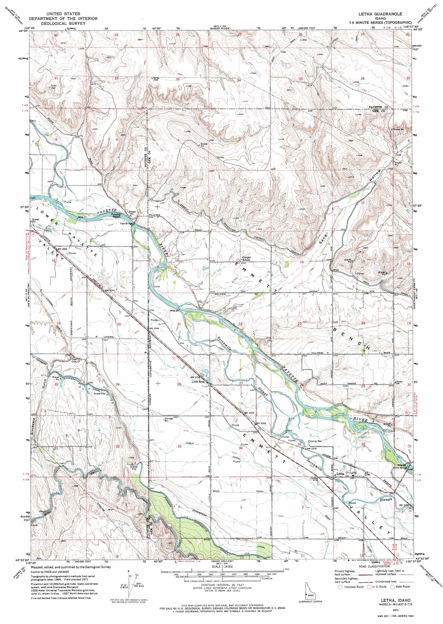
Letha Topo Map Idaho
To zoom in, hover over the map of Letha
USGS Topo Quad 43116h6 - 1:24,000 scale
| Topo Map Name: | Letha |
| USGS Topo Quad ID: | 43116h6 |
| Print Size: | ca. 21 1/4" wide x 27" high |
| Southeast Coordinates: | 43.875° N latitude / 116.625° W longitude |
| Map Center Coordinates: | 43.9375° N latitude / 116.6875° W longitude |
| U.S. State: | ID |
| Filename: | o43116h6.jpg |
| Download Map JPG Image: | Letha topo map 1:24,000 scale |
| Map Type: | Topographic |
| Topo Series: | 7.5´ |
| Map Scale: | 1:24,000 |
| Source of Map Images: | United States Geological Survey (USGS) |
| Alternate Map Versions: |
Letha ID 1971, updated 1973 Download PDF Buy paper map Letha ID 2010 Download PDF Buy paper map Letha ID 2013 Download PDF Buy paper map |
1:24,000 Topo Quads surrounding Letha
Weiser South |
Weiser Cove |
Holland Gulch |
Paddock Valley Reservoir |
Coonrod Gulch |
Payette |
Birding Island |
Sheep Ridge |
Hog Cove Butte |
Squaw Butte |
Nyssa |
New Plymouth |
Letha |
Northwest Emmett |
Northeast Emmett |
Parma |
Parma Se |
Sand Hollow |
Southwest Emmett |
Southeast Emmett |
Wilder |
Notus |
Caldwell |
Middleton |
Star |
> Back to 43116e1 at 1:100,000 scale
> Back to 43116a1 at 1:250,000 scale
> Back to U.S. Topo Maps home
Letha topo map: Gazetteer
Letha: Bridges
Falk Bridge elevation 683m 2240′Letha Bridge elevation 698m 2290′
Letha: Canals
B Lateral elevation 687m 2253′Farmers Cooperative Wasteway elevation 688m 2257′
Graveyard Gulch Wasteway elevation 684m 2244′
Letha: Populated Places
Letha elevation 696m 2283′Little Rock elevation 689m 2260′
Letha: Streams
Sevenmile Slough elevation 685m 2247′Letha: Valleys
Emmett Valley elevation 691m 2267′Graveyard Gulch elevation 695m 2280′
Sand Hollow elevation 721m 2365′
Letha digital topo map on disk
Buy this Letha topo map showing relief, roads, GPS coordinates and other geographical features, as a high-resolution digital map file on DVD: