New Plymouth Topo Map Idaho
To zoom in, hover over the map of New Plymouth
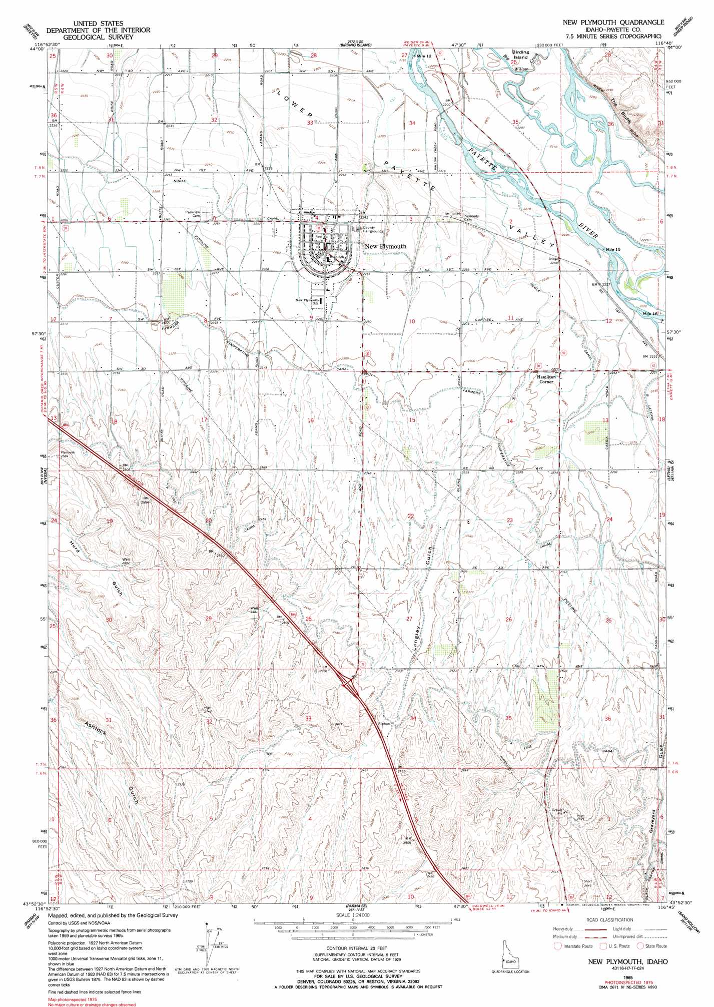
USGS Topo Quad 43116h7 - 1:24,000 scale
| Topo Map Name: | New Plymouth |
| USGS Topo Quad ID: | 43116h7 |
| Print Size: | ca. 21 1/4" wide x 27" high |
| Southeast Coordinates: | 43.875° N latitude / 116.75° W longitude |
| Map Center Coordinates: | 43.9375° N latitude / 116.8125° W longitude |
| U.S. State: | ID |
| Filename: | o43116h7.jpg |
| Download Map JPG Image: | New Plymouth topo map 1:24,000 scale |
| Map Type: | Topographic |
| Topo Series: | 7.5´ |
| Map Scale: | 1:24,000 |
| Source of Map Images: | United States Geological Survey (USGS) |
| Alternate Map Versions: |
New Plymouth ID 1965, updated 1967 Download PDF Buy paper map New Plymouth ID 1965, updated 1992 Download PDF Buy paper map New Plymouth ID 2010 Download PDF Buy paper map New Plymouth ID 2013 Download PDF Buy paper map |
1:24,000 Topo Quads surrounding New Plymouth
Moores Hollow |
Weiser South |
Weiser Cove |
Holland Gulch |
Paddock Valley Reservoir |
Malheur Butte |
Payette |
Birding Island |
Sheep Ridge |
Hog Cove Butte |
Cairo |
Nyssa |
New Plymouth |
Letha |
Northwest Emmett |
Owyhee |
Parma |
Parma Se |
Sand Hollow |
Southwest Emmett |
Adrian |
Wilder |
Notus |
Caldwell |
Middleton |
> Back to 43116e1 at 1:100,000 scale
> Back to 43116a1 at 1:250,000 scale
> Back to U.S. Topo Maps home
New Plymouth topo map: Gazetteer
New Plymouth: Canals
Farmers Cooperative Canal elevation 703m 2306′Noble Canal elevation 687m 2253′
New Plymouth: Cliffs
The Bluffs elevation 700m 2296′New Plymouth: Populated Places
Hamilton Corner elevation 695m 2280′New Plymouth elevation 689m 2260′
New Plymouth: Valleys
Langley Gulch elevation 690m 2263′Lower Payette Valley elevation 679m 2227′
New Plymouth digital topo map on disk
Buy this New Plymouth topo map showing relief, roads, GPS coordinates and other geographical features, as a high-resolution digital map file on DVD: