Lambert Rocks Topo Map Oregon
To zoom in, hover over the map of Lambert Rocks
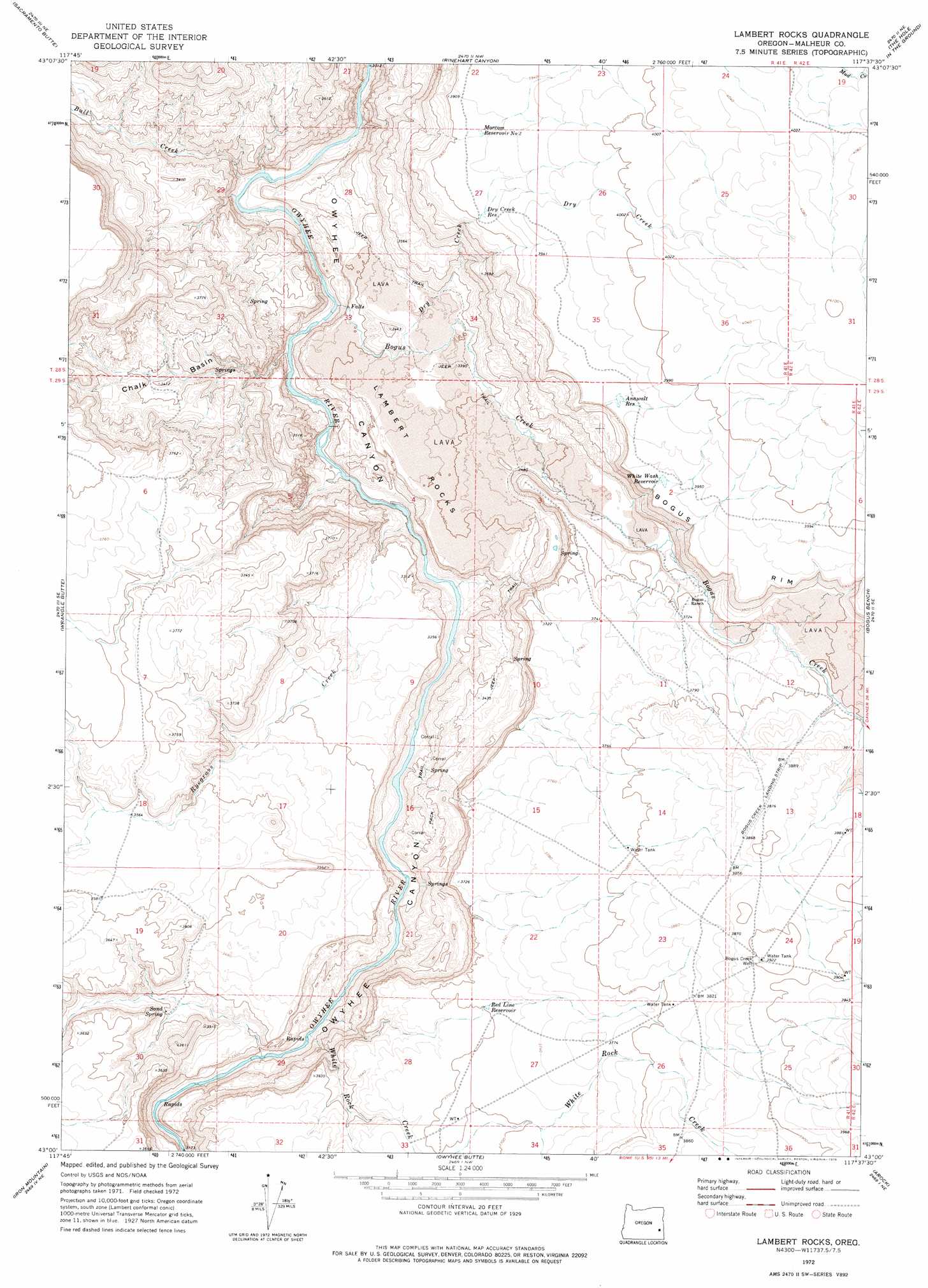
USGS Topo Quad 43117a6 - 1:24,000 scale
| Topo Map Name: | Lambert Rocks |
| USGS Topo Quad ID: | 43117a6 |
| Print Size: | ca. 21 1/4" wide x 27" high |
| Southeast Coordinates: | 43° N latitude / 117.625° W longitude |
| Map Center Coordinates: | 43.0625° N latitude / 117.6875° W longitude |
| U.S. State: | OR |
| Filename: | o43117a6.jpg |
| Download Map JPG Image: | Lambert Rocks topo map 1:24,000 scale |
| Map Type: | Topographic |
| Topo Series: | 7.5´ |
| Map Scale: | 1:24,000 |
| Source of Map Images: | United States Geological Survey (USGS) |
| Alternate Map Versions: |
Lambert Rocks OR 1972, updated 1975 Download PDF Buy paper map Lambert Rocks OR 2011 Download PDF Buy paper map Lambert Rocks OR 2014 Download PDF Buy paper map |
1:24,000 Topo Quads surrounding Lambert Rocks
Crowley |
Burnt Flat |
Cedar Mountain |
Big Mud Flat |
Diamond Butte |
Mustang Butte |
Sacramento Butte |
Rinehart Canyon |
The Hole In The Ground |
Jordan Craters North |
Saddle Butte |
Wrangle Butte |
Lambert Rocks |
Bogus Bench |
Jordan Craters South |
Palomino Lake |
Iron Mountain |
Owyhee Butte |
Arock |
Threemile Hill |
Palomino Hills |
Burns Junction |
Rome |
Scott Reservoir |
Dry Creek Rim |
> Back to 43117a1 at 1:100,000 scale
> Back to 43116a1 at 1:250,000 scale
> Back to U.S. Topo Maps home
Lambert Rocks topo map: Gazetteer
Lambert Rocks: Basins
Chalk Basin elevation 1026m 3366′Lambert Rocks: Cliffs
Bogus Rim elevation 1187m 3894′Lambert Rocks: Lavas
Lambert Rocks elevation 1028m 3372′Lambert Rocks: Reservoirs
Anawalt Reservoir elevation 1204m 3950′Dry Creek Reservoir elevation 1190m 3904′
Morcom Reservoir Number Two elevation 1194m 3917′
Red Line Reservoir elevation 1129m 3704′
White Wash Reservoir elevation 1199m 3933′
Lambert Rocks: Springs
Sand Spring elevation 1040m 3412′Lambert Rocks: Streams
Bogus Creek elevation 933m 3061′Bull Creek elevation 925m 3034′
Dry Creek elevation 1020m 3346′
Ryegrass Creek elevation 946m 3103′
White Rock Creek elevation 963m 3159′
Lambert Rocks: Wells
Bogus Creek Well elevation 1195m 3920′Lambert Rocks digital topo map on disk
Buy this Lambert Rocks topo map showing relief, roads, GPS coordinates and other geographical features, as a high-resolution digital map file on DVD: