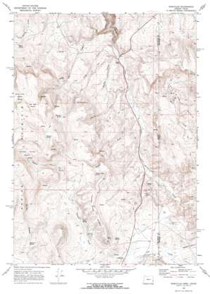
Sheaville Topo Map Oregon
To zoom in, hover over the map of Sheaville
USGS Topo Quad 43117b1 - 1:24,000 scale
| Topo Map Name: | Sheaville |
| USGS Topo Quad ID: | 43117b1 |
| Print Size: | ca. 21 1/4" wide x 27" high |
| Southeast Coordinates: | 43.125° N latitude / 117° W longitude |
| Map Center Coordinates: | 43.1875° N latitude / 117.0625° W longitude |
| U.S. States: | OR, ID |
| Filename: | o43117b1.jpg |
| Download Map JPG Image: | Sheaville topo map 1:24,000 scale |
| Map Type: | Topographic |
| Topo Series: | 7.5´ |
| Map Scale: | 1:24,000 |
| Source of Map Images: | United States Geological Survey (USGS) |
| Alternate Map Versions: |
Sheaville OR 1969, updated 1973 Download PDF Buy paper map Sheaville OR 1969, updated 1973 Download PDF Buy paper map Sheaville OR 2011 Download PDF Buy paper map Sheaville OR 2014 Download PDF Buy paper map |
1:24,000 Topo Quads surrounding Sheaville
> Back to 43117a1 at 1:100,000 scale
> Back to 43116a1 at 1:250,000 scale
> Back to U.S. Topo Maps home
Sheaville topo map: Gazetteer
Sheaville: Basins
Coal Mine Basin elevation 1327m 4353′Thomas Creek Basin elevation 1641m 5383′
Sheaville: Flats
Dog Creek Meadow elevation 1686m 5531′Spring Creek Meadow elevation 1676m 5498′
Sheaville: Populated Places
Sheaville elevation 1393m 4570′Sheaville: Post Offices
Camp Lyon Post Office (historical) elevation 1408m 4619′Sheaville Post Office (historical) elevation 1393m 4570′
Sheaville: Ridges
Thomas Creek Ridge elevation 1538m 5045′Sheaville: Springs
Badger Spring elevation 1444m 4737′Baltzar Spring elevation 1381m 4530′
Bottle Spring elevation 1416m 4645′
Cold Spring elevation 1432m 4698′
Dog Spring elevation 1420m 4658′
Emery Spring elevation 1325m 4347′
Fenwick Spring elevation 1737m 5698′
Hereford Spring elevation 1597m 5239′
Shorthorn Spring elevation 1471m 4826′
Sticky Joe Spring elevation 1427m 4681′
Wilson Creek Spring elevation 1459m 4786′
Sheaville: Streams
Coal Mine Basin Creek elevation 1257m 4124′Coal Mine Basin Creek elevation 1256m 4120′
Cow Creek elevation 1394m 4573′
Cow Creek Slough elevation 1402m 4599′
Dog Creek elevation 1226m 4022′
O'Keefe Creek elevation 1252m 4107′
Whiskey Creek elevation 1237m 4058′
Wilson Creek elevation 1259m 4130′
Sheaville: Valleys
Hog Gulch elevation 1236m 4055′Westgate Gulch elevation 1412m 4632′
Sheaville digital topo map on disk
Buy this Sheaville topo map showing relief, roads, GPS coordinates and other geographical features, as a high-resolution digital map file on DVD:


