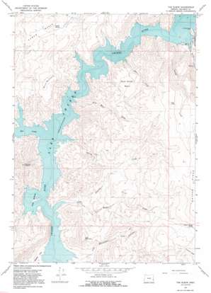
The Elbow Topo Map Oregon
To zoom in, hover over the map of The Elbow
USGS Topo Quad 43117e3 - 1:24,000 scale
| Topo Map Name: | The Elbow |
| USGS Topo Quad ID: | 43117e3 |
| Print Size: | ca. 21 1/4" wide x 27" high |
| Southeast Coordinates: | 43.5° N latitude / 117.25° W longitude |
| Map Center Coordinates: | 43.5625° N latitude / 117.3125° W longitude |
| U.S. State: | OR |
| Filename: | o43117e3.jpg |
| Download Map JPG Image: | The Elbow topo map 1:24,000 scale |
| Map Type: | Topographic |
| Topo Series: | 7.5´ |
| Map Scale: | 1:24,000 |
| Source of Map Images: | United States Geological Survey (USGS) |
| Alternate Map Versions: |
The Elbow OR 1967, updated 1971 Download PDF Buy paper map The Elbow OR 1967, updated 1991 Download PDF Buy paper map The Elbow OR 2011 Download PDF Buy paper map The Elbow OR 2014 Download PDF Buy paper map |
1:24,000 Topo Quads surrounding The Elbow
> Back to 43117e1 at 1:100,000 scale
> Back to 43116a1 at 1:250,000 scale
> Back to U.S. Topo Maps home
The Elbow topo map: Gazetteer
The Elbow: Basins
Oxbow Basin elevation 970m 3182′Wild Horse Basin elevation 1088m 3569′
The Elbow: Bays
Dry Creek Arm elevation 850m 2788′The Elbow: Bends
Big Elbow elevation 810m 2657′Burnt Elbow elevation 810m 2657′
The Elbow elevation 819m 2687′
The Elbow: Lakes
Dry Lake elevation 1414m 4639′The Elbow: Parks
V W McCormack Area elevation 822m 2696′The Elbow: Ridges
Owyhee Ridge elevation 1501m 4924′The Elbow: Springs
Oxyoke Spring elevation 928m 3044′Rookie Canyon Spring elevation 1357m 4452′
The Elbow: Streams
Birch Creek elevation 819m 2687′Cherry Creek elevation 813m 2667′
Deer Creek elevation 825m 2706′
Dry Creek elevation 810m 2657′
Indian Creek elevation 816m 2677′
Rookie Creek elevation 843m 2765′
Wild Horse Creek elevation 810m 2657′
The Elbow: Summits
Burnt Mountain elevation 1164m 3818′Iron Mountain elevation 1202m 3943′
Nannys Nipple elevation 1223m 4012′
Sheep Heads Mountain elevation 1430m 4691′
The Elbow: Valleys
Iron Mountain Canyon elevation 817m 2680′Road Canyon elevation 813m 2667′
The Elbow digital topo map on disk
Buy this The Elbow topo map showing relief, roads, GPS coordinates and other geographical features, as a high-resolution digital map file on DVD:


