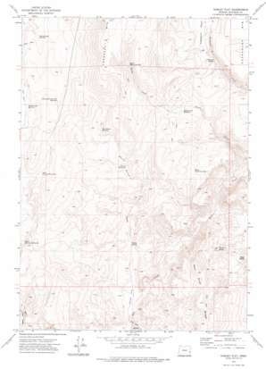
Hurley Flat Topo Map Oregon
To zoom in, hover over the map of Hurley Flat
USGS Topo Quad 43117e5 - 1:24,000 scale
| Topo Map Name: | Hurley Flat |
| USGS Topo Quad ID: | 43117e5 |
| Print Size: | ca. 21 1/4" wide x 27" high |
| Southeast Coordinates: | 43.5° N latitude / 117.5° W longitude |
| Map Center Coordinates: | 43.5625° N latitude / 117.5625° W longitude |
| U.S. State: | OR |
| Filename: | o43117e5.jpg |
| Download Map JPG Image: | Hurley Flat topo map 1:24,000 scale |
| Map Type: | Topographic |
| Topo Series: | 7.5´ |
| Map Scale: | 1:24,000 |
| Source of Map Images: | United States Geological Survey (USGS) |
| Alternate Map Versions: |
Hurley Flat OR 1972, updated 1975 Download PDF Buy paper map Hurley Flat OR 2011 Download PDF Buy paper map Hurley Flat OR 2014 Download PDF Buy paper map |
1:24,000 Topo Quads surrounding Hurley Flat
> Back to 43117e1 at 1:100,000 scale
> Back to 43116a1 at 1:250,000 scale
> Back to U.S. Topo Maps home
Hurley Flat topo map: Gazetteer
Hurley Flat: Flats
Hurley Flat elevation 1082m 3549′Hurley Flat: Reservoirs
Head of Keeney Creek Reservoir elevation 1366m 4481′Hurley Reservoir elevation 1274m 4179′
Keeney Creek Reservoir Number Three elevation 1292m 4238′
Keeney Creek Reservoir Number Two elevation 1326m 4350′
Lower Slim and Fatty Reservoir elevation 1267m 4156′
Sheep Corral Reservoir elevation 1282m 4206′
South Sheep Creek Reservoir elevation 1283m 4209′
Upper Sheep Creek Reservoir elevation 1486m 4875′
Upper Slim and Fatty Reservoir elevation 1350m 4429′
Washboard Reservoir elevation 1358m 4455′
Hurley Flat: Springs
Cherry Spring elevation 1138m 3733′Freezeout Spring elevation 1268m 4160′
Hurley Spring elevation 1111m 3645′
Hurley Flat: Streams
Hurley Spring Creek elevation 1074m 3523′Sheep Creek elevation 981m 3218′
Wall Rock Creek elevation 1080m 3543′
Hurley Flat: Summits
Deer Butte elevation 1255m 4117′Freezeout Mountain elevation 1668m 5472′
Hurley Flat: Valleys
Dry Creek Gorge elevation 1122m 3681′Hurley Flat digital topo map on disk
Buy this Hurley Flat topo map showing relief, roads, GPS coordinates and other geographical features, as a high-resolution digital map file on DVD:


