Vines Hill Topo Map Oregon
To zoom in, hover over the map of Vines Hill
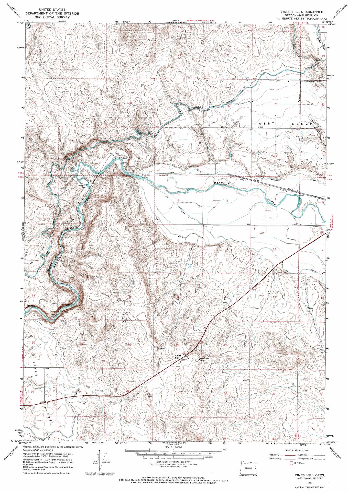
USGS Topo Quad 43117h4 - 1:24,000 scale
| Topo Map Name: | Vines Hill |
| USGS Topo Quad ID: | 43117h4 |
| Print Size: | ca. 21 1/4" wide x 27" high |
| Southeast Coordinates: | 43.875° N latitude / 117.375° W longitude |
| Map Center Coordinates: | 43.9375° N latitude / 117.4375° W longitude |
| U.S. State: | OR |
| Filename: | o43117h4.jpg |
| Download Map JPG Image: | Vines Hill topo map 1:24,000 scale |
| Map Type: | Topographic |
| Topo Series: | 7.5´ |
| Map Scale: | 1:24,000 |
| Source of Map Images: | United States Geological Survey (USGS) |
| Alternate Map Versions: |
Vines Hill OR 1967, updated 1971 Download PDF Buy paper map Vines Hill OR 2011 Download PDF Buy paper map Vines Hill OR 2014 Download PDF Buy paper map |
1:24,000 Topo Quads surrounding Vines Hill
Juniper Mountain |
Brogan |
Jamieson |
Mccarthy Ridge |
Tub Mountain |
Buckbrush Creek |
Swede Flat |
Hope Butte |
Willow Creek |
Henry Gulch |
Westfall |
Little Valley |
Vines Hill |
Vale West |
Vale East |
Namorf |
Harper |
Kane Spring Gulch |
Double Mountain |
Mitchell Butte |
Avery Creek |
Keeney Ridge |
Sourdough Spring |
Grassy Mountain |
Owyhee Dam |
> Back to 43117e1 at 1:100,000 scale
> Back to 43116a1 at 1:250,000 scale
> Back to U.S. Topo Maps home
Vines Hill topo map: Gazetteer
Vines Hill: Benches
West Bench elevation 772m 2532′Vines Hill: Canals
Biggs Ditch elevation 713m 2339′Little Valley Lateral elevation 789m 2588′
Stacey Ditch elevation 712m 2335′
Vines Ditch elevation 721m 2365′
Vines Hill: Summits
Vines Hill elevation 883m 2896′Vines Hill: Valleys
Little Valley elevation 785m 2575′Malheur Canyon elevation 721m 2365′
Vines Hill digital topo map on disk
Buy this Vines Hill topo map showing relief, roads, GPS coordinates and other geographical features, as a high-resolution digital map file on DVD: