Little Valley Topo Map Oregon
To zoom in, hover over the map of Little Valley
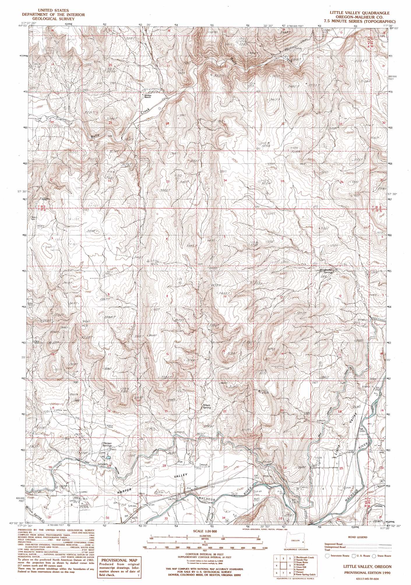
USGS Topo Quad 43117h5 - 1:24,000 scale
| Topo Map Name: | Little Valley |
| USGS Topo Quad ID: | 43117h5 |
| Print Size: | ca. 21 1/4" wide x 27" high |
| Southeast Coordinates: | 43.875° N latitude / 117.5° W longitude |
| Map Center Coordinates: | 43.9375° N latitude / 117.5625° W longitude |
| U.S. State: | OR |
| Filename: | o43117h5.jpg |
| Download Map JPG Image: | Little Valley topo map 1:24,000 scale |
| Map Type: | Topographic |
| Topo Series: | 7.5´ |
| Map Scale: | 1:24,000 |
| Source of Map Images: | United States Geological Survey (USGS) |
| Alternate Map Versions: |
Little Valley OR 1990, updated 1990 Download PDF Buy paper map Little Valley OR 2011 Download PDF Buy paper map Little Valley OR 2014 Download PDF Buy paper map |
1:24,000 Topo Quads surrounding Little Valley
Scratch Post Mountain |
Juniper Mountain |
Brogan |
Jamieson |
Mccarthy Ridge |
Log Creek |
Buckbrush Creek |
Swede Flat |
Hope Butte |
Willow Creek |
Little Black Canyon |
Westfall |
Little Valley |
Vines Hill |
Vale West |
South Mountain |
Namorf |
Harper |
Kane Spring Gulch |
Double Mountain |
Tims Peak |
Avery Creek |
Keeney Ridge |
Sourdough Spring |
Grassy Mountain |
> Back to 43117e1 at 1:100,000 scale
> Back to 43116a1 at 1:250,000 scale
> Back to U.S. Topo Maps home
Little Valley topo map: Gazetteer
Little Valley: Springs
Alkali Spring elevation 829m 2719′Harper Springs elevation 811m 2660′
Wildhorse Spring elevation 854m 2801′
Little Valley: Streams
Cottonwood Creek elevation 754m 2473′Little Valley: Valleys
Harper Valley elevation 754m 2473′Little Valley digital topo map on disk
Buy this Little Valley topo map showing relief, roads, GPS coordinates and other geographical features, as a high-resolution digital map file on DVD: