Little Black Canyon Topo Map Oregon
To zoom in, hover over the map of Little Black Canyon
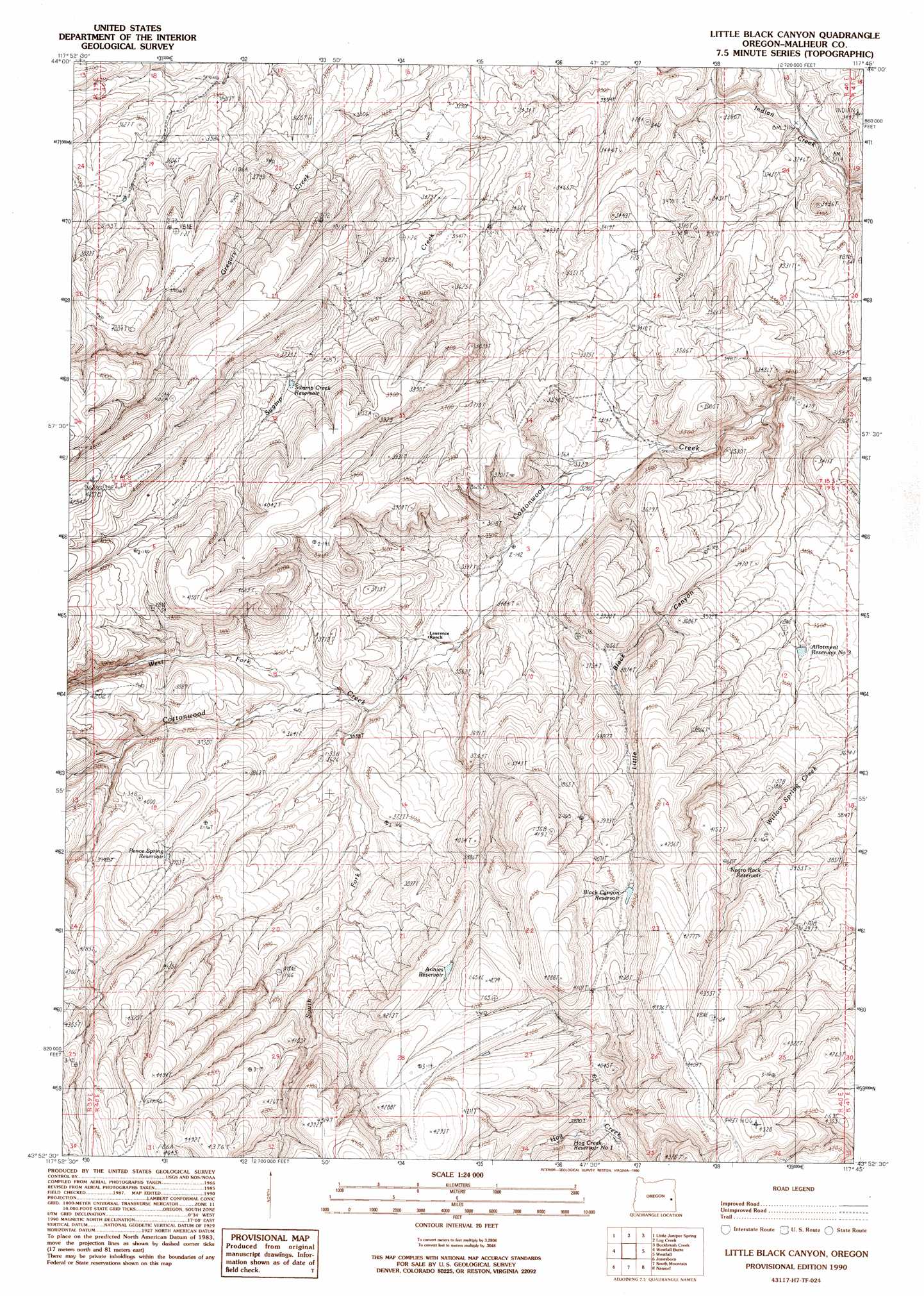
USGS Topo Quad 43117h7 - 1:24,000 scale
| Topo Map Name: | Little Black Canyon |
| USGS Topo Quad ID: | 43117h7 |
| Print Size: | ca. 21 1/4" wide x 27" high |
| Southeast Coordinates: | 43.875° N latitude / 117.75° W longitude |
| Map Center Coordinates: | 43.9375° N latitude / 117.8125° W longitude |
| U.S. State: | OR |
| Filename: | o43117h7.jpg |
| Download Map JPG Image: | Little Black Canyon topo map 1:24,000 scale |
| Map Type: | Topographic |
| Topo Series: | 7.5´ |
| Map Scale: | 1:24,000 |
| Source of Map Images: | United States Geological Survey (USGS) |
| Alternate Map Versions: |
Little Black Canyon OR 1990, updated 1990 Download PDF Buy paper map Little Black Canyon OR 2011 Download PDF Buy paper map Little Black Canyon OR 2014 Download PDF Buy paper map |
1:24,000 Topo Quads surrounding Little Black Canyon
De Bord Peaks |
Clover Creek Ranch |
Scratch Post Mountain |
Juniper Mountain |
Brogan |
Hunter Mtn |
Little Juniper Spring |
Log Creek |
Buckbrush Creek |
Swede Flat |
De Armond Mountain |
Westfall Butte |
Little Black Canyon |
Westfall |
Little Valley |
Stemler Ridge |
Jonesboro |
South Mountain |
Namorf |
Harper |
Juntura |
Monument Peak |
Tims Peak |
Avery Creek |
Keeney Ridge |
> Back to 43117e1 at 1:100,000 scale
> Back to 43116a1 at 1:250,000 scale
> Back to U.S. Topo Maps home
Little Black Canyon topo map: Gazetteer
Little Black Canyon: Reservoirs
Allotment Four Reservoir elevation 1200m 3937′Allotment Reservoir Number Three elevation 1074m 3523′
Annies Reservoir elevation 1257m 4124′
Black Canyon Reservoir elevation 1203m 3946′
Hog Creek Reservoir Number One elevation 1149m 3769′
Negro Rock Reservoir elevation 1203m 3946′
Pence Spring Reservoir elevation 1198m 3930′
Red Canyon Reservoir elevation 1288m 4225′
Swamp Creek Reservoir elevation 1111m 3645′
Little Black Canyon: Streams
South Fork Cottonwood Creek elevation 1062m 3484′West Fork Cottonwood Creek elevation 1073m 3520′
Little Black Canyon: Valleys
Little Black Canyon elevation 993m 3257′Little Black Canyon digital topo map on disk
Buy this Little Black Canyon topo map showing relief, roads, GPS coordinates and other geographical features, as a high-resolution digital map file on DVD: