Diamond Swamp Topo Map Oregon
To zoom in, hover over the map of Diamond Swamp
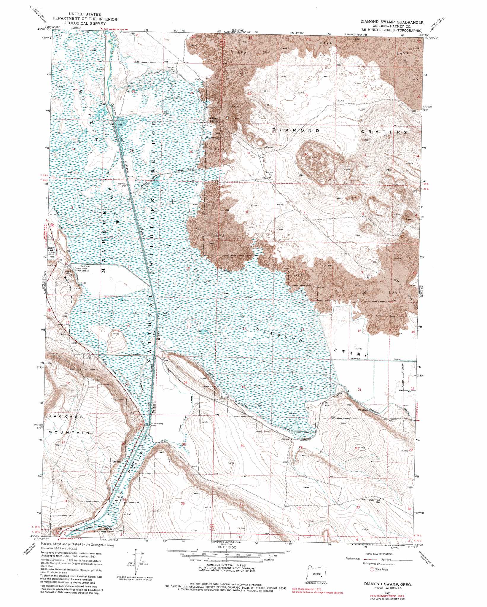
USGS Topo Quad 43118a7 - 1:24,000 scale
| Topo Map Name: | Diamond Swamp |
| USGS Topo Quad ID: | 43118a7 |
| Print Size: | ca. 21 1/4" wide x 27" high |
| Southeast Coordinates: | 43° N latitude / 118.75° W longitude |
| Map Center Coordinates: | 43.0625° N latitude / 118.8125° W longitude |
| U.S. State: | OR |
| Filename: | o43118a7.jpg |
| Download Map JPG Image: | Diamond Swamp topo map 1:24,000 scale |
| Map Type: | Topographic |
| Topo Series: | 7.5´ |
| Map Scale: | 1:24,000 |
| Source of Map Images: | United States Geological Survey (USGS) |
| Alternate Map Versions: |
Diamond Swamp OR 1967, updated 1972 Download PDF Buy paper map Diamond Swamp OR 1967, updated 1981 Download PDF Buy paper map Diamond Swamp OR 1967, updated 1981 Download PDF Buy paper map Diamond Swamp OR 2011 Download PDF Buy paper map Diamond Swamp OR 2014 Download PDF Buy paper map |
1:24,000 Topo Quads surrounding Diamond Swamp
Northeast Harney Lake |
The Narrows |
Malheur Lake West |
Malheur Lake East |
New Princeton |
Southeast Harney Lake |
Coyote Buttes |
Jackass Butte Ne |
Barton Lake |
Adobe Flat |
Twin Buttes |
Jackass Butte |
Diamond Swamp |
Diamond |
Happy Valley |
Keg Sprs Valley East |
Irish Lake |
Krumbo Reservoir |
Krumbo Ridge |
Poison Springs |
Walls Lake |
Frenchglen |
Page Springs |
Mccoy Ridge |
Big Pasture Creek |
> Back to 43118a1 at 1:100,000 scale
> Back to 43118a1 at 1:250,000 scale
> Back to U.S. Topo Maps home
Diamond Swamp topo map: Gazetteer
Diamond Swamp: Canals
Center Canal elevation 1263m 4143′Diamond Drain elevation 1263m 4143′
East Grain Camp Canal elevation 1264m 4146′
Skunk Farm Canal elevation 1262m 4140′
South Diamond Canal elevation 1263m 4143′
Diamond Swamp: Craters
Diamond Craters elevation 1310m 4297′Diamond Swamp: Dams
Grain Camp Dam elevation 1264m 4146′Diamond Swamp: Reservoirs
Unit Nine Pond elevation 1260m 4133′Diamond Swamp: Ridges
Buena Vista Butte elevation 1296m 4251′Diamond Swamp: Springs
Hog Wallow Spring elevation 1269m 4163′Oliver Spring elevation 1262m 4140′
Diamond Swamp: Swamps
Diamond Swamp elevation 1262m 4140′Diamond Swamp digital topo map on disk
Buy this Diamond Swamp topo map showing relief, roads, GPS coordinates and other geographical features, as a high-resolution digital map file on DVD: