Sand Gap Topo Map Oregon
To zoom in, hover over the map of Sand Gap
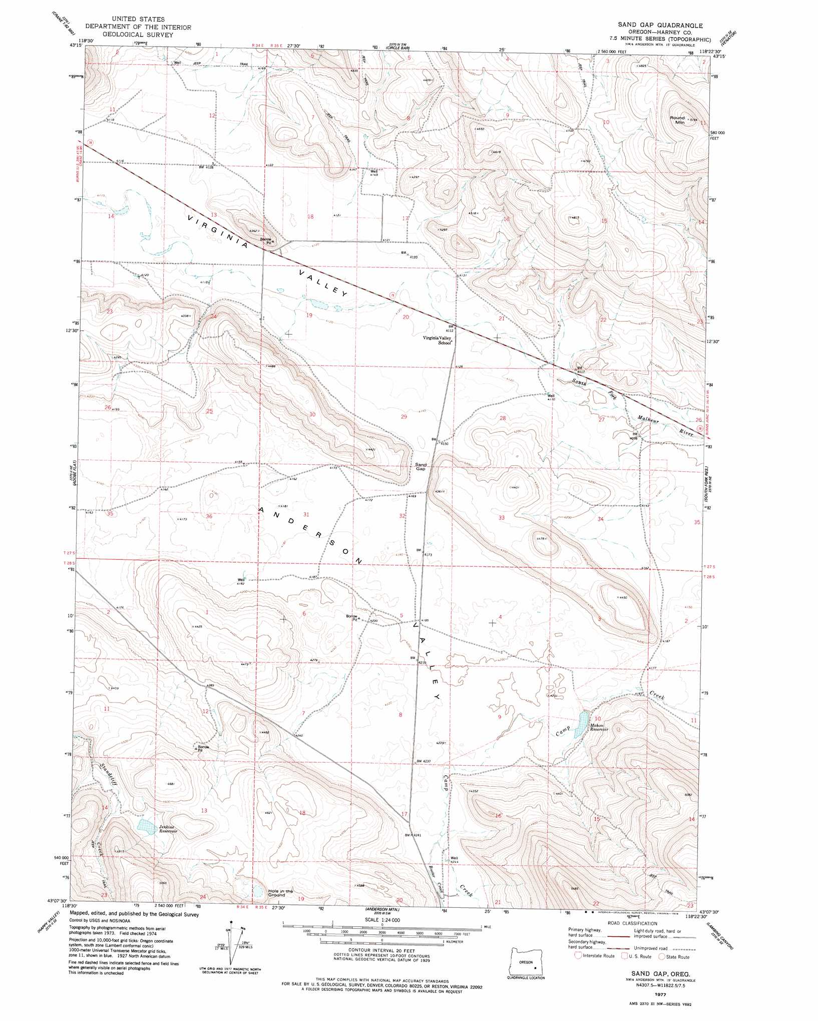
USGS Topo Quad 43118b4 - 1:24,000 scale
| Topo Map Name: | Sand Gap |
| USGS Topo Quad ID: | 43118b4 |
| Print Size: | ca. 21 1/4" wide x 27" high |
| Southeast Coordinates: | 43.125° N latitude / 118.375° W longitude |
| Map Center Coordinates: | 43.1875° N latitude / 118.4375° W longitude |
| U.S. State: | OR |
| Filename: | o43118b4.jpg |
| Download Map JPG Image: | Sand Gap topo map 1:24,000 scale |
| Map Type: | Topographic |
| Topo Series: | 7.5´ |
| Map Scale: | 1:24,000 |
| Source of Map Images: | United States Geological Survey (USGS) |
| Alternate Map Versions: |
Sand Gap OR 1977, updated 1978 Download PDF Buy paper map Sand Gap OR 2011 Download PDF Buy paper map Sand Gap OR 2014 Download PDF Buy paper map |
1:24,000 Topo Quads surrounding Sand Gap
Warm Springs Butte |
Crane |
Tin Can Ridge |
Dunnean |
Mcewen Butte |
Malheur Lake East |
New Princeton |
Circle Bar |
Venator |
Venator Reservoir |
Barton Lake |
Adobe Flat |
Sand Gap |
South Fork Reservoir |
Duck Creek Butte |
Diamond |
Happy Valley |
Anderson Mountain |
Lambing Canyon |
Folly Farm |
Krumbo Ridge |
Poison Springs |
Comegys Lake |
Juniper Lake |
Ryegrass Butte |
> Back to 43118a1 at 1:100,000 scale
> Back to 43118a1 at 1:250,000 scale
> Back to U.S. Topo Maps home
Sand Gap topo map: Gazetteer
Sand Gap: Dams
Mahon Dam elevation 1283m 4209′Sand Gap: Gaps
Sand Gap elevation 1270m 4166′Sand Gap: Lakes
Hole in the Ground elevation 1350m 4429′Sand Gap: Reservoirs
Jenkins Reservoir elevation 1366m 4481′Mahon Reservoir elevation 1283m 4209′
Sand Gap: Streams
Buster Creek elevation 1293m 4242′Sand Gap: Summits
Round Mountains elevation 1570m 5150′Sand Gap digital topo map on disk
Buy this Sand Gap topo map showing relief, roads, GPS coordinates and other geographical features, as a high-resolution digital map file on DVD: