Stockade Mountain Topo Map Oregon
To zoom in, hover over the map of Stockade Mountain
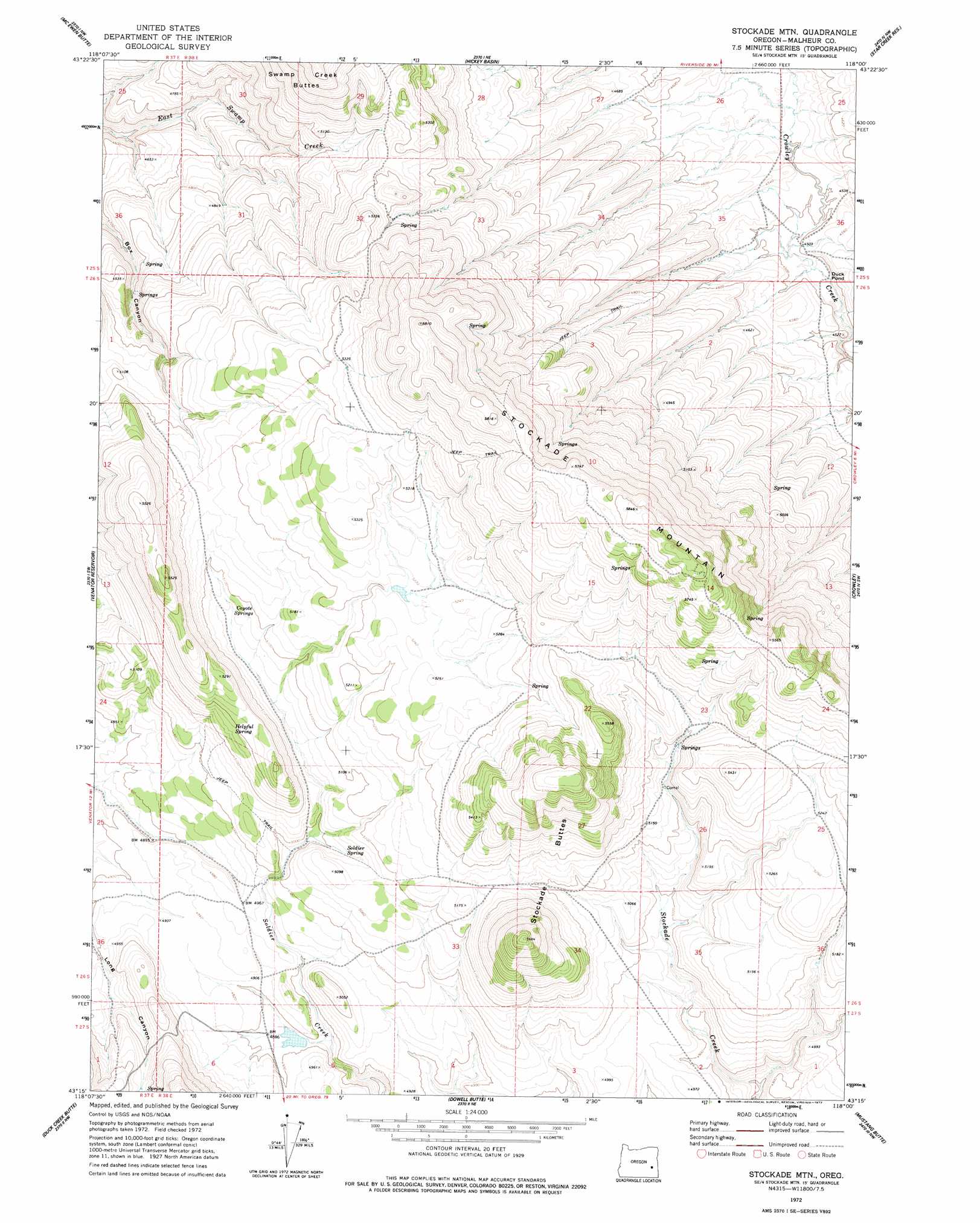
USGS Topo Quad 43118c1 - 1:24,000 scale
| Topo Map Name: | Stockade Mountain |
| USGS Topo Quad ID: | 43118c1 |
| Print Size: | ca. 21 1/4" wide x 27" high |
| Southeast Coordinates: | 43.25° N latitude / 118° W longitude |
| Map Center Coordinates: | 43.3125° N latitude / 118.0625° W longitude |
| U.S. State: | OR |
| Filename: | o43118c1.jpg |
| Download Map JPG Image: | Stockade Mountain topo map 1:24,000 scale |
| Map Type: | Topographic |
| Topo Series: | 7.5´ |
| Map Scale: | 1:24,000 |
| Source of Map Images: | United States Geological Survey (USGS) |
| Alternate Map Versions: |
Stockade Mtn OR 1972, updated 1977 Download PDF Buy paper map Stockade Mountain OR 2011 Download PDF Buy paper map Stockade Mountain OR 2014 Download PDF Buy paper map |
1:24,000 Topo Quads surrounding Stockade Mountain
Warm Springs Creek |
Warm Springs Reservoir |
Mosquito Mountain |
Shumway Reservoir |
Alder Creek |
Dunnean |
Mcewen Butte |
Hickey Basin |
Star Creek Reservoir |
Skull Spring |
Venator |
Venator Reservoir |
Stockade Mountain |
Crowley |
Burnt Flat |
South Fork Reservoir |
Duck Creek Butte |
Dowell Butte |
Mustang Butte |
Sacramento Butte |
Lambing Canyon |
Folly Farm |
Turnbull Peak |
Saddle Butte |
Wrangle Butte |
> Back to 43118a1 at 1:100,000 scale
> Back to 43118a1 at 1:250,000 scale
> Back to U.S. Topo Maps home
Stockade Mountain topo map: Gazetteer
Stockade Mountain: Springs
Coyote Springs elevation 1543m 5062′Helpful Spring elevation 1577m 5173′
Soldier Spring elevation 1532m 5026′
Stockade Mountain: Streams
Juniper Creek elevation 1378m 4520′Meadow Creek elevation 1363m 4471′
Stockade Mountain: Summits
Stockade Buttes elevation 1730m 5675′Stockade Mountain elevation 1762m 5780′
Whitehorse Mountain elevation 1519m 4983′
Stockade Mountain digital topo map on disk
Buy this Stockade Mountain topo map showing relief, roads, GPS coordinates and other geographical features, as a high-resolution digital map file on DVD: