Redess Topo Map Oregon
To zoom in, hover over the map of Redess
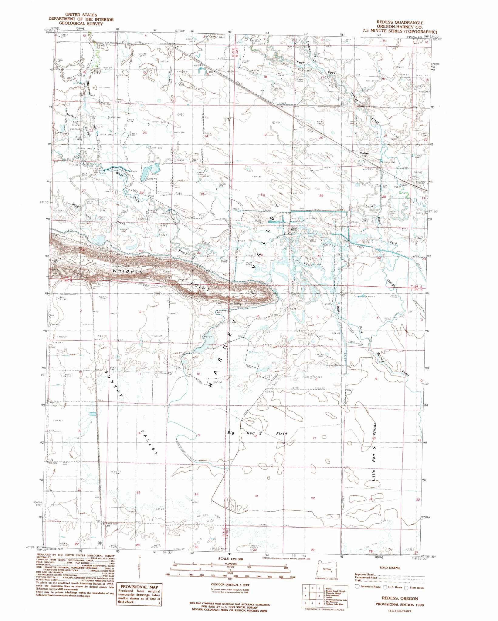
USGS Topo Quad 43118d8 - 1:24,000 scale
| Topo Map Name: | Redess |
| USGS Topo Quad ID: | 43118d8 |
| Print Size: | ca. 21 1/4" wide x 27" high |
| Southeast Coordinates: | 43.375° N latitude / 118.875° W longitude |
| Map Center Coordinates: | 43.4375° N latitude / 118.9375° W longitude |
| U.S. State: | OR |
| Filename: | o43118d8.jpg |
| Download Map JPG Image: | Redess topo map 1:24,000 scale |
| Map Type: | Topographic |
| Topo Series: | 7.5´ |
| Map Scale: | 1:24,000 |
| Source of Map Images: | United States Geological Survey (USGS) |
| Alternate Map Versions: |
Redess OR 1990, updated 1990 Download PDF Buy paper map Redess OR 2011 Download PDF Buy paper map Redess OR 2014 Download PDF Buy paper map |
1:24,000 Topo Quads surrounding Redess
Burns Ne |
Poison Creek |
Devine Ridge South |
Harney |
Buchanan |
Burns Butte |
Burns |
Poison Creek Slough |
Ninemile Slough |
Carson Point |
Weaver Lake |
Dog Mountain |
Redess |
Lawen |
Warm Springs Butte |
Northwest Harney Lake |
Northeast Harney Lake |
The Narrows |
Malheur Lake West |
Malheur Lake East |
Southwest Harney Lake |
Southeast Harney Lake |
Coyote Buttes |
Jackass Butte Ne |
Barton Lake |
> Back to 43118a1 at 1:100,000 scale
> Back to 43118a1 at 1:250,000 scale
> Back to U.S. Topo Maps home
Redess topo map: Gazetteer
Redess: Canals
Big Red S Canal elevation 1255m 4117′Redess: Flats
Big Red S Field elevation 1251m 4104′Little Red S Fields elevation 1251m 4104′
Redess: Post Offices
Henney Post Office (historical) elevation 1252m 4107′Redess: Ridges
Wrights Point elevation 1334m 4376′Redess: Streams
Boat Ford Slough elevation 1251m 4104′Chapman Slough elevation 1255m 4117′
Embree Slough elevation 1255m 4117′
McGee Slough elevation 1255m 4117′
McRae Slough elevation 1254m 4114′
Sage Hen Creek elevation 1255m 4117′
Redess digital topo map on disk
Buy this Redess topo map showing relief, roads, GPS coordinates and other geographical features, as a high-resolution digital map file on DVD: