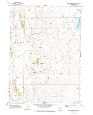
Warm Springs Creek Topo Map Oregon
To zoom in, hover over the map of Warm Springs Creek
USGS Topo Quad 43118e3 - 1:24,000 scale
| Topo Map Name: | Warm Springs Creek |
| USGS Topo Quad ID: | 43118e3 |
| Print Size: | ca. 21 1/4" wide x 27" high |
| Southeast Coordinates: | 43.5° N latitude / 118.25° W longitude |
| Map Center Coordinates: | 43.5625° N latitude / 118.3125° W longitude |
| U.S. State: | OR |
| Filename: | o43118e3.jpg |
| Download Map JPG Image: | Warm Springs Creek topo map 1:24,000 scale |
| Map Type: | Topographic |
| Topo Series: | 7.5´ |
| Map Scale: | 1:24,000 |
| Source of Map Images: | United States Geological Survey (USGS) |
| Alternate Map Versions: |
Warm Springs Creek OR 1973, updated 1977 Download PDF Buy paper map Warm Springs Creek OR 2011 Download PDF Buy paper map Warm Springs Creek OR 2014 Download PDF Buy paper map |
1:24,000 Topo Quads surrounding Warm Springs Creek
> Back to 43118e1 at 1:100,000 scale
> Back to 43118a1 at 1:250,000 scale
> Back to U.S. Topo Maps home
Warm Springs Creek topo map: Gazetteer
Warm Springs Creek: Basins
Little Stinkingwater Basin elevation 1555m 5101′Texaco Basin elevation 1417m 4648′
Warm Springs Creek: Flats
Chicken Flat elevation 1556m 5104′Warm Springs Creek: Reservoirs
Big Boulder Reservoir elevation 1560m 5118′Big Reservoir elevation 1561m 5121′
Bobcat Reservoir elevation 1584m 5196′
Washboard Reservoir elevation 1499m 4917′
Warm Springs Creek: Springs
Chicken Spring elevation 1568m 5144′Cold Springs elevation 1368m 4488′
Company Springs elevation 1326m 4350′
Grasshopper Spring elevation 1601m 5252′
Hawthorne Springs elevation 1405m 4609′
Mahogany Spring elevation 1443m 4734′
Pinto Spring elevation 1419m 4655′
Sorrel Spring elevation 1338m 4389′
Step Spring elevation 1485m 4872′
Stockade Springs elevation 1401m 4596′
Thompson Spring elevation 1219m 3999′
Willow Springs elevation 1422m 4665′
Warm Springs Creek: Streams
Stockade Creek elevation 1198m 3930′Warm Springs Creek elevation 1040m 3412′
Warm Springs Creek: Valleys
Gold Gulch elevation 1046m 3431′Warm Springs Creek digital topo map on disk
Buy this Warm Springs Creek topo map showing relief, roads, GPS coordinates and other geographical features, as a high-resolution digital map file on DVD:


